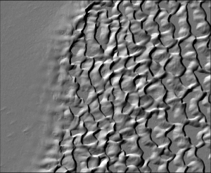
Lemhi Watershed Idaho Lidar Data Released
OpenTopography is pleased to announce the release of an 80 km2 lidar point cloud dataset for the Lemhi River watershed in east-central Idaho.
Due to planned power system maintenance in the SDSC machine room, servers that provide OpenTopography lidar point cloud access and processing will be down on MAy 3rd, 2011. We expect this outage to be complete by 12 pm PDT. If you have questions or concerns please contact info@opentopography.org.
OpenTopography is pleased to announce that lidar point cloud data for the whole Lake Tahoe Basin (941 km2) on the California/Nevada border are now available.
OpenTopography is pleased to announce the release of 1,556 km2 of lidar point cloud data covering the South Coast and Deschutes regions of Oregon.
As part of OpenTopography's ongoing efforts to provide quick and reliable access to lidar data and derived products (e.g., high-resolution DEMs), our latest system update (OT v. 3.1) features a number of improvements to the data access and processing system designed to improve performance and make OpenTopography more reliable under growing processing loads.
A paper highlighting the Services Oriented Architecture implemented by OpenTopography to enable lidar data access and processing has been accepted for presentation at the 2nd International Conference and Exhibition on Computing for Geospatial Research and Application (COM.Geo) on May 23-25, 2011 in Washington DC.
As OpenTopography continues to grow, adding new data, resources, and links to tools, it became apparent that the site would benefit from a more visible and full-featured search feature. To that end, we've released an integrated search capability, prominently located in the header bar in the upper right-hand part of all webpages.
OpenTopography is pleased to announce the release (OT v 3.0) of an updated data discovery interface which we hope will make it easier to for users to learn about hosted data and to access available data products. The new interface continues to rely on the familiar Google Maps display, but now users are able to select an area on the map, discover data that covers that area, and then link directly to the appropriate page to download and process data. Results for a selected area appear below the map.
OpenTopography will be making a number of system updates to both our user interface and back-end systems on the evening of Monday, February 14th. During this time, access to the OpenTopography Data tab may be occasionally impeded. Access to other parts of the OpenTopography site should not be impaired. We hope that the system will be back to normal by Tuesday morning, February 5th. We apologize for the inconvenience. Thank you.
OpenTopography team members Chris Crosby (SDSC) and Sarah Robinson (ASU) are visiting the Googleplex in Mountain View, CA this week for the Geological Society of America Penrose Conference: Google Earth: Visualizing the Possibilities for Geoscience Education and Research.