OpenTopography v 3.3 Enhances Visibility for Dataset Funders, Collectors and Project Partners
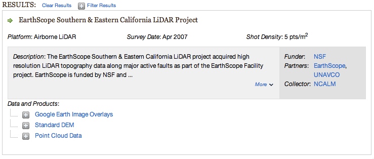
The OpenTopography team is pleased to announce the release of version 3.3 of the OpenTopography system. This release includes numerous user interface and system enhancements as well as bug fixes. The most prominent update in v 3.3 from the perspective of users and our data partners is that we've now made the "roles" of groups involved in a dataset collection more prominent. To achieve this, results displayed on the data discovery page as well as individual point cloud dataset pages now list the roles of groups involved in the dataset collection. Roles for each dataset include Funder(s), project Partner(s), and the dataset Collector(s). This update was made to continue OpenTopography's ongoing efforts to ensure that all groups receive appropriate credit for their involvement in a given lidar dataset.
Example: Find Data results - newly added roles are highlighted in the dark grey box at right:

Other user-visible updates released in OT v 3.3:
- Visualization products (browse images and Google Earth image overlays) are now optional when processing point cloud data. Previously these products were generated automatically for all lidar gridding jobs. However, since some OT users do not utilize these products, we now allow users to turn the feature off to improve processing run times.
- Updated Earthscope lidar acknowledgement language.
- More streamlined login. Login is now possible directly from the myOpentopo page.
- Google Maps updated to latest version on all map-based OT pages
Other aspects of the OT v. 3.3 release should be transparent to users but address bugs and underlying system design.
