Pre-wildfire lidar for Los Angeles is available to aid response efforts
The ongoing Los Angeles wildfires, including the Palisades, Eaton and Hurst fires, are scorching parts of the city and have destroyed thousands of homes and other buildings. On January 7, California Governor Gavin Newsom declared a state of emergency due to the fires.
In response to these devastating wildfires in southern California, OpenTopography is temporarily opening our services applied to all USGS 3D Elevation Project (3DEP) and NOAA Coastal lidar datasets covering Los Angeles County.
OpenTopography's easy to use web-based interfaces for accessing, processing, and visualizing high resolution pre-wildfire lidar in these affected regions can help to support the response to these devastating fires. Pre-event high resolution lidar data provides vegetation and terrain baselines useful for modeling fire behavior and prioritizing resources. For example, the data can be used to identify critical infrastructure near the fire zone, support safe operations of helicopters and planes navigating the terrain, and forecast fire containment needs.
Forty-two point cloud datasets and two digital terrain models from the USGS 3D Elevation and NOAA Coastal Lidar programs covering Los Angeles are now openly downloadable and processable via OpenTopography. The creation of an OpenTopography account is not required to access these datasets but allows higher processing limits for point cloud datasets and provides access to a personal dashboard to track data jobs and results. Learn more about the USGS 1 m digital terrain model here.
Find the data here:
- Download the 1 m USGS DTM over Pacific Palisades, CA, data cover the area impacted by the Palisades Fire and were produced from lidar data acquired before the fire
- Download the 1 m USGS DTM over Altadena, CA, data cover the area impacted the Eaton Fire and were produced from lidar data acquired before the fire
- Find, process and download point cloud datasets from before the fire

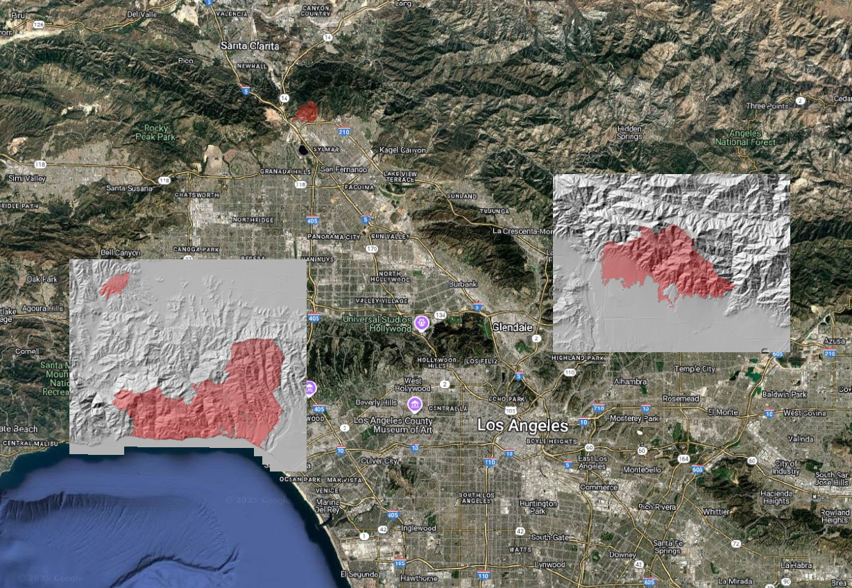
Map of downloadable pre-fire USGS 1 m lidar digital terrain models (DTM) covering the areas impacted by the Palisades and Eaton fires. Fire footprints are as of January 14.

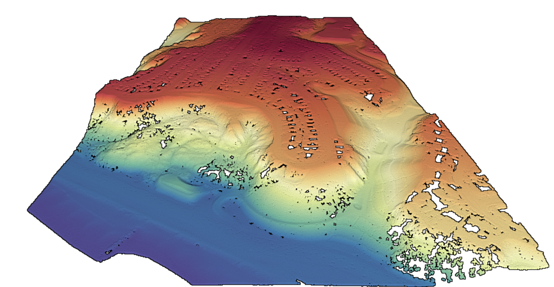
3D view of a pre-wildfire lidar point cloud for a portion of Pacific Palisades showing the coastal bluffs in the center and Potrero Canyon on the right. The fire destroyed houses in this area. The 7 points/ m2 lidar dataset was acquired in 2015-2016. Data source: Los Angeles lidar 2016

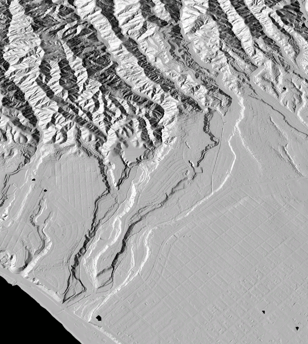
3D view of the topographic pre-wildfire bare earth hillshade at Pacific Palisades, Santa Monica and the upland canyons. The 7 points/ m2 lidar dataset was acquired in 2015-2016. Data source: Los Angeles lidar 2016
OpenTopography is supported by the U.S. National Science Foundation to provide access to high-resolution topography data, and related tools and resources, primarily for use primarily in academic Earth science research and education. Under normal circumstances, OpenTopography provides access to USGS 3DEP and NOAA coastal lidar data to our core academic community for free and to non-academic users via a subscription to OT+.
GET STARTED:
Lidar Basics: Learn about what lidar is, how lidar works, and how lidar is used
Access Data: Find lidar and other topographic datasets
Make a Digital Elevation Model: Watch this video to learn how to make a DEM and hillshade on OpenTopography with just a few mouse clicks.
Interested in learning more about OpenTopography? Check out our Partner With Us page for an overview of OpenTopography services for the hosting, management, distribution, and processing of high resolution topography for academic, government, and commercial stakeholders. Get in touch with our team here.
