USGS 3DEP lidar covering areas impacted by Hurricane Ian now available from OpenTopography
This subscription provides access to lidar topography covering most of the US mainland, Hawaii, and territories as well as satellite data over the Arctic and Antarctic. This includes access to the USGS 3D Elevation Program (3DEP) and NOAA Coastal Lidar.
In response to Hurricane Ian, OpenTopography is temporarily removing our academic user restriction on access to USGS 3D Elevation Project (3DEP) lidar datasets for impacted areas in Florida, Georgia, South Carolina, and North Carolina. We hope that OpenTopography's easy to use interface for accessing, processing, and visualizing high resolution USGS 3DEP lidar datasets in these affected regions will help to support hurricane emergency response, recovery and rebuilding, assessment of environmental impacts, and research.
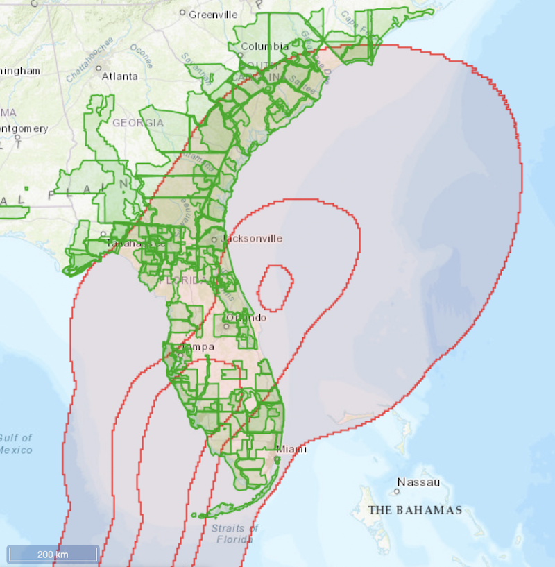
Over 120 USGS 3DEP lidar datasets, covering 131,000 square miles (3.4 trillion lidar points), in Hurricane Ian impacted regions of Florida, Georgia, South Carolina and North Carolina are now publicly accessible via OpenTopography. Creation of an OpenTopography account is encouraged but not required. To access these data visit the OpenTopography Find Data Map.

Map showing the USGS 3DEP lidar datasets (green) in Florida, Georgia, South Carolina and North Carolina now temporarily available from OpenTopography in response to Hurricane Ian. Area of tropical-storm-force winds path (red) from NOAA.

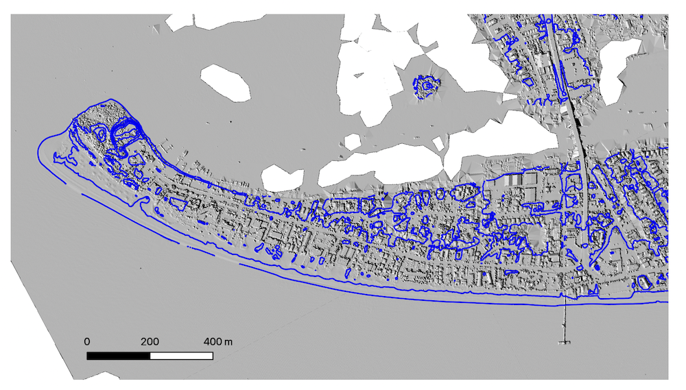
Digital Surface Model with 1 m contour lines showing Fort Myers Beach in 2018. This area was heavily damaged by Hurricane Ian.
OpenTopography is supported by the U.S. National Science Foundation to provide access to high-resolution topography data, and related tools and resources, primarily for use primarily in Earth science research and education. OpenTopography provides access to USGS 3DEP lidar data to our core academic community for free but use by non-academics is normally restricted due to funding limitations. We're removing this restriction temporarily in response to Hurricane Ian to help with relief efforts. To learn more about OpenTopography restrictions on access to 3DEP please see this page.
GET STARTED:
Lidar Basics: Learn about what lidar is, how lidar works, and how lidar is used
Access Data: Find lidar and other topographic datasets
Make a Digital Elevation Model: Watch this video to learn how to make a DEM and hillshade on OpenTopography with just a few mouse clicks.
Extract hydrological information: Watch this video to learn how to calculate flow paths on hydrologically conditioned DEMs on OpenTopography.

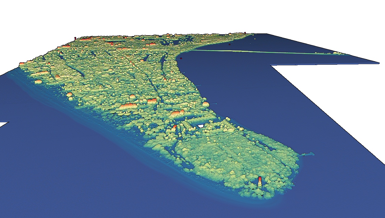
3D visualization of 2018 lidar point cloud for Sanibel Island, heavily impacted by Hurricane Ian.
Interested in learning more about OpenTopography? Check out our Partner With Us page for an overview of OpenTopography services for the hosting, management, distribution, and processing of high resolution topography for academic, government, and commercial stakeholders. Get in touch with our team here.
