Lake Tahoe Basin Lidar Data Released
OpenTopography is pleased to announce that lidar point cloud data for the whole Lake Tahoe Basin (941 km2) on the California/Nevada border are now available. This 12+ billion point dataset was collected by Watershed Sciences, Inc. through a contract administered by Tahoe Regional Planning Agency (TRPA) and the U.S. Geological Survey. The Tahoe LiDAR project was funded through a Southern Nevada Public Land Management Act grant program that is administered by the US Bureau of Land Management to support a range of environmental and ecological science and planning activities. At greater than 11 shots per square meter, these data provide an amazing representation of the landscape within the Tahoe Basin, and we anticipate them being one of the more heavily utilized datasets hosted by OpenTopography.
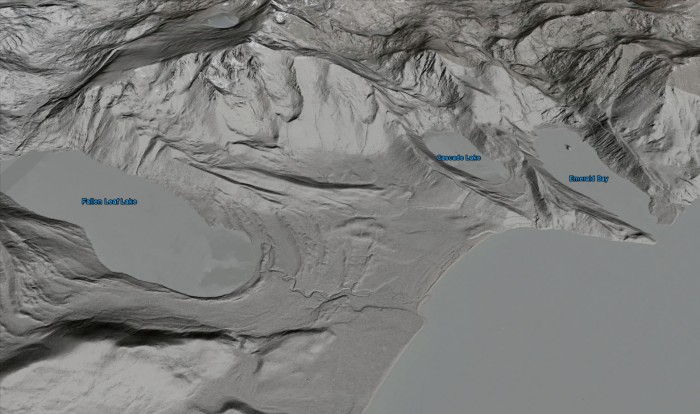
OpenTopography has signed a memorandum of understanding with TRPA to leverage the OpenTopography system to provide public access to these valuable data. This initial release provides access to the raw lidar point cloud data, but later releases will include Google Earth image overlays (e.g. image below), as well as pre-computed digital elevation model (DEM) data. We've also set up a Lake Tahoe Lidar User Group discussion forum for users who wish to interact with others working with these data.
Update 05/03/2011: Lidar derived imagery for the Tahoe dataset can now be viewed in Google Earth - see this OpenTopography blog post for more information.
Update 06/07/2011: Vendor generated standard digital elevation models (DEMs) and intensity rasters can now be download from the OpenTopography Standard DEM interface - more information on the data are available in a short blog post: Tahoe Standard DEM Data

Bare earth lidar image for the Emerald Bay area of the southwestern Lake Tahoe Basin overlain on Google Earth
Background:
Watershed Sciences, Inc. (WSI) collected Light Detection and Ranging (LiDAR) data of land surrounding Lake Tahoe from August 11th to August 24th, 2010. The requested area of interest (AOI), excluding the actual lake, was 232,536 acres of delivered LiDAR data. The LiDAR survey used two Leica ALS50 Phase II laser systems mounted in a Cessna Caravan 208B. The Leica systems were set to acquire 83,000 - 105,900 laser pulses per second (i.e., 83 - 105.9 kHz pulse rate) and flown at 900 - 1300 meters above ground level (AGL) depending on weather and terrain, capturing a scan angle of +/-14* from nadir. These settings were developed to yield points with an average native pulse density of >8 pulses per square meter over terrestrial surfaces. The resulting average first-return density of delivered dataset is 11.82 points per square meter with an average ground point density of 2.26 points per square meter. The vertical accuracy was estimated at 3.5 cm RMSE. All TRPA LiDAR data is in the public domain.
