February 2025 Data Releases
Mar 25, 2025
OpenTopography provides easy, centralized access to a diverse collection of topographic data. We strive to simplify data discovery by providing a single, accessible platform that integrates data from academic, private, and federal sources, including USGS 3DEP and NOAA Digital Coast. Below is a highlight of datasets that became available on the OpenTopography platform in February 2025.
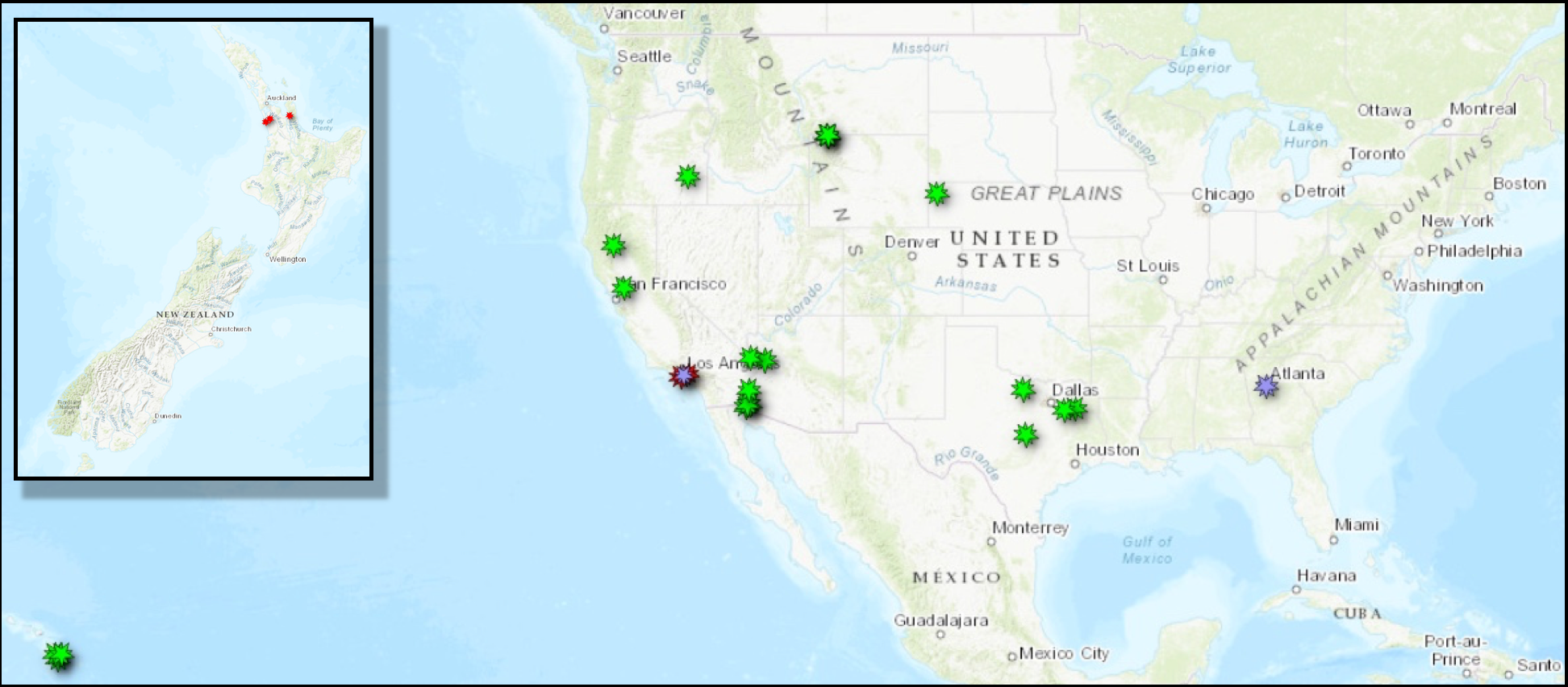
Location of datasets released in February 2025 and accessible through OpenTopography. USGS 3DEP datasets are in green, OpenTopography-hosted data is in red, and Community DataSpace datasets are in purple. Note: Map inset shows OT-hosted Land Information New Zealand datasets in red.
USGS 3DEP Datasets
The USGS is currently making 3DEP lidar point cloud data available via an Amazon Web Services (AWS) S3 Requester Pays Bucket, and as an AWS Public Dataset. To learn more about 3DEP and AWS see this USGS press release: USGS 3DEP Lidar Point Cloud Now Available as Amazon Public Dataset. Consistent with OpenTopography's mission of making high resolution topography data easier to discover and use, we are leveraging the USGS 3DEP move to AWS to provide a layer of value-added services that enable our users to subset, grid, download, and/or visualize any portion of the USGS 3DEP collection.
USGS 3DEP data is freely available to our core US academic user community (e.g. users who register with a .edu email domain). However, non-academics can access 3DEP data, as well as all other restricted datasets, by signing up for OpenTopography Plus (OT+). OT+ is a subscription service that enables one-stop, easy-to-use access to the highest quality lidar topography for the US. For more details about OT+, or to sign up, see the OT+ signup page.
New USGS 3DEP data:
- CA SolanoCounty 1 A23
- CA NorthernCA 2 B22
- WY GrandTetonNP 2 D22
- HI NOAAMauiOahu 3 B20
- NE Statewide 2 D23
- AZ Mohave 1 D23
- AZ LowerColoradoTB 1 C23
- TX CentralEast 1 A23
- TX CentralEast 2 A23
- OR SouthEast 7 D22
OpenTopography Hosted Datasets
The majority of datasets hosted directly by OpenTopography are free and open to all users. In February 2025, there were two new datasets added in California in response to the Palisades and Eaton Fires. OpenTopography utilized pre and post-event fire data to create a series of topographic difference products highlighted in our recent blog post. We also created an interactive web map to aid visualization and interaction with the datasets over areas of the Palisades and Eaton Fires.
New OpenTopography hosted data:
- Preliminary Digital Elevation Models for Eaton Fire, CA 2025
- Preliminary Digital Elevation Models for Palisades Fire, CA 2025
Land Information New Zealand (LINZ) Datasets
OpenTopography has an on ongoing collaboration with Land Information New Zealand that makes OpenTopography the primary distribution platform for point cloud data collected as part of the LINZ national elevation program.
New Land Information New Zealand data:
OpenTopography Community DataSpace Datasets
The OpenTopography Community Dataspace allows users who are producing small to moderate sized topographic datasets (with technologies such as lidar and photogrammetry) to archive their data with OpenTopography via a simple drag and drop user interface. This feature is designed to support data publication and citation, academic data reuse, and educational applications. Each submission is reviewed by OpenTopography staff and approved on a case-by-case basis. Datasets in the OT Dataspace receive a Digital Object Identifier (DOI) are are displayed on the OpenTopography Find Data Map so they are discoverable and downloadable alongside data hosted by OpenTopography. The Dataspace is meant to complement standard OpenTopography data hosting for larger datasets produced by our data provider partners
New Community Dataspace data:
- Panola Mountain Research Watershed Outcrop Survey, Georgia, USA, July 2021
- Topographic differencing spanning the 2025 Palisades and Eaton Fires, LA
Sample Graphics From Data Released in February 2025
3D point cloud colored by intensity of new lava flows over the Big Island of Hawaii. Data Source: USGS 3DEP: HI NOAAMauiOahu 3 B20.
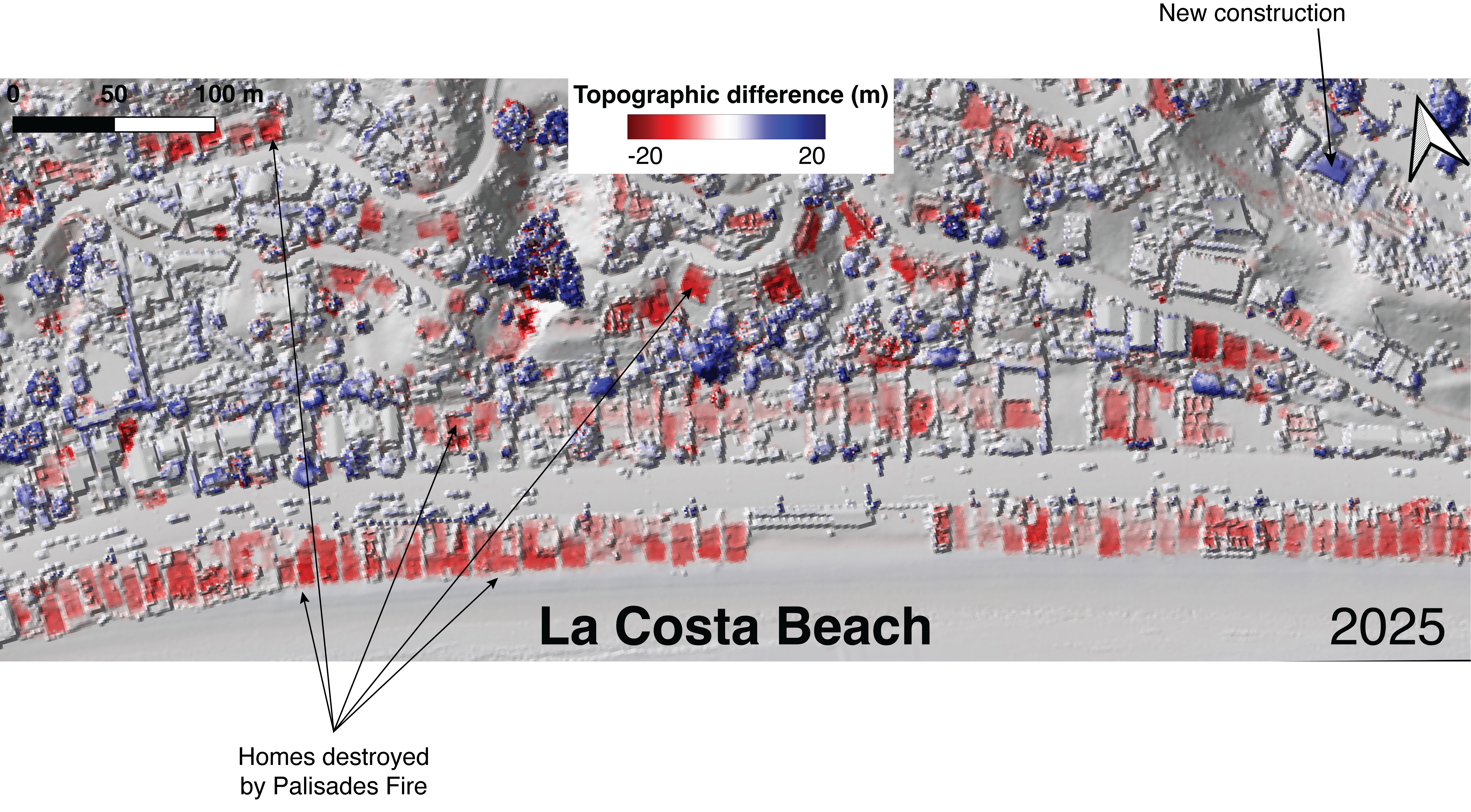
Topographic differencing products were produced for the Eaton and Palisades Fire. This graphic shows areas where homes were destroyed by the fires in red. For more details about this data, see the blogpost here. Data Source: Community Dataspace: Topographic differencing spanning the 2025 Palisades and Eaton Fires, LA
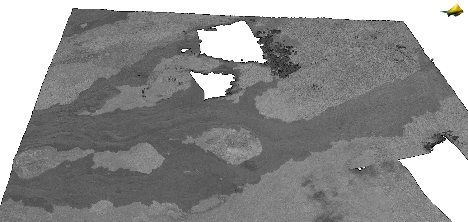
Hillshade of a section of managed forest land in Northern California from the dataset: USGS 3DEP: CA NorthernCA 2 B22
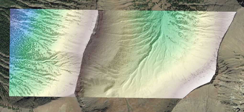
Colored hillshade of Woody Ridge in Wyoming draped on Google Earth imagery. Data Source: USGS 3DEP: WY GrandTetonNP 2 D22
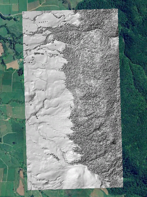
Hillshade of the edge of Kaimai Mamaku Forest Park in New Zealand. Background imagery: Google Earth. Data Source: LINZ: Waikato, New Zealand 2024 D22