Golden Gate LiDAR Project
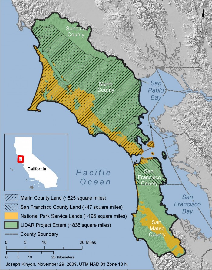
Another new LiDAR data collection funded with stimulus dollars that I recently became aware of is the ARRA Golden Gate LiDAR Project. Led by San Francisco State University and funded by USGS ARRA, this project will collect data in coastal regions around San Francisco:
The project extent is based upon the watershed boundaries for all watersheds that contain the lands of Marin County and San Francisco County. It also includes the watersheds that contain Point Reyes National Seashore and the Golden Gate National Recreation Area. The area of interest includes watersheds that are also located in southern Sonoma County and northern San Mateo County and when combined total ~835 square miles (planimetric estimate) of area. The project area includes the Marin Peninsula and San Francisco Peninsula that form the western edge of San Francisco Bay and San Pablo Bay.
Like the Northeast ARRA data collection I just posted about, the Golden Gate data sound like they will be collected to the meet the USGS-NGP Base LiDAR Specification with 2m nominal point spacing. The data will be available via the USGS CLICK archive and will be incorporated into the USGS 1/9 arc-second NED layer. The project website indicates that data collection may have begun last month.
For the OpenTopography community, these Golden Gate data are likely of great interest given that they expand upon the existing Bay Area LiDAR coverage provided by the OpenTopography-hosted Northern California EarthScope LiDAR and are designed to capture full watersheds. Although lower resolution than the data collected by EarthScope, these data should be very interesting to a large number of users.
Map of the collection area from the Golden Gate LiDAR project website:

