
September 2026 Data Releases
Oct 17, 2026
A new Community Dataspace time series tracks sediment mobilization after the Eaton Fire, with repeat UAV lidar surveys of 20 debris basins along the San Gabriel Mountains front in Los Angeles County. Seven surveys between October 2025 and February 2026 bracket three major post-fire storms, supporting multi-temporal topographic change analysis. Also new this month, the final two USGS 3DEP 1 m datasets for Illinois have been added, completing 1 m coverage of the entire state.
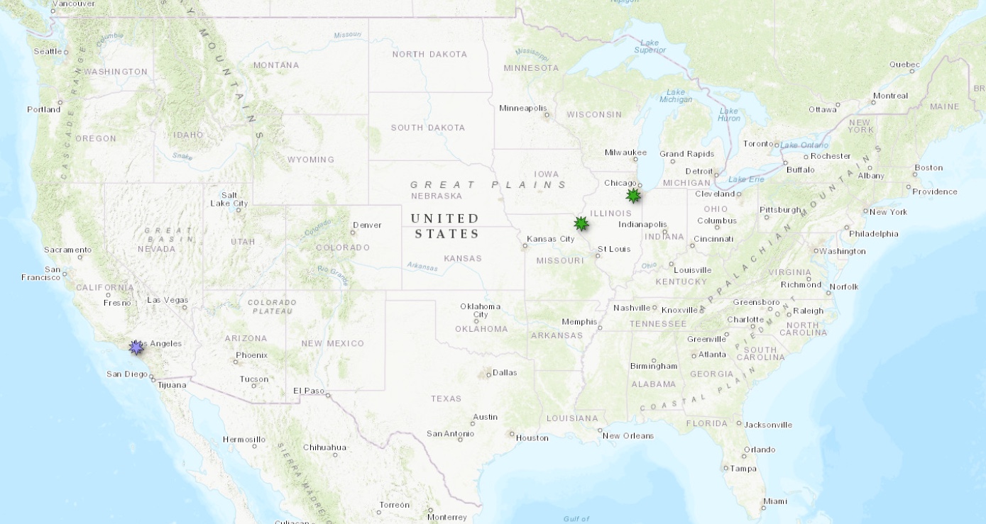
New Community Dataspace datasets in Southern California (purple makers) and new USGS 3DEP 1m data in Illinois (green markers)
USGS 3DEP 1m Raster Dataset Updates
The USGS 3DEP standard one-meter digital terrain models (DTMs) are produced exclusively from high resolution lidar source data. These DTMs are hydro-flattened, represent the topographic bare-earth surface, and are seamless within collection projects. This dataset is continually growing as new lidar data is collected, processed, and integrated into the 1 meter mosaic.
The USGS 1m data is freely available to our core US academic user community (e.g. users who register with a .edu email domain). However, non-academics can access USGS data, as well as all other restricted datasets, by signing up for OpenTopography Plus (OT+). OT+ is a subscription service that enables one-stop, easy-to-use access to the highest quality topography data for the US. For more details about OT+, or to sign up, see the OT+ signup page.
Latest USGS 1m DEM data:
OpenTopography Community Dataspace Datasets
The OpenTopography Community Dataspace allows users who are producing small to moderate sized topographic datasets (with technologies such as lidar and photogrammetry) to archive their data with OpenTopography via a simple drag and drop user interface. This feature is designed to support data publication and citation, academic data reuse, and educational applications. Each submission is reviewed by OpenTopography staff and approved on a case-by-case basis. Datasets in the OT Dataspace receive a Digital Object Identifier (DOI) and are displayed on the OpenTopography Find Data Map so they are discoverable and downloadable alongside data hosted by OpenTopography. The Dataspace is meant to complement standard OpenTopography data hosting for larger datasets produced by our data provider partners.
New Community Dataspace data:
Sample Graphics From Data Released in September 2026
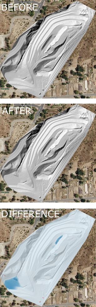
Pre- and post-storm topography of the Lincoln debris basin in Southern California, shown over Google Earth imagery. Top: hillshade of a Digital Terrain Model (DTM) from before a December 2025 storm. Middle: hillshade of the DTM from after the storm. Bottom: difference grid (post-storm minus pre-storm) highlighting sediment mobilized by the storm and deposited in the basin, with darker blues indicating greater deposition. Data Source: CDS: UAV LiDAR Surveys for Quantifying Post-Eaton Fire Sediment Mobilization, CA.
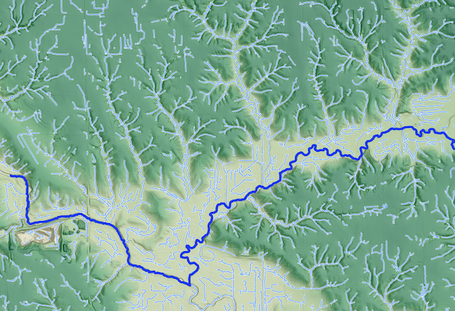
Hydrology of the La Moine river in Illinois. Background DTM and hydrology derived from the USGS 3DEP 1m DTM. Central channel of the La Moine is in dark blue, with tributaries in lighter blue. Data Source: USGS 3DEP: USGS 1 meter Digital Elevation Model.
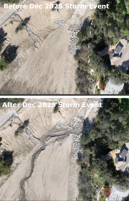
Point clouds colored by RGB values from orthophotos showing the before and after effects of the December 2025 Storm event in the Bailey debris basin in Southern California. Data Source: CDS: UAV LiDAR Surveys for Quantifying Post-Eaton Fire Sediment Mobilization, CA.