
August 2026 Data Releases
Sep 15, 2026
New lidar coverage was added this month in California, Virginia, and Pennsylvania, including a NOAA bathymetry dataset spanning the Appalachian rivers of West Virginia and Pennsylvania that captures depth data along these major waterways. Two large USGS 3DEP lidar datasets were also added over southern California. Lastly, a new Community Dataspace dataset was contributed for a site in southern Japan, collected using SLAM (Simultaneous Localization and Mapping) lidar — a mobile scanning technique that tracks the sensor's position by comparing successive laser scans as it moves, allowing data collection in dense or enclosed terrain.
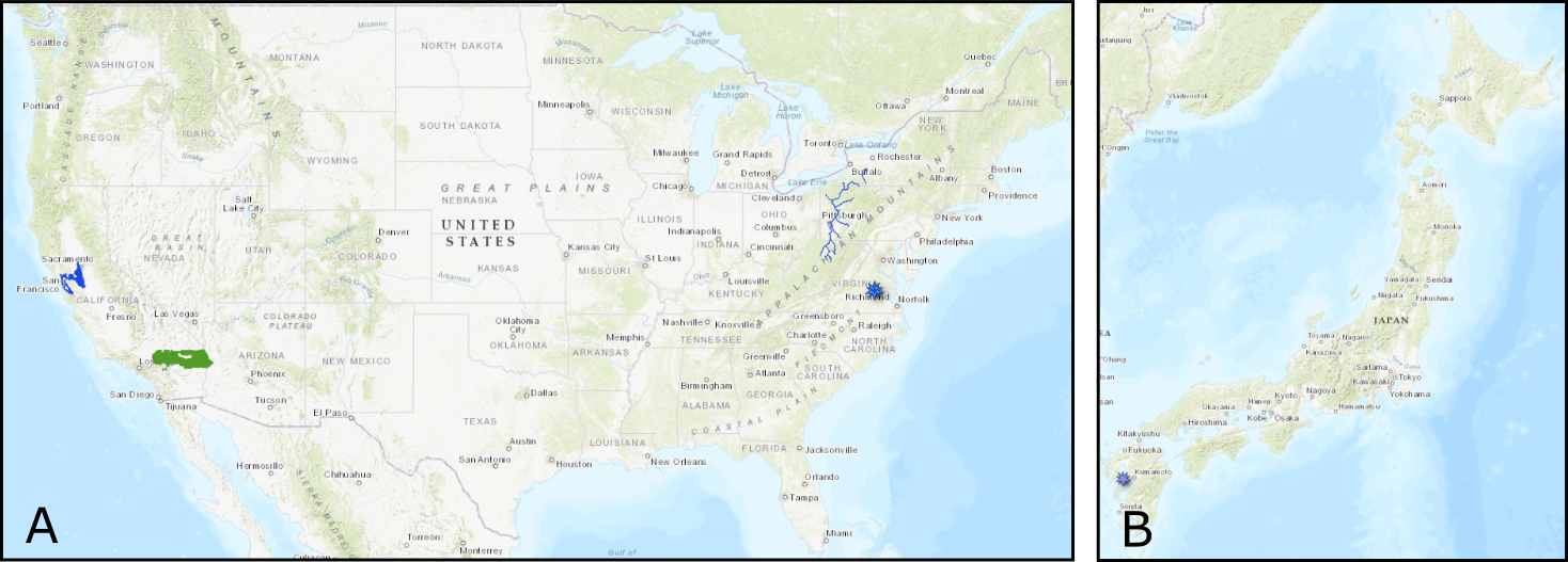
A. Locations of new USGS 3DEP datasets in southern California (green polygons), and NOAA datasets along waterways in Appalachia, Virginia (blue marker), and in northern California. B. Community Dataspace dataset in southern Japan (purple maker).
USGS 3D Elevation Program (3DEP) Datasets
The USGS is currently making 3DEP lidar point cloud data available via an Amazon Web Services (AWS) S3 Requester Pays Bucket, and as an AWS Public Dataset. To learn more about 3DEP and AWS see this USGS press release: USGS 3DEP Lidar Point Cloud Now Available as Amazon Public Dataset. Consistent with OpenTopography's mission of making high resolution topography data easier to discover and use, we provide a layer of value-added services that enable our users to subset, grid, download, and/or visualize any portion of the USGS 3DEP collection.
USGS 3DEP data is freely available to our core US academic user community (e.g. users who register with a .edu email domain). However, non-academics can access 3DEP data, as well as all other restricted datasets, by signing up for OpenTopography Plus (OT+). OT+ is a subscription service that enables one-stop, easy-to-use access to the highest quality lidar topography for the US. For more details about OT+, or to sign up, see the OT+ signup page.
New USGS 3DEP Datasets:
OpenTopography Community Dataspace Datasets
The OpenTopography Community Dataspace allows users who are producing small to moderate sized topographic datasets (with technologies such as lidar and photogrammetry) to archive their data with OpenTopography via a simple drag and drop user interface. This feature is designed to support data publication and citation, academic data reuse, and educational applications. Each submission is reviewed by OpenTopography staff and approved on a case-by-case basis. Datasets in the OT Dataspace receive a Digital Object Identifier (DOI) and are displayed on the OpenTopography Find Data Map so they are discoverable and downloadable alongside data hosted by OpenTopography. The Dataspace is meant to complement standard OpenTopography data hosting for larger datasets produced by our data provider partners.
New Community Dataspace data:
NOAA Coastal Lidar Datasets
The NOAA Coastal Lidar Data is a collection of lidar projects from many different sources and agencies, geographically focused on the coastal areas of the United States of America. The data are stored in the Entwine Point Tile format, and hosted on Amazon as part of the AWS Public Dataset Program. Consistent with OpenTopography's mission of making high resolution topography data easier to discover and use, we provide a layer of value-added services that enable our users to subset, grid, download, and/or visualize any portion of the NOAA Coastal Lidar collection.
NOAA Digital Coast data is freely available to our core US academic user community (e.g. users who register with a .edu email domain). However, non-academics can access NOAA data, as well as all other restricted datasets, by signing up for OpenTopography Plus (OT+). OT+ is a subscription service that enables one-stop, easy-to-use access to the highest quality lidar topography for the US. For more details about OT+, or to sign up, see the OT+ signup page.
New NOAA Coastal Lidar data:
- 2024 - 2025 NOAA NGS Topobathy Lidar: Appalachia Rivers
- 2025 City of Richmond Lidar: Richmond, VA
- 2025 Lidar: San Francisco Bay - Delta Estuary, CA
Sample Graphics From Data Released in August 2026
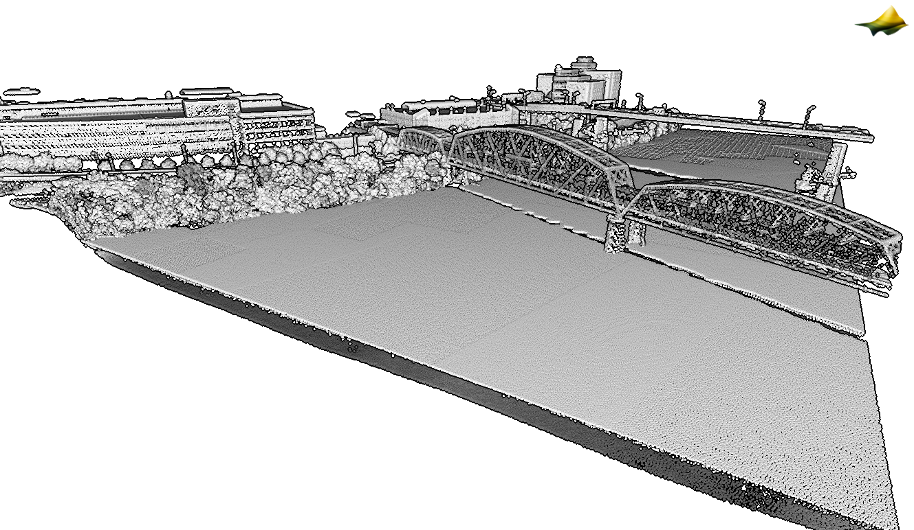
Liberty Bridge and a portion of a Port Authority bridge over the Monongahela River in Pittsburg. Data is colored by intensity. Note this dataset contains bathymetry data, so both the water surface and river bed is visible. Data Source: NOAA: 2024 - 2025 NOAA NGS Topobathy Lidar: Appalachia Rivers.
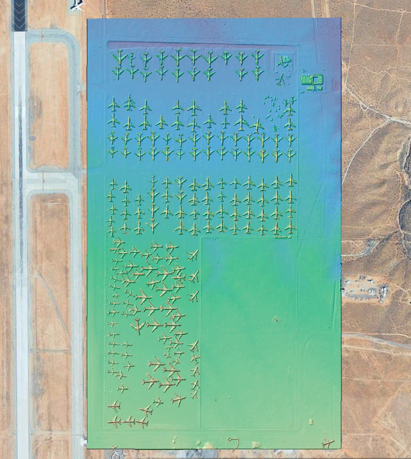
Hillshade colored by elevation of decommissioned planes in the Victorville Airplane Graveyard in California. Background Imagery: Google Earth.. Data Source: USGS 3DEP Lidar: CA FEMAR9Southeast 2 D24.
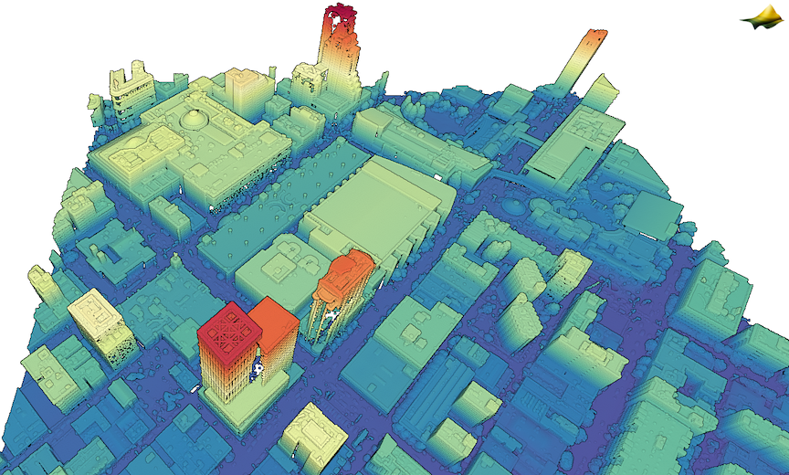
3D point cloud colored by elevation of view down Howard Street in San Francisco, California. The Moscone Center, which will host the 2026 AGU Fall Meeting is in the center of the image.NOAA: 2025 Lidar: San Francisco Bay - Delta Estuary, CA.
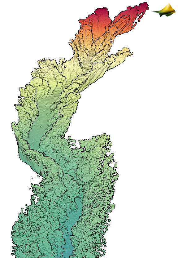
3D point cloud colored by elevation of the Tansandani Gully near Mt Unzen, Japan. Data was collected using PPK-corrected SLAM Mobile lidar. Data Source: OT CDS: Tansandani Gully (Mt Unzen, Japan) using PPK-corrected SLAM Mobile LiDAR