March 2026 Data Releases
Mar 30, 2026
OpenTopography added new high-resolution datasets in March 2026, including lidar surveys from the Los Angeles region capturing post-fire landscape change from 2020–2022. New USGS 3DEP datasets in California and Nevada and NOAA Coastal lidar data from the Ozarks region and Oregon further expand coverage across diverse environments.
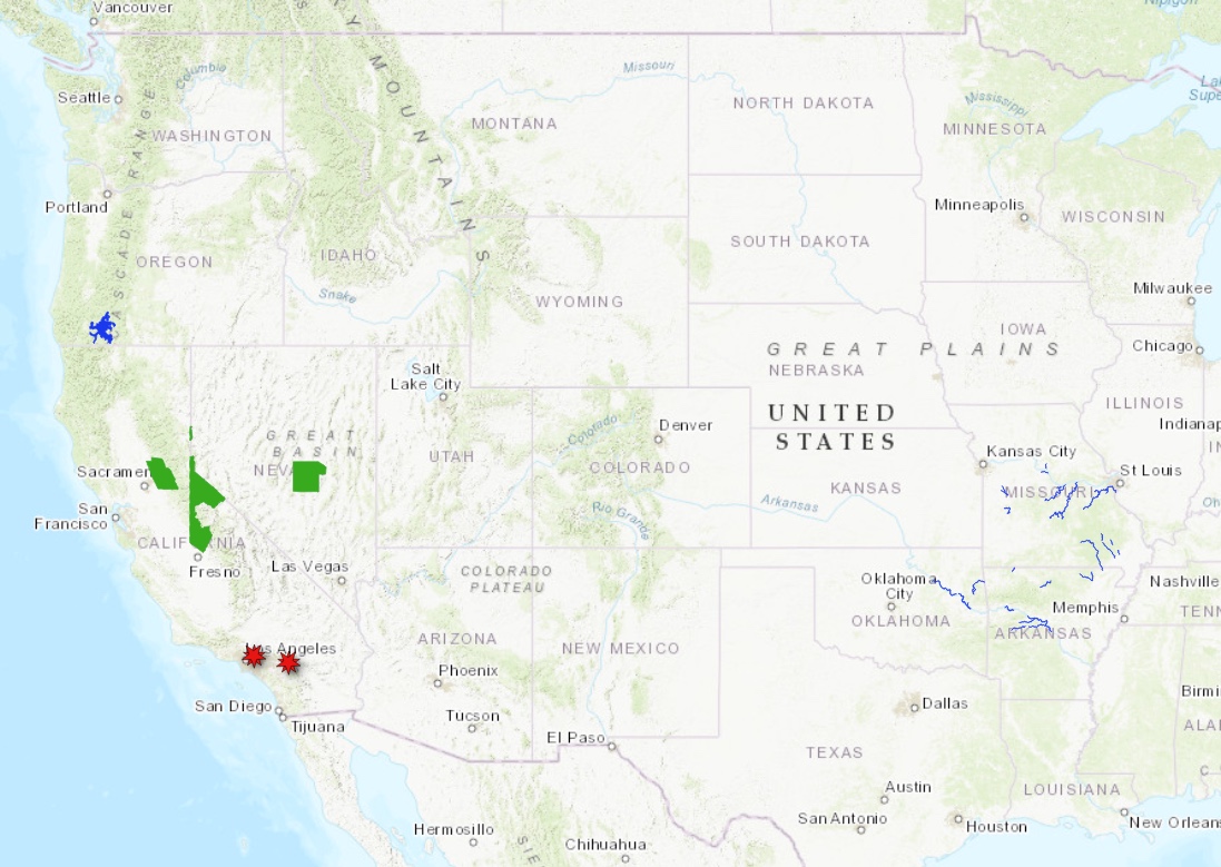
Locations of new USGS 3DEP datasets (green polygons), new NOAA datasets (blue polygons), and 4 new OT-hosted datasets near Los Angeles, CA (red markers)
OpenTopography Hosted Datasets
Four new fire-related datasets in the Los Angeles, California region have been added this month. A Post-Bobcat Fire lidar dataset was collected in the San Gabriel Mountains in 2020. In addition, there is a series of disaster-response data from 2020-2022 that was used to map terrain influenced by the Apple Fire (July 31, 2020).
New OpenTopography hosted data:
- Post-Bobcat Fire lidar of Sawpit Wash, California, 2020
- Riverside County Flood Control Apple Fire Lidar, CA 2020
- Riverside County Flood Control Apple Fire Lidar, CA 2021
- Riverside County Flood Control Apple Fire Lidar, CA 2022
USGS 3D Elevation Program (3DEP) Datasets
The USGS is currently making 3DEP lidar point cloud data available via an Amazon Web Services (AWS) S3 Requester Pays Bucket, and as an AWS Public Dataset. To learn more about 3DEP and AWS see this USGS press release: USGS 3DEP Lidar Point Cloud Now Available as Amazon Public Dataset. Consistent with OpenTopography's mission of making high resolution topography data easier to discover and use, we provide a layer of value-added services that enable our users to subset, grid, download, and/or visualize any portion of the USGS 3DEP collection.
USGS 3DEP data is freely available to our core US academic user community (e.g. users who register with a .edu email domain). However, non-academics can access 3DEP data, as well as all other restricted datasets, by signing up for OpenTopography Plus (OT+). OT+ is a subscription service that enables one-stop, easy-to-use access to the highest quality lidar topography for the US. For more details about OT+, or to sign up, see the OT+ signup page.
New USGS 3DEP Datasets:
NOAA Coastal Lidar Datasets
The NOAA Coastal Lidar Data is a collection of lidar projects from many different sources and agencies, geographically focused on the coastal areas of the United States of America. The data are stored in the Entwine Point Tile format, and hosted on Amazon as part of the AWS Public Dataset Program. Consistent with OpenTopography's mission of making high resolution topography data easier to discover and use, we provide a layer of value-added services that enable our users to subset, grid, download, and/or visualize any portion of the NOAA Coastal Lidar collection.
NOAA Digital Coast data is freely available to our core US academic user community (e.g. users who register with a .edu email domain). However, non-academics can access NOAA data, as well as all other restricted datasets, by signing up for OpenTopography Plus (OT+). OT+ is a subscription service that enables one-stop, easy-to-use access to the highest quality lidar topography for the US. For more details about OT+, or to sign up, see the OT+ signup page.
New NOAA Coastal Lidar data:
- 2023 - 2024 NOAA NGS Topobathy Lidar: Ozarks area (Missouri, Arkansas and Oklahoma Rivers)
- 2022 - 2023 DOGAMI/OLC Lidar: Jackson County, OR
Sample Graphics From Data Released in March 2026

3D Point cloud colored by elevation gradient over the Sierra Nevada Mountains. Data Source: USGS 3DEP: CA SierraNevada 8 2022
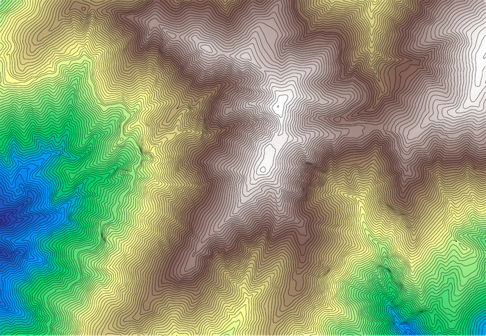
Smoothed contours over a section of the San Gabriel Mountains, California. Data Source: OT: Post-Bobcat Fire lidar of Sawpit Wash, California, 2020

DEM colored by elevation and draped on a hillshade of a section of central Nevada. Data Source: USGS 3DEP: NV Southern 2 D23.
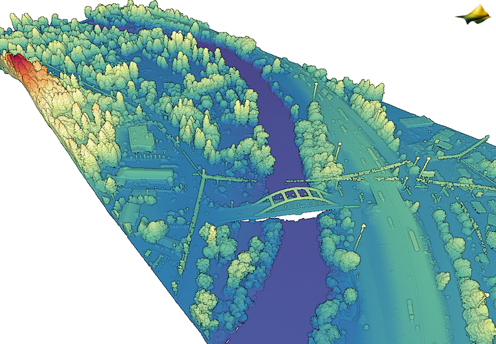
3D point cloud colored by elevation of a section of the Rogue River in Oregon. Data Source: NOAA: 2022 - 2023 DOGAMI/OLC Lidar: Jackson County, OR.