September 2025 Data Releases
Sep 30, 2025
OpenTopography provides easy, centralized access to a diverse collection of topographic data. We strive to simplify data discovery by providing a single, accessible platform that integrates data from a variety of sources including the USGS 3D Elevation Program (3DEP), NOAA Coastal Lidar, Natural Resources Canada, Polar Geospatial Center, and many more. Below are highlights of datasets that became available or were updated on the OpenTopography platform in September 2025.

A. Location of new LINZ dataset in red in New Zealand. B. Location of new NOAA datasets in Alaska in blue. C. Location of new USGS 3DEP 1 meter data in red, new NOAA datasets in blue, and a new Community Dataspace dataset near Ridgecrest, CA in purple.
USGS 3DEP 1m Raster Dataset Updates
The USGS 3DEP standard one-meter digital terrain models (DTMs) are produced exclusively from high resolution lidar source data. These DTMs are hydro-flattened, represent the topographic bare-earth surface, and are seamless within collection projects. This dataset is continually growing as new lidar data is collected, processed, and integrated into the 1 meter mosaic.
The USGS 1m data is freely available to our core US academic user community (e.g. users who register with a .edu email domain). However, non-academics can access USGS data, as well as all other restricted datasets, by signing up for OpenTopography Plus (OT+). OT+ is a subscription service that enables one-stop, easy-to-use access to the highest quality topography data for the US. For more details about OT+, or to sign up, see the OT+ signup page.
Latest USGS 1m DEM data:
Land Information New Zealand (LINZ) Datasets
OpenTopography has an on ongoing collaboration with Land Information New Zealand that makes OpenTopography the primary distribution platform for point cloud data collected as part of the LINZ national elevation program.
New Land Information New Zealand data:
NOAA Coastal Lidar Datasets
The NOAA Coastal Lidar Data is a collection of lidar projects from many different sources and agencies, geographically focused on the coastal areas of the United States of America. The data are stored in the Entwine Point Tile format, and hosted on Amazon as part of the AWS Public Dataset Program. Consistent with OpenTopography's mission of making high resolution topography data easier to discover and use, we provide a layer of value-added services that enable our users to subset, grid, download, and/or visualize any portion of the NOAA Coastal Lidar collection.
NOAA Digital Coast data is freely available to our core US academic user community (e.g. users who register with a .edu email domain). However, non-academics can access NOAA data, as well as all other restricted datasets, by signing up for OpenTopography Plus (OT+). OT+ is a subscription service that enables one-stop, easy-to-use access to the highest quality lidar topography for the US. For more details about OT+, or to sign up, see the OT+ signup page.
New NOAA Coastal Lidar data:
- 2023 NYS ITS Lidar: Lake Ontario Shoreline, NY
- 2024 NOAA Lidar: AK Coastal Communities (Eek, Goodnews Bay, Nelson Lagoon, Quinhagak, Togiak)
- 2016 USFS Lidar: Colville Forest East, WA
- 2023 NOAA Lidar: AK Coastal Communities (Dillingham/Aleknagik, Ekuk, Ekwok, Koliganek, Manokotak, New Stuyahok)
- 2024 NOAA Lidar: AK Coastal Communities (Kachemak Bay)
OpenTopography Community Dataspace Datasets
The OpenTopography Community Dataspace allows users who are producing small to moderate sized topographic datasets (with technologies such as lidar and photogrammetry) to archive their data with OpenTopography via a simple drag and drop user interface. This feature is designed to support data publication and citation, academic data reuse, and educational applications. Each submission is reviewed by OpenTopography staff and approved on a case-by-case basis. Datasets in the OT Dataspace receive a Digital Object Identifier (DOI) and are displayed on the OpenTopography Find Data Map so they are discoverable and downloadable alongside data hosted by OpenTopography. The Dataspace is meant to complement standard OpenTopography data hosting for larger datasets produced by our data provider partners.
New Community Dataspace data:
Sample Graphics From Data Released in September 2025
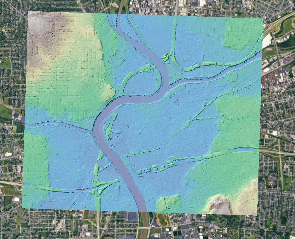
Colorized hillshade of the USGS 1m DTM data over Dayton, Ohio. Note this dataset is a hydro-flattened digital terrain model, so it has buildings, bridges, and overpasses removed. Data Source: USGS: USGS 1 meter Digital Elevation Model.
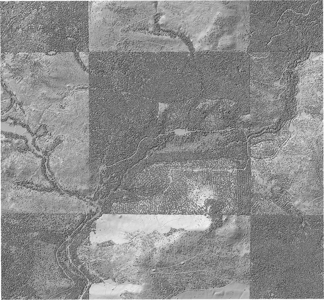
Hillshade of forest management region in eastern Washington. Data Source: NOAA: 2016 USFS Lidar: Colville Forest East, WA.
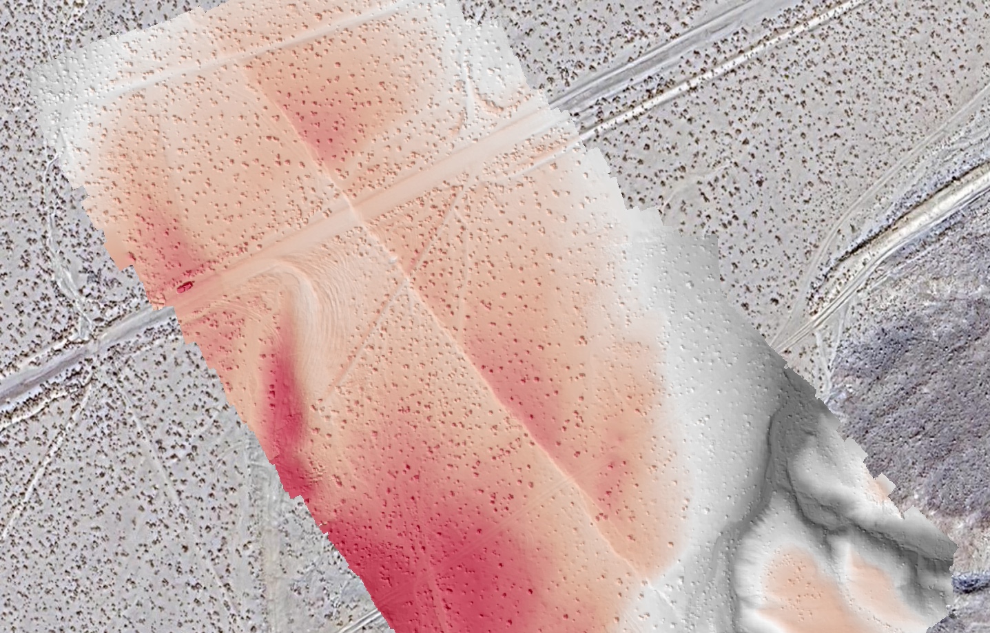
Colored hillshade covering a portion of the 2019 M7.1 Ridgecrest earthquake surface rupture in California (red is higher elevation, grey is lower elevation). Data Source: CDS: High-Res SfM Topography of a Portion of the 2019 M7.1 Ridgecrest Rupture.
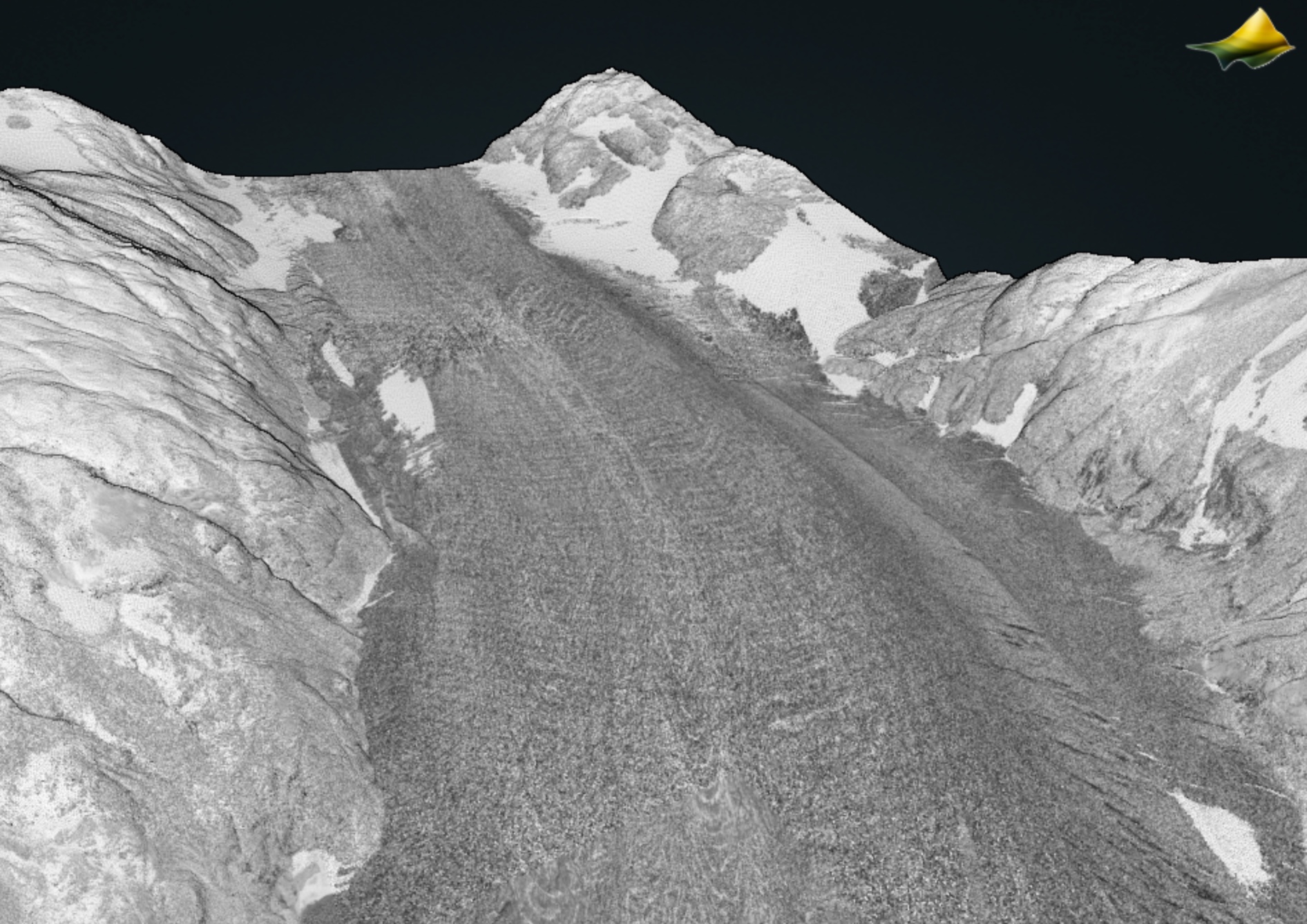
3D point cloud of intensity of a glacier near Kachemak Bay, Alaska. Data Source: NOAA: 2024 NOAA Lidar: AK Coastal Communities (Kachemak Bay).
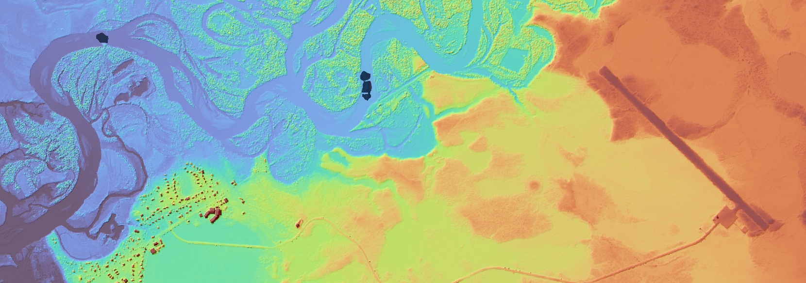
Colorized hillshade of Quinhagak, Alaska. Data Source: NOAA: 2024 NOAA Lidar: AK Coastal Communities (Eek, Goodnews Bay, Nelson Lagoon, Quinhagak, Togiak).