API access to USGS 3DEP rasters now available
Oct 2, 2023
OpenTopography has expanded its API-accessible datasets to now include the U.S. Geological Survey's 3D Elevation Program (3DEP) digital elevation models (DEMs) at 1 arc-second (~30m), 1/3 arc-second (~10m), and 1m spatial resolution. The USGS 3DEP rasters are the primary elevation data product produced and distributed by the USGS, and cover the conterminous United States, Alaska, Hawaii, and the island territories. Each DEM dataset is identified by its horizontal resolution and is produced to a consistent set of specifications. The elevations in these DEMs represent the topographic bare-earth surface (a.k.a. Digital Terrain Model (DTM)). The 1 arc-second and 1/3 arc-second datasets are open to all registered users of OpenTopography, and require a free API key. If you already have an OpenTopography API key for our global datasets API, you do not need a new key. If you do not already have a key, instructions for obtaining a free key are below. Access to the USGS 3DEP 1m DEM data is currently limited to academic users due to limited funding from our National Science Foundation sponsor.
OpenTopography access to USGS 3DEP DEMs leverages the USGS National Map API as well as recent USGS efforts to migrate 3DEP DEM data to Cloud Optimized GeoTIFF (COG) format hosted on Amazon Web services (AWS). All USGS Standard DEM data requests through OpenTopography will subset the USGS rasters from AWS on-the-fly and return a seamless, raster mosaic based on a user's area of interest. This API-based approach ensures that OpenTopography users have access to the most recently available USGS 3DEP topographic data. Please note that this service relies on external USGS services beyond OpenTopography control and thus outages may be possible.
If you have questions or concerns please send them to: info@opentopography.org
Details on API access:
How do I obtain an API key?
Users can easily request and access a free API key by simply logging into their OpenTopography account, going to the OpenTopography home page and clicking the button, "Request an API key":
Alternatively, users can easily request and access a free API key through their MyOpenTopo dashboard:
- Simply access your MyOpenTopo Dashboard and click on "Get an API Key Link"

- That's it! If using the OpenAPI spec via swagger, you can enter your key in the API_Key field. If you are accessing the API via curl or an HTTP request, be sure to add the parameter, API_Key=yourAPIkey to the command. Your key is saved in the "API Key" section of your myOpenTopo dashboard for future use. For example, here is an HTTP request to download the USGS 30m data in GeoTIFF format over the Big Island of Hawaii:
https://portal.opentopography.org/API/usgsdem?datasetName=USGS30m&south=18.887569&north=20.322977&west=-156.13086&east=-154.764984&outputFormat=GTiff&API_Key=yourAPIkeyHere
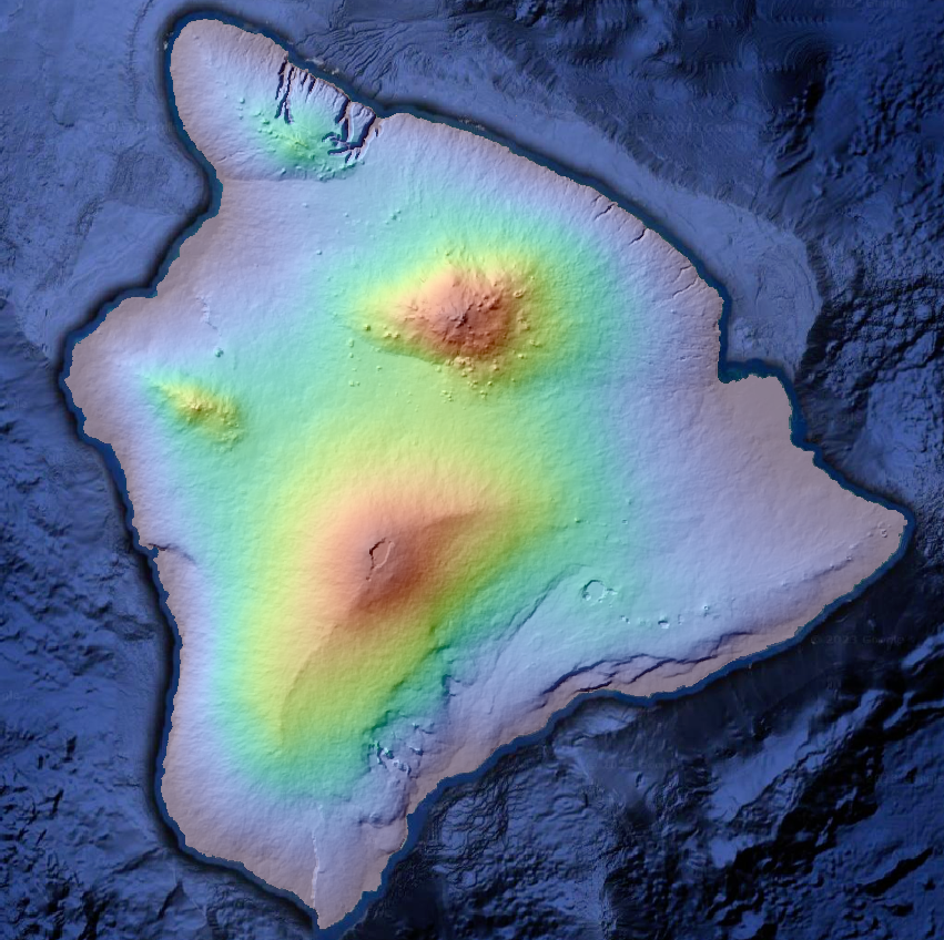
USGS 3DEP 30m GeoTIFF Digital Terrain Model (DTM) of the Big Island of Hawaii. The DTM is colored by elevation and then overlaid on a hillshade. Background bathymetry courtesy of Google Earth. Big Island GeoTIFF was retrieved using the OpenTopography API (same http request syntax as shown above).
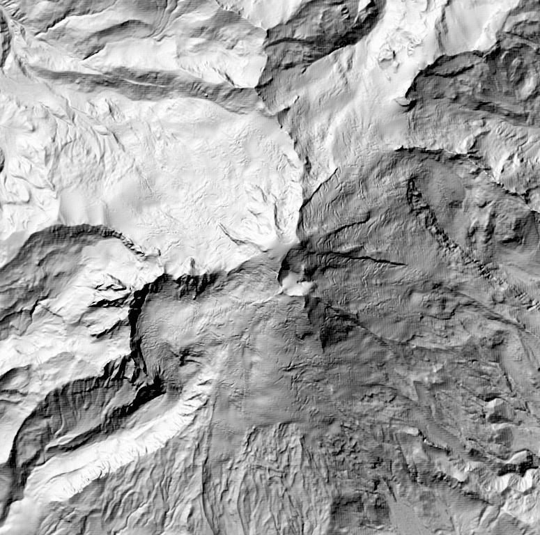
USGS 3DEP 10m GeoTIFF hillshade of Mount Baker in Washington. GeoTIFF was retrieved using the OpenTopography API.
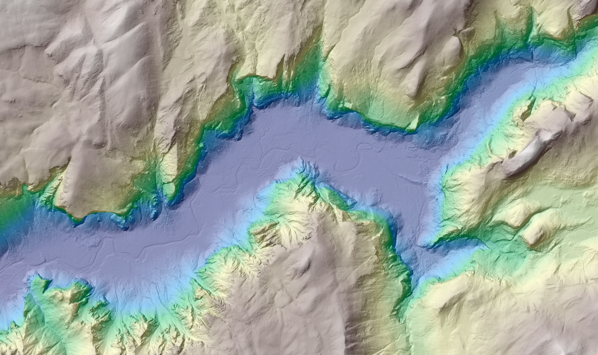
USGS 3DEP 1m GeoTIFF hillshade of Yosemite Valley in California. DTM is colored by elevation. GeoTIFF was retrieved using the OpenTopography API.