The National Association of Geoscience Teachers (NAGT) ranked this exercise as 'exemplary' and host it here.
In Indiana, major rivers and their tributaries cross much of the state. These rivers can produce significant hazards related to flooding and erosion, which threaten nearby residents and infrastructure. Rivers are dynamic landforms, and they naturally shift their position on the landscape over time. The path of a river may change rapidly during a flood, or it may slowly evolve over long periods of time.
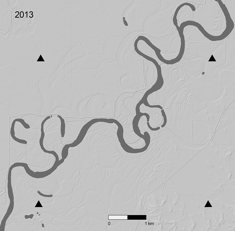
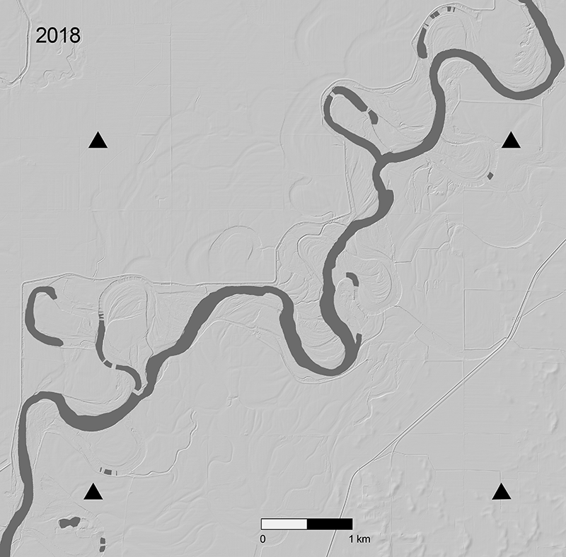
In this exercise, students use hillshade images derived from airborne lidar (light detection and ranging) from a section of the White River in Indiana to map how the river has changed over the span of five years. Students learn to identify and describe how river meanders and oxbow lakes evolve by comparing the form of the river from 2013 and 2018. Students also use the lidar hillshade to evaluate the longer-term evolution of the river's form and assess how local infrastructure may be impacted. Students are additionally given a plot of river discharge measured from a stream gage station just north of the mapped section of river. They learn how to evaluate changes and trends in river discharge and assess how river discharge can be related to river morphology.
Learning Goals:
- Identify and map river features on bare-earth lidar hillshade images.
- Analyze changes in river morphology over short and long timescales and relate those changes to the evolution of river meanders.
- Evaluate changes and trends in river discharge by analyzing a graph and interpreting data.
Context for Use:
This activity is designed for introductory-level undergraduate college and university students. It is appropriate for introductory-level Earth science, physical geology, or water resources courses. The quantitative rigor of the questions on the lab handout can be enhanced to adapt the exercise for a more advanced geomorphology course. Students should be introduced to the basic concepts of river morphology and understand how rivers erode and deposit material. It is also helpful if students are introduced to stream gages and are given a brief overview of how river discharge is measured. A PowerPoint presentation is included that provides relevant background information and context.
Materials Needed:
- Printed lidar hillshade images from 2013 and 2018 (keep image to full width of paper, do not scale margins)
- One piece of tracing paper
- Red and blue colored pencils
- (optional) Tape to help tracing paper stay in place
Materials Provided:
- PowerPoint Presentation
- Student handout for exercise
- Image files for mapping
- Google Earth KMZ file of map location
- The answer file is available for educators by emailing Emily Zawacki at emily.zawacki@earthscope.org
Web Resources:
- Indiana’s Fluvial Erosion Hazard Program
- USGS Flood Inundation Mapper
- OpenTopography’s Indiana Topographic Change Map Viewer
- OpenTopography’s ‘What is Lidar?’
Acknowledgements: This exercise was designed and developed by Emily Zawacki. Zawacki thanks Beth Pratt-Sitaula and Chelsea Scott for their helpful feedback and review of this exercise.


