What is Lidar?
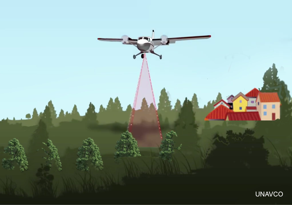
 Lidar (alternatively spelled LiDAR or LIDAR) is an acronym for Light Detection and Ranging, a remote sensing method that uses laser light pulses to measure variable distances (aka ranges) to the Earth. Lidar is used to create high resolution three-dimensional representations of Earth's surface, including buildings, vegetation, and the ground.
Lidar systems can be attached to aircraft like airplanes, helicopters, or drones, to satellites, cars, ground-based or handheld devices, and you even may have a lidar scanner in your cell phone. Airborne lidar is typically used to collect data from a broad area. Ground-based lidar is known as terrestrial laser scanning and is often used to collect more localized and short-range data.
How does lidar work?
Lidar is able to determine distances to objects or features on Earth's surface (and thus their elevation) by measuring the two-way travel time of a laser light pulse. The time it takes for a laser pulse to reflect off an object and return back to the sensor is known as "time of flight." Since we know the speed of light (300,000 km/s), we can calculate the distance to an object. The distance is calculated as the speed of light multiplied by the time of flight, divided by two (since the laser pulse traveled to the ground and back).

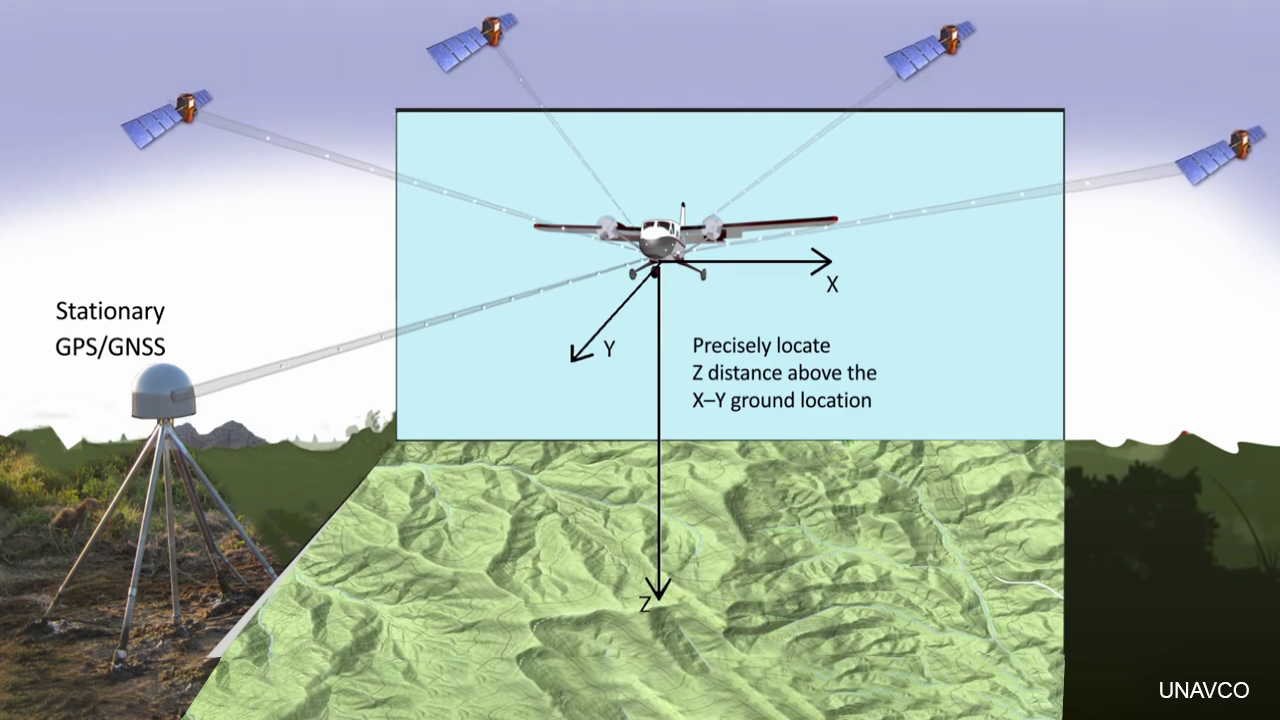
Airborne laser scanners can emit tens of thousands to millions of pulses per second, and the sensors generally have an accuracy of 1-15 cm. However, it is necessary to know exactly where the airplane or ground-based lidar scanner is located in order to produce elevation models of the surface. Multiple GPS/GNSS satellites and receivers are used to precisely locate the scanner and track its x, y (horizontal), and z (altitude) position. As well, airplanes have inertial navigation system instruments to measure the orientation of the aircraft and correct for its tips and rolls in air currents.

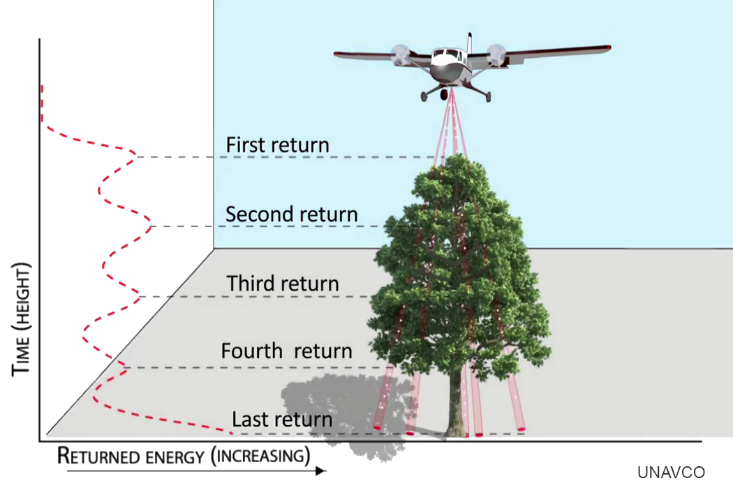
A single laser pulse can reflect off of multiple objects and surfaces as it travels towards the ground. The first surface a pulse reflects off of is called the "first return." The first returns represent the uppermost surfaces in a landscape. Just as gaps in tree and forest canopy can let light through, the laser pulse can also pass through these gaps and bounce off intermediate returns on its way to the ground. The "last return" is typically at or near the ground surface.
 |
 |
 |
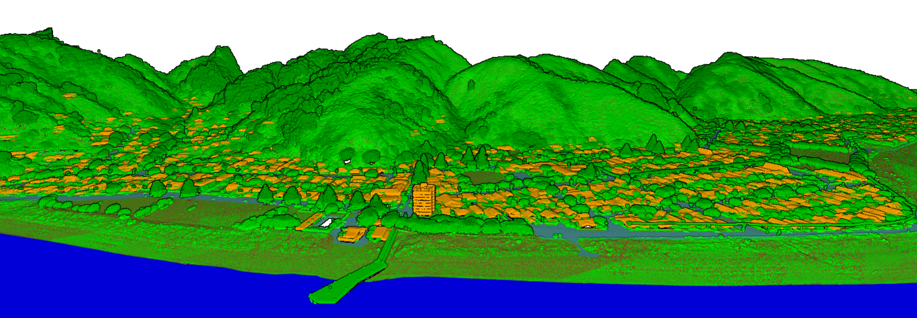
Each lidar return can have a classification assigned to it to define the type of surface it reflected off of, such as high vegetation, low vegetation, building, water, and the bare ground. Each defined return creates part of the lidar point cloud, where each point has an x, y, and z position that can be used to create a three-dimensional representation of the surface environment.

3D point cloud colored by classification (brown=ground, green=vegetation, orange=buildings, blue=water) of the Eastbourne suburb of Lower Hutt, New Zealand.
What is a Digital Elevation Model (DEM)?
Digital elevation models (DEMs) are gridded raster representation of a surface. A digital surface model (DSM) is a three-dimensional representations of the upper elevations of a landscape. This representation includes the bare surface and above ground features like vegetations, buildings, and other structures. A digital terrain model (DTM) is a three-dimensional representation of the bare ground surface. In a DTM, the natural and built features (i.e., vegetation and buildings) are removed from the landscape to show just the topography. A DSM is constructed from the first lidar return, and a DTM is largely constructed from the final lidar return.
Canopy height models (CHM)—also known as a normalized digital surface model (nDSM)—are the measurement of trees, vegetation, buildings, and other structures above the bare ground surface. One way to calculate a CHM is by subtracting a DTM from a DSM. The CHM yields the actual height of tree and vegetation cover, without the influence of the elevation of the bare ground surface.
| Digital Surface Model (DSM) | Digital Terrain Model (DTM) | Canopy Height Model (CHM) |
 |
 |
 |
How is lidar used?
High resolution topography from lidar is used for many applications including, but not limited to, flood mitigation, infrastructure development, national security, conservation and forest management, scientific research, and education. In Earth science research, lidar is used for studies related to earthquakes and faults, landslides, volcano monitoring, ecology, hydrology, the critical zone, river systems, and archaeology.
 |
 |
 |
| Growth of the new dome, glacier advance, and rock falls within the Mount St. Helens crater between September 2003 and October 2004. Credit: USGS and NASA | Relative elevation model (REM) of the White River, Indiana highlighting its former meander paths and oxbow lakes. | Vertical differencing showing rocks and trees fall near Half Dome in Yosemite between summer 2006 and summer 2010. |
Video Resources
| How Lidar Works in Earth and Environmental Sciences by UNAVCO | How Does LiDAR Remote Sensing Work? by NEON |
| Lidar-Illuminating Earthquake Hazards: A video from OpenTopography and the Southern California Earthquake Center that provides an introduction to both lidar technology as well as the earthquake science that is being done with the data. | |
