LINZ dataset covering Marlborough, New Zealand now available
A new lidar dataset covering approximately 4,840 km2 of Malborough, New Zealand, including Marlborough Sounds, Picton, Wairau Valley and the surrounding area, is now available on OpenTopography. The dataset has an average point spacing of 9.32 pts/m2 and was funded by the Marlborough District Council with data management by Toitū Te Whenua Land Information New Zealand (LINZ). This dataset is available through on ongoing collaboration between OpenTopography and LINZ that makes OpenTopography the primary distribution platform for point cloud data collected as part of the LINZ national elevation program.
Find the latest data here:
Previous overlapping data:
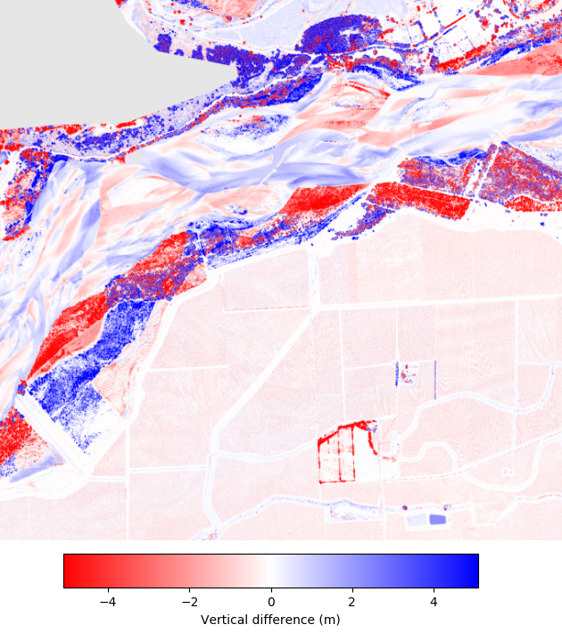
Slider image showing change over Marlborough, New Zealand. Click in the image and drag the cursor side-to-side to see the changes from 2014 to 2020. Note changes in the river banks near the top of the image.

Map of elevation change between 2014 and 2020 over Marlborough, New Zealand from above pictures. This image was produced using OpenTopography's vertical differencing tool. This on-demand tool calculates the difference between DEMs generated from point clouds, and provides users with a quick and easy way of analyzing topographic change.

