Three new NCALM datasets from California and Oregon available on OpenTopography
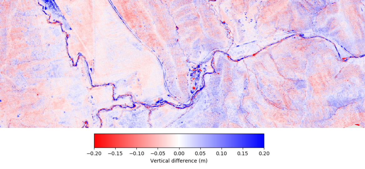
Three new lidar datasets collected by the National Center for Airborne Laser Mapping (NCALM) in California and Oregon are now available on OpenTopography. A repeat lidar dataset of Antelope Valley, CA covering approximately 24 km2 was collected by NCALM for Dr. William Dietrich at the University of California, Berkeley. The data were collected over Antelope Valley Ranch, ~60 km west of Yuba City, CA. Previous mapping of this area was completed in 2017, details of which can be found here.
The second NCALM lidar dataset released covers approximately 66 km2 northwest of Santa Barbara, CA and was collected as part of an NCALM Seed Grant for Kaili Brande at the University of California, Santa Barbara. This dataset was used to evaluate 3D fuel structure and plant community composition in relation to prescribed fire at the University of California Sedgwick Reserve.
The third NCALM lidar dataset released covers approximately 60 km2 near Grand Pass, Oregon. This data was collected as part of an NCALM Seed Grant for Brooke Hunter at the University of Oregon and was used to detect post-fire debris flows and erosion from the Douglas Fire near Grants Pass, Oregon.
NCALM is an NSF-funded center that supports the use of airborne laser mapping technology (a.k.a. lidar) in the scientific community and is jointly operated by the Department of Civil & Environmental Engineering, Cullen College of Engineering, University of Houston and the Department of Earth and Planetary Science, University of California, Berkeley. OpenTopography is the primary distributor of NCALM data.
Find the data here:
- Repeat Mapping of Antelope Valley Ranch, CA, 2019
- 3D Fuel Structure in Relation to Prescribed Fire, CA 2020
- Post-Fire Debris Flow Detection and Erosion, Oregon 2020

Map of elevation change between 2017 and 2019 over Antelope Valley Ranch in California. This image was produced using OpenTopography's vertical differencing tool. This on-demand tool calculates the difference between DEMs generated from point clouds, and provides users with a quick and easy way of analyzing topographic change.

3D point cloud colored by elevation of the University of California Sedgwick Reserve.

Digital Terrain Model (DTM) colored by elevation near Grants Pass, Oregon draped over Google Earth imagery.
