New Release of Vegetation Raster Data for Sonoma County, CA
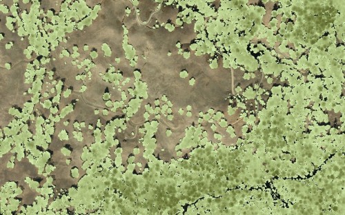
In October 2014, OpenTopography released lidar point cloud data and limited raster layers (bare earth, highest hit, intensity) for Sonoma County, CA. This week, new raster layers were added to the Sonoma County raster data in the OpenTopography portal. All raster layers now include: bare earth, hydro-flattened bare earth, highest hit, canopy density, and vegetation height as well as intensity layers for all returns, and vegetation.
From Sonoma County Vegetation Mapping & Lidar Program, "Sonoma Veg Map is a 5-year program to map Sonoma County's topography, physical and biotic features, and diverse plant communities and habitats. It is a joint program of the Sonoma County Agricultural Preservation and Open Space District and the Sonoma County Water Agency. Contributing partners include the California Department of Fish and Wildlife, the United States Geological Survey, the Sonoma County Information Systems Department, the Sonoma County Transportation and Public Works Department, The Nature Conservancy, the City of Petaluma, NASA, and the University of Maryland."
- Raster: UMD-NASA Carbon Mapping /Sonoma County Vegetation Mapping and LiDAR Program
- Point Cloud: UMD-NASA Carbon Mapping /Sonoma County Vegetation Mapping and LiDAR Program

Vegetation height raster overlayed on airborne imagery in northern Sonoma County, California
