Twelve new datasets in seven states available. Includes Northern Sierras, Yosemite, White Sands

OpenTopography is pleased to announce the release of twelve new lidar point cloud datasets covering a range of landscapes and geologic features in seven different states. These data were collected for a variety of scientific applications, and feature high-resolution topography for dune fields, active faults, and various watersheds and fluvial systems.
National Center for Airborne Laser Mapping datasets:
NCALM is an NSF-funded center that supports the use of airborne laser mapping technology (a.k.a. lidar) in the scientific community and is jointly operated by the Department of Civil & Environmental Engineering, Cullen College of Engineering, University of Houston and the Department of Earth and Planetary Science, University of California-Berkeley. These ten datasets were collected under NCALM's graduate student seed proposal program that awards ten projects per year to graduate student PIs who need lidar data for their research. Each collection is typically limited to no more than 40 square kilometers. The datasets released in this batch are seed proposal collections performed from 2007 to 2010. The release of these data via OpenTopography is the product of a memoranda of understanding (MOU) between OpenTopography and NCALM to make OT the primary distribution pathway for NCALM data:
- Airborne Laser Mapping of Independence Lake, CA
- Airborne Laser Mapping of Yosemite National Park, CA, 2007
- Oroville, CA: Middle Fork of the Feather River, Sierra Nevada Foothills
- Piercy, CA: Response of Bedrock River to Base Level Lowering, SF Eel River
- Clearwater NF, ID: Effects of Watershed Restoration on Hillslope Stability
- Durham, NH: Hyporheic Zone Extent and Exchange in a Coastal Stream
- Thorton, NH: Hydrologic and Topographic Controls on Organic Carbon in Soils
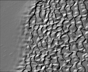
- White Sands National Monument, NM: LiDAR Survey of Dune Fields
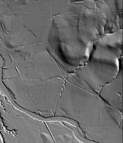
- Surface Expression of the 1886 Charleston, South Carolina Earthquake
- Canyon Lake Gorge, TX: Mechanics of Megaflood Erosion

In addition to the ten NCALM seed projects above, this release also includes one larger, 2.8 billion point, 707 square kilometer dataset collected near Iowa City after the 2008 Iowa River Flood. The data collection was funded by the NSF Small Grant for Exploratory Research (SGER) program:
USGS:
The U.S. Geological Survey (USGS) Geologic Hazards Science Center (Golden, CO) coordinated the acquisition of ~198 square kilometers of airborne Light Distance and Ranging (LiDAR) data to support active fault studies in the Northern Walker Lane (California-Nevada border). Faults surveyed include, from west to east, the Mohawk Valley, Grizzly Valley, Honey Lake, and Warm Springs Valley fault systems. The dataset is extremely high-resolution with a mean shot density of greater than 19 shots per square meter:
