Sacramento River, CA Topo-Bathymetric Lidar Data Now Available
Jan 15, 2025
![]()
The Yurok Tribe Fisheries Department Design and Technical Services Program, in conjunction with the United States Bureau of Reclamation Central Valley Project Improvement Act Habitat Restoration Program, conducted a system wide base-line data collection effort across 174 miles on the Sacramento River. High resolution aerial imagery, topography, bathymetry, and water surface elevations were collected and are intended to support the development of a hydrodynamic model framework for predicting habitat across a range of flows. The model will support measures needed to restore anadromous fish to optimum and sustainable levels in accordance with the restored carrying capacities of Central Valley rivers, streams, and riparian habitats. The data will also be used to support planning, design, and analysis of current and future restoration projects on the Sacramento River
Get the data:
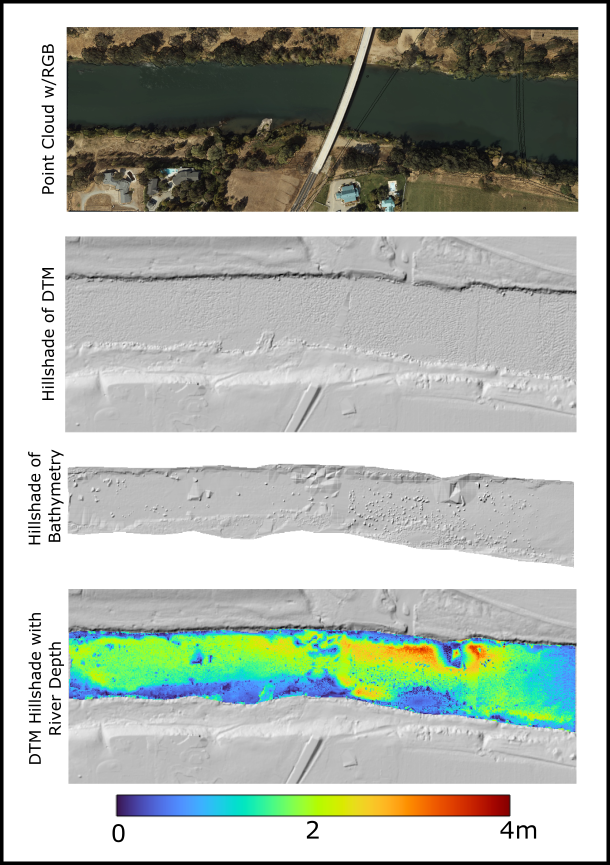
Multi-panel plot of a section of the Sacramento River. Top panel shows a point cloud colored by RGB values followed by hillshade plots of the ground and bathymetry data. Finally, the bathymetry was differenced from the water surface to produce a water depth map that is displayed in color draped on the DTM hillshade in the bottom panel.
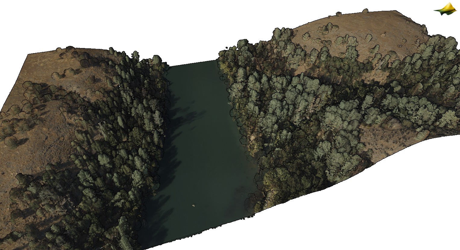 Point cloud colored by RGB values for a section of the Sacramento River near Seven Mile Creek