New post-2016 Kaikōura Earthquake, New Zealand lidar dataset now available
A new lidar dataset covering approximately 1,724 km2 of northeastern Canterbury, New Zealand is now available on OpenTopography. The dataset was collected in response to the M7.8 November 13th 2016 Kaikōura earthquake to document ground rupture, landslides, damage to infrastructure, and for earthquake recovery. The collection was commissioned by Toitū Te Whenua Land Information New Zealand on behalf of GNS Science, Environment Canterbury Regional Council, Marlborough District Council, Kaikoura District Council, Hurunui District Council, Waka Kotahi NZ Transport Agency, and the Earthquake Commission. This dataset is available through an ongoing collaboration between OpenTopography and LINZ that makes OpenTopography the primary distribution platform for point cloud data collected as part of the LINZ national elevation program.
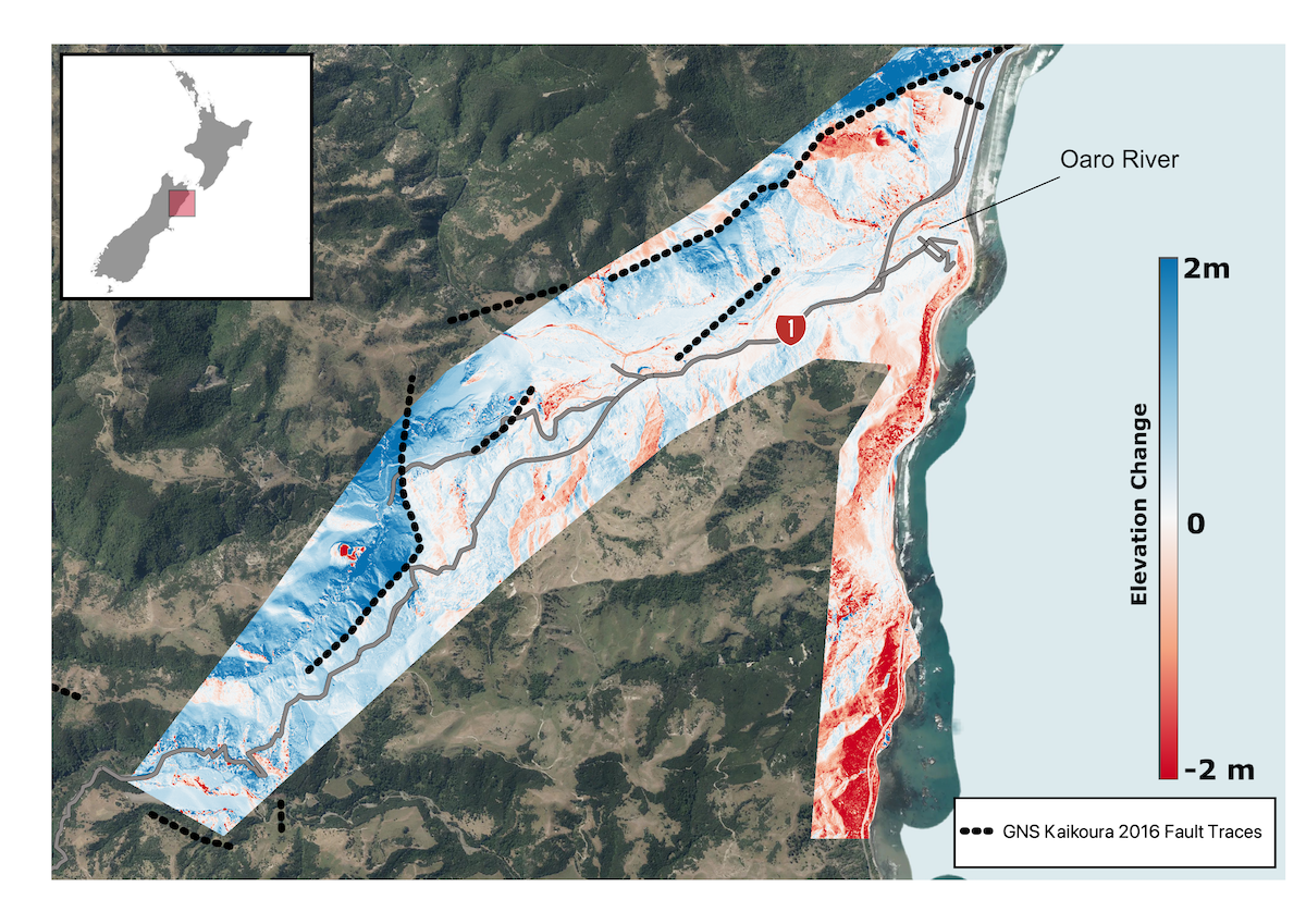
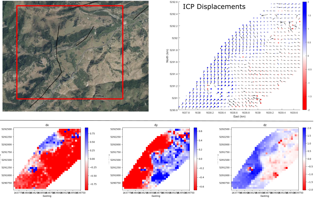
This dataset overlaps a 2012 LINZ dataset in the same region, Kaikoura, Canterbury, New Zealand 2012, making topographic differencing possible, and offers a unique opportunity to better understand the effects of the M7.8 earthquake that struck the Kaikora region on November 13th 2016 (e.g., Clark et al., 2017, https://doi.org/10.1016/j.epsl.2017.06.048). OpenTopography's tools for both vertical and 3D topographic differencing can be applied by users to explore changes due to the 2016 earthquake as illustrated in the images below.
Find the data here:

Vertical topographic differencing between datasets, "Kaikōura, Canterbury, New Zealand 2016" and "Kaikoura, Canterbury, New Zealand 2012" near Oaro in the Canterbury region of New Zealand. Dotted lines are the Kaikoura fault traces overlain on LINZ imagery.

3D point cloud differencing showing the east-west (dx), north-south (dy), and vertical (dz) coseismic displacements calculated by differencing the "Kaikōura, Canterbury, New Zealand 2016" and "Kaikoura, Canterbury, New Zealand 2012" datasets.
