Point cloud data from California and New Mexico now available
OpenTopography is pleased to announce the release of two point cloud datasets covering areas of northern New Mexico and the Mojave desert in California. Both datasets were collected by the National Center for Airborne Laser Mapping (NCALM) in 2012. The data from New Mexico were collected under a National Science Foundation (NSF) award. The data from California were collected as part of NCALM's graduate student seed proposal program which awards ten projects per year to graduate student PIs who need lidar data for their research. NCALM is a NSF-funded center that supports the use of airborne laser mapping technology (a.k.a. lidar) in the scientific community and is jointly operated by the Department of Civil & Environmental Engineering, Cullen College of Engineering, University of Houston and the Department of Earth and Planetary Science, University of California, Berkeley. The release of these data via OpenTopography is the product of a memorandum of understanding (MOU) between OpenTopography and NCALM to make OT the primary distribution pathway for NCALM data.
NCALM Datasets:
- Jemez River Basin, NM: Post-fire Landscape Response
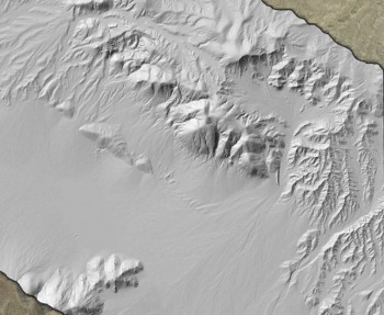
- Harper Lake Fault Slip Distribution, Central Mojave, CA

Hillshade image showing the Harper Fault zone in the Mojave Desert, California
