OpenTopography Releases Canopy Height Model Tool
OpenTopography is happy to announce the release of an on-demand canopy height model tool. Canopy height models are a measurement of the height of trees, buildings, and other structures above the ground topography. This product is used in a variety of forestry applications including tracking vegetation and trees in a forest over time, calculating biomass, and estimating leaf area index.
A canopy height model is calculated by subtracting the digital terrain model (DTM) from the digital surface model (DSM). A DTM refers to the bare earth, and a DSM measures the elevation of the top of a landscape including vegetation and buildings.
The canopy height model tool is available via the user-interface for datasets hosted by OpenTopography that contain both a pre-computed DTM and DSM . To use the tool, highlight the area of interest on the Find Data map and click the ‘raster’ button for the dataset of interest listed below the map. The canopy height model is generated by checking the box in the Canopy Height Model (CHM) window. Users have the option of using the default or specifying a different resolution of the canopy height model and of generating Google Earth KMZ files. The output includes the canopy height model, the DTM, and DSM which are displayed graphically and can be downloaded in several GIS formats.

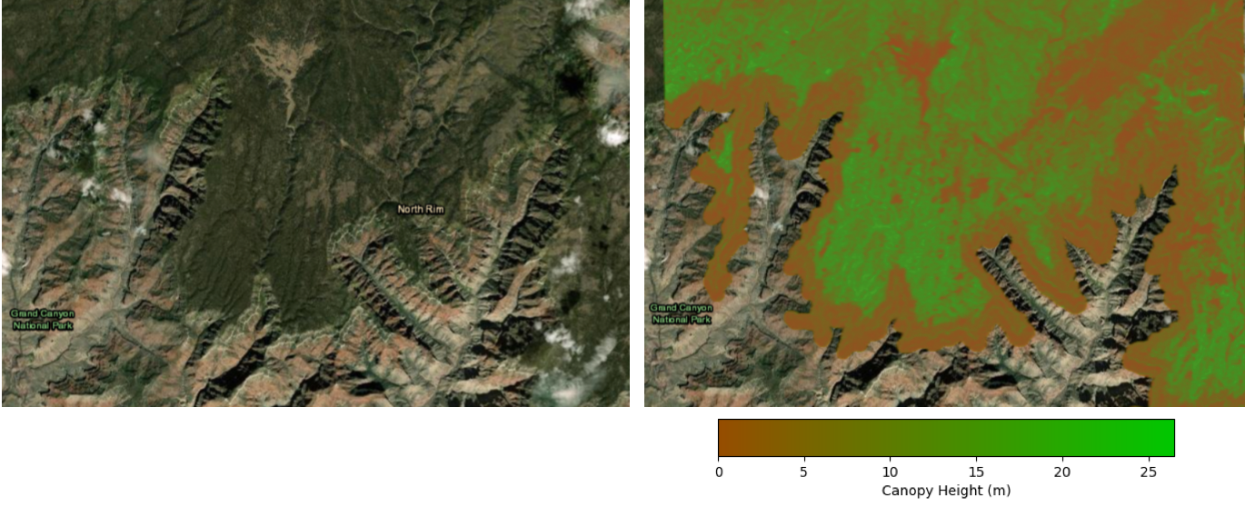
Grand Canyon, Arizona: lidar topography covering the Kaibab Plateau and North Rim of the Grand Canyon was acquired in the summer of 2012. The canopy height model shows the difference between vegetation on the plateau and the steep canyon walls of the Grand Canyon below.

Susquehanna Shale Hills Critical Zone Observatory, central Pennsylvania. The landscape is defined by valley and ridge topography and is used for agriculture. The topography above was acquired in July 2010 as a leaf-on dataset. The canopy height model shows the contrast between high vegetation in the hills and the lower vegetation of the agricultural lands.
