OpenTopography Expands International Coverage with Canadian High-Resolution DEM
Jul 21, 2025
![]()
We are excited to announce a major expansion of OpenTopography's international data catalog with the addition of the High Resolution Digital Elevation Model (HRDEM) from Natural Resources Canada.
The HRDEM is part of the CanElevation Series and supports the National Elevation Data Strategy implemented by Natural Resources Canada. OpenTopography now provides on-demand access to the 1-meter, lidar-derived portion of this collection, offering unprecedented detail across much of southern Canada.
Derived from high-precision airborne lidar, this 1-meter resolution dataset is ideal for a wide range of applications—from floodplain mapping and geologic fault analysis to forestry, hydrology, and urban development.
Access to the 1-meter HRDEM data is available free of charge to all academic users. For commercial and international users, the dataset is accessible through an OT+ subscription.
While the HRDEM focuses on southern Canada using airborne lidar, ArcticDEM complements it by covering Canada’s northern extents where lidar coverage is limited. For users interested in elevation data for Northern or Arctic regions of Canada, we recommend the ArcticDEM collection, which provides high-resolution topography derived from satellite stereo imagery at a variety of spatial resolutions.
Get started with the Canadian HRDEM data.
An interactive hillshade slider centered on Mount Royal Park in Montreal, Quebec. The Digital Terrain Model is on the left, and the Digital Surface Model is on the right. Click and drag the center line to the left or right to compare the DSM and DTM for this region.
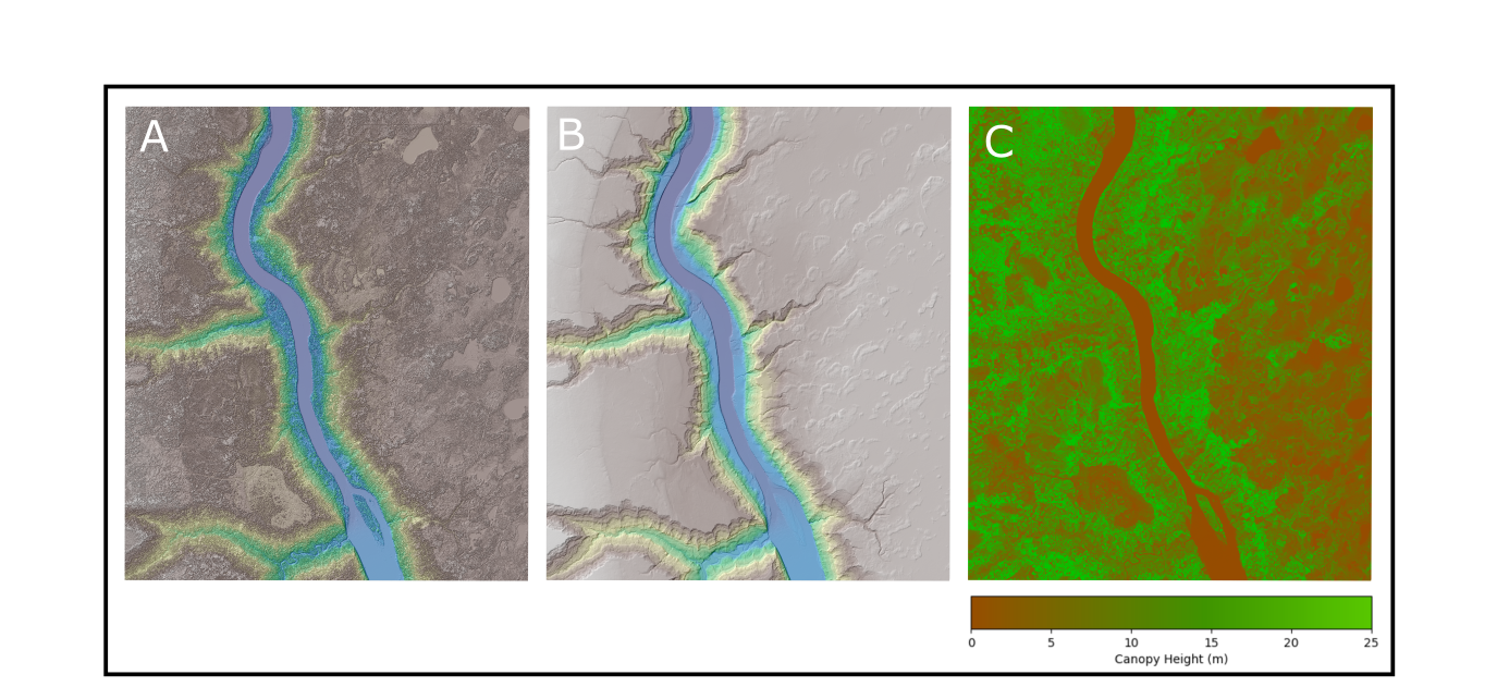
A three panel figure of a section of the Athabasca River in Alberta. Figure A is the Digital Surface Model which includes buildings, trees and other structures. Figure B is the Digital Terrain Model and is a bare-earth representation of the topography. Figure C is the Canopy Height Model (CHM) which is the difference between the DSM and the DTM. A CHM can be derived anywhere within the HRDEM since there is both DTM and DSM data available everywhere within the dataset.
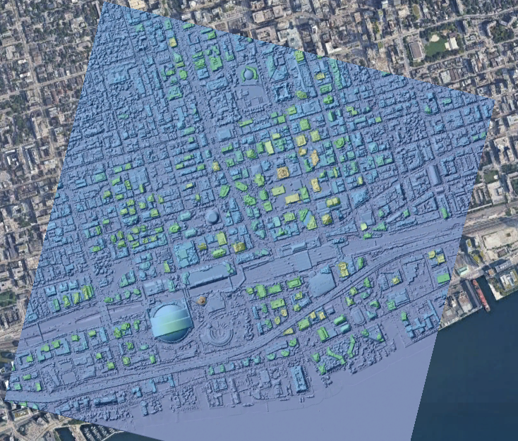
A hillshade colored by elevation of downtown Toronto draped on Google Earth imagery.