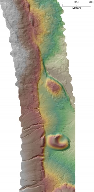
New Southern California LiDAR Available: Elsinore Fault, Burro Flats San Andreas, and Owens Valley
Sep 15, 2009
Available GeoEarthScope LiDAR data in southern California has now grown to include the Elsinore fault, the Burro Flats segment of San Andreas fault, and the Crater Mountain portion of the Owens Valley. These data are a new addition to the GeoES SoCal coverage that includes the previously released Garlock fault data. The newly released data are available via OpenTopography in both Google Earth viewable hillshades images and in standard digital elevation model format. Point cloud data for these new fault segments will be released shortly.
Below: 1 meter bare earth digital elevation model shown with shaded relief (NW orientation) from the newly released southern Owens Valley Crater Mountain segment.

