New SfM data over the Southern San Andreas Fault, CA
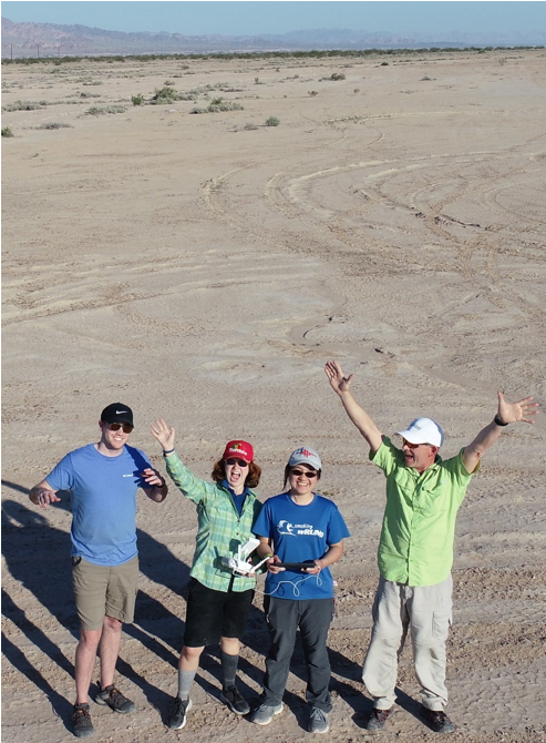
OpenTopography is pleased to release a new structure from motion (SfM) photogrammetry dataset that covers ~40 km of the Coachella section of the Southern San Andreas Fault. The data extend from north of Painted Canyon south to Bombay Beach, California, USA and include a well-georeferenced point cloud (8.4 x 10⁹ points), 10 cm DSM, and 4 cm orthomosaic. The contribution is the result of a collaborative effort between Utah Valley University (UVU) and Arizona State University and was supported by a Southern California Earthquake Center award to Chelsea Scott and funding from UVU to Michael Bunds. Vicki Lee (now at Virginia Tech) and Brigham Whitney (UVU) also contributed to the field effort. The 8.4 billion point cloud is the largest sUAS SfM dataset yet hosted by OpenTopography, and one of its larger datasets of any kind by point count. The dataset was collected expressly to be made open and available to the community for use in research and classroom activities.
Nearly 16,000 photographs were collected using a fixed-wing sUAS with onboard dGNSS over a 4-day field campaign in February, 2020, and were processed on a cluster of workstations at Utah Valley University. The dataset complements the B4 lidar dataset (Bevis et al., 2005) collected in 2005 by providing higher resolution and color, but over a narrower aperture along the surveyed portion of the San Andreas Fault. The new dataset also partially overlaps with lidar generated in the 2010 Salton Sea Project. OpenTopography offers tools developed by Scott and others (2021) to perform on-demand vertical and 3D differencing between the new data and the older lidar datasets
Get the data: High Resolution SfM Topography of the Southern San Andreas Fault
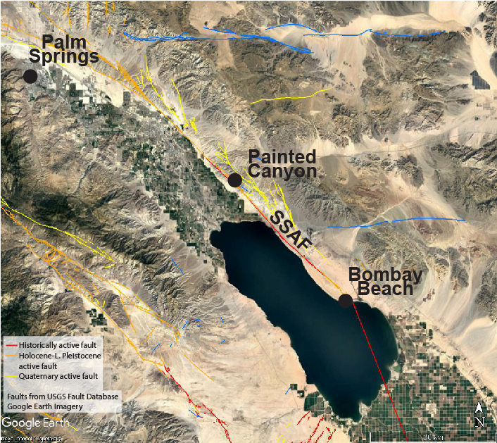
The Southern San Andreas Fault (SSAF). The new SfM dataset extends from near Painted Canyon south to Bombay Beach.
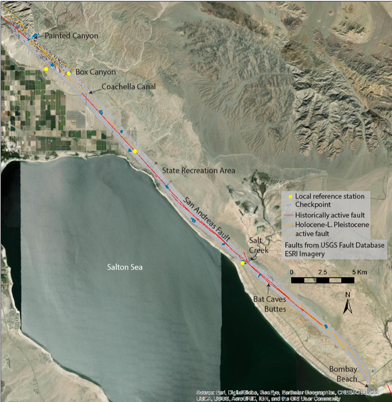
Dataset coverage is shown in gray, and the San Andreas Fault in red and orange.
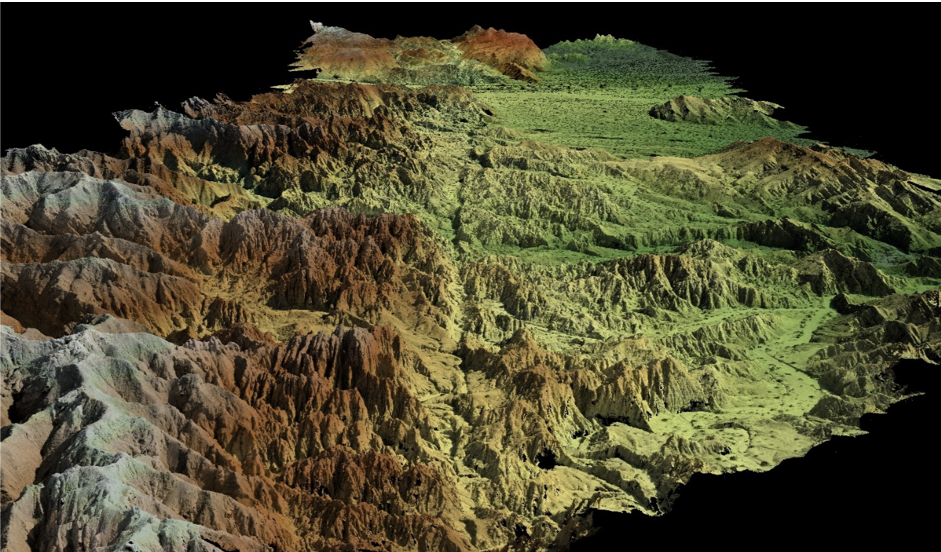
Perspective view of a portion of the point cloud (colored by elevation) looking southeast along the San Andreas Fault across Mecca Hills and Painted Canyon.
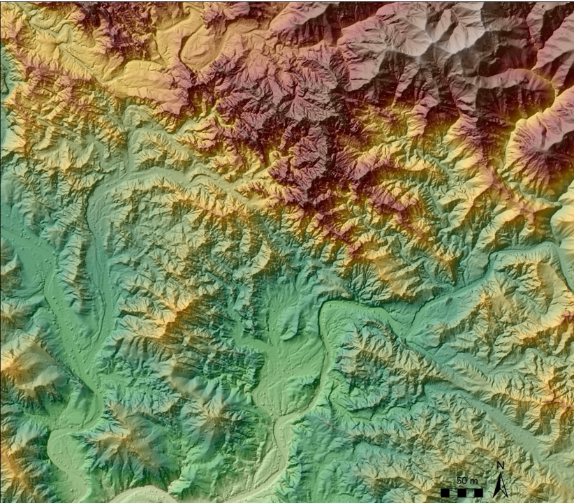
Example color-contoured shaded relief map of an area north of Painted Canyon showing the San Andreas Fault
The San Andreas Fault: Much of the motion between the Pacific and North American Plates occurs along the San Andreas Fault (SAF) in California. The fault extends from north of San Francisco southward past the Los Angeles basin to Bombay Beach on the Salton Sea. The Coachella section, the site of the new data, extends from near Palm Springs to Bombay Beach. Unlike the rest of the San Andreas Fault, the Coachella section has not produced a major, surface-rupturing earthquake in historic time and has a relatively high likelihood of producing a damaging earthquake in the coming decades (~20% 30-year probability for an event > M7.0; Field et al., UCERF3, 2017). High resolution topography is an important tool for studying past faulting, which is a vital input to forecasting the likelihood of future earthquakes. The new dataset will be a valuable baseline for the study of tectonic movement following a future large earthquake as well.
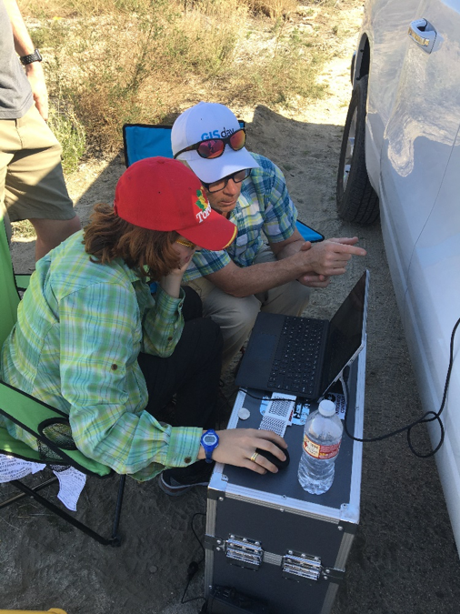
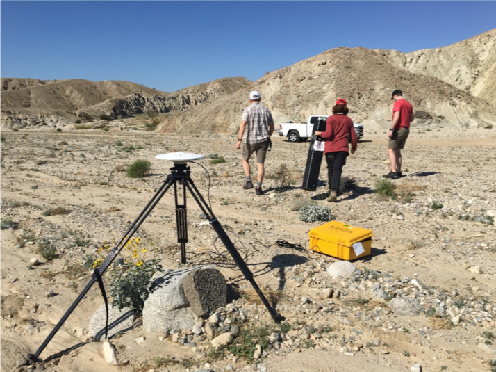
sUAS data collection and processing: The new high accuracy and high resolution data were made by processing nearly 16,000 photographs taken from a small, fixed-wing, uncrewed aerial system or drone (sUAS). The sUAS used was a Sensefly eBee plus, which is equipped with a high accuracy differential GNSS system that enables the location of the camera for each photograph to be measured to within about 2 to 3 cm. The photographs were processed with Agisoft Metashape software, which applies structure-from-motion and multi-view stereo methods to produce a point cloud of the ground surface. The camera location information allows the position of each point in the cloud to be accurately known. Processing was done at Utah Valley University on a cluster of workstations with 52 CPU cores and 12 high performance GPUs. Uncertainty in the final dataset is ~3.3 cm vertical and 2 cm horizontal (1-sigma), based on comparison of the dataset to 155 independently – measured checkpoints, which exceeds the uncertainty specifications for high quality (QL1) airborne lidar (USGS NEEA standards; Heidemann, 2018). A more complete description of the data collection and processing methods can be found here in the metadata for the dataset.
 |
 |
 |
|
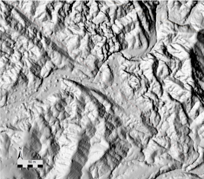
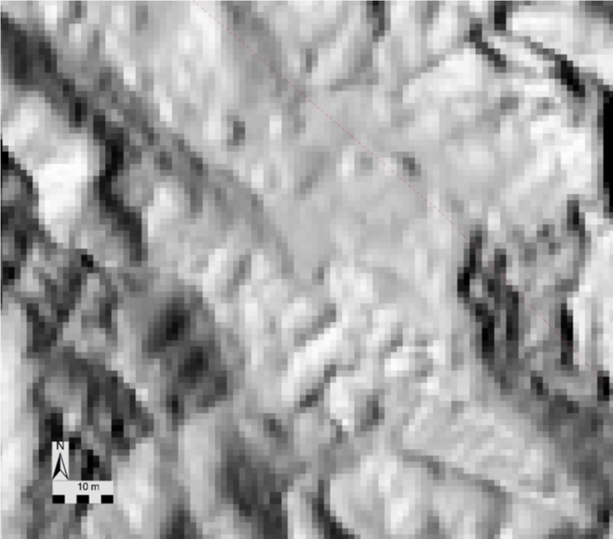
Comparison of topography resolution between SfM data (above, 0.10 m pixel spacing) and B4 lidar (below, 1 m pixel spacing).
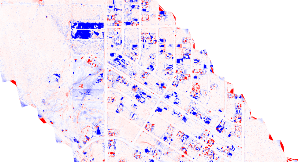
Vertical topographic differencing between new SfM data and 2005 B4 lidar reveals new structures, other cultural changes, and growth of vegetation along the San Andreas Fault near Mortmar, California. Blue is positive change in elevation; differencing was done using OpenTopography’s on-demand differencing tools. Perform on-demand differencing here
References Cited
Bevis, M. and Hudnut, K. (2005): B4 Lidar Project: Airborne Laser Swath Mapping (ALSM) survey of the San Andreas Fault (SAF) system of central and southern California, including the Banning segment of the SAF and the San Jacinto fault system. National Center for Airborne Laser Mapping (NCALM), U.S. Geological Survey, the Ohio State University, and the Southern California Integrated GPS Project. Distributed by OpenTopography. https://doi.org/10.5066/F7TQ5ZQ6
Field et al., Jordan, T.H., Page, M.T., Milner, K.R., Shaw, B.E., Dawson, T.E., Biasi, G.P., Parson, T., Hardebeck, J.L., Michael, A.J., Weldon, R.J., Powers, P.M., Johnson, K.M,, Zeng, Y., Felzer, K.R., Elst, N., Madden, C., Arrowsmith, R., Werner, M., and Thatcher, W.R., 2017, A Synoptic View of the Third Uniform California Earthquake Rupture Forecast (UCERF3), Seismological Research Letters, v88, n. 5, pp. 1259-1267, https://doi.org/10.1785/0220170045
Heidemann, H.K., 2018, Lidar Base Specification, Chapter 4 of Section B, Book 11 U.S. Geological Survey Standards, Collection and Delineation of Spatial Data.
Salton Sea Lidar Project, 2010, U.S. Geological Survey, distributed by OpenTopography. https://doi.org/10.5069/G9V985ZF
Scott, C., Phan, M., Nandigam, V., Crosby, C., Arrowsmith, J.R., 2021, Measuring change at Earth’s surface: On-demand vertical and three- dimensional topographic differencing implemented in OpenTopography, Geosphere, https://doi.org/10.1130/GES02259.1
U.S. Geological Survey and California Geological Survey, Quaternary fault and fold database for the United States, accessed August, 2021, at https://www.usgs.gov/natural-hazards/earthquake-hazards/faults

