New Point Cloud Data for California, Colorado and Florida
OpenTopography is pleased to announce the release of three new datasets covering areas of California, Colorado and Florida. These datasets were collected by the National Center for Airborne Laser Mapping (NCALM) during 2010 - 2012 campaigns. NCALM is a NSF-funded center that supports the use of airborne laser mapping technology (a.k.a. lidar) in the scientific community and is jointly operated by the Department of Civil & Environmental Engineering, Cullen College of Engineering, University of Houston and the Department of Earth and Planetary Science, University of California, Berkeley. One of the datasets was collected under NCALM's graduate student seed proposal program that awards ten projects per year to graduate student PIs who need lidar data for their research. Each collection is typically limited to no more than 40 square kilometers. The release of these data via OpenTopography is the product of a memorandum of understanding (MOU) between OpenTopography and NCALM to make OT the primary distribution pathway for NCALM data.
NCALM Datasets:


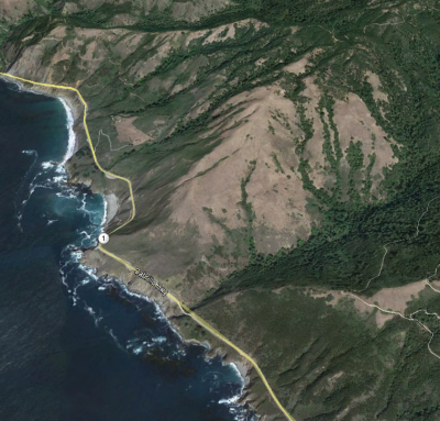
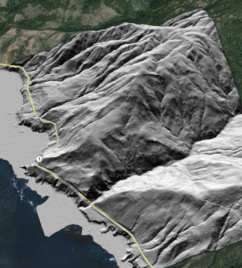
Oblique view looking northeast of a Google Earth image (left) and lidar derived ground hillshade (right) of Big Sur area, Central California Coast. The hillshade highlights degrading southeast facing slopes driven by colluvial and alluvial processes as well as uplifted marine terraces.
Dataset Highlight: 2010 CU-Boulder Campus and Flatirons
LiDAR survey of the CU-Boulder campus as part of a solar energy potential and photovoltaic planning study. The acquisition covers 45 km2 and includes East Campus, West Campus, and South Campus, as well as portions of the Flatirons and surrounding areas in multiple return, classified points. The CU Environmental Center is using the LiDAR data, combined with building footprint vector data from the campus GIS system, to facilitate site selection for new solar arrays. This allows campus solar sites to take into account day length, position of the sun, seasonal atmospheric effects, orientation and the local shading effects from trees, buildings and other structures.

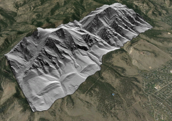
Oblique view of bare Earth hillshade overlaid on Google Earth imagery showing the iconic Flatirons near Boulder, Colorado.
