New point cloud and raster data from Mayapan, Mexico archaeological site
08/31/15 UPDATE: Due to concerns from the Principle Investigator of this project, NCALM has asked OpenTopography to take this dataset down. In accordance with this request, we’ve made the Mayapan dataset private until further notice.
We are pleased to announce the release of an international lidar dataset from Mayapan, Mexico. These data were collected in 2012 as part of an archaeological project studying this Pre-Columbian Maya site on the Yucatan Peninsula. The data were collected by the National Center for Airborne Laser Mapping (NCALM). NCALM is a NSF-funded center that supports the use of airborne laser mapping technology (a.k.a. lidar) in the scientific community and is jointly operated by the Department of Civil & Environmental Engineering, Cullen College of Engineering, University of Houston and the Department of Earth and Planetary Science, University of California, Berkeley. The release of these data via OpenTopography is the product of a memorandum of understanding (MOU) between OpenTopography and NCALM to make OT the primary distribution pathway for NCALM data.
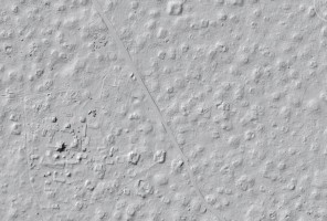
This is a very high point density (44 points/m2) dataset in order to penetrate the dense vegetation. The ground point density for this dataset is 10 points per square meter which nicely shows the archaeological sites.


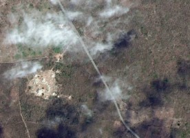
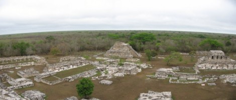
(top left) Google Earth imagery of the Mayapan, Mexico site showing highly vegetated area. (top right) Hillshade image derived from point cloud data showing main structure along with minor structures normally covered by vegetation. (bottom) Mayapan ruins from above (picture from Wikipedia)
