New OpenTopography Publication on Topographic Differencing
OpenTopography is pleased to announce our new open-access publication in Geosphere about our on-demand differencing tools: "Measuring change at Earth’s surface: On-demand vertical and three- dimensional topographic differencing implemented in OpenTopography."
Vertical differencing measures change from a variety of processes including urban growth, vegetation change, river erosion, volcanic eruptions, and coastal processes and is the subtraction of raster-based elevations. 3D differencing resolves the displacement from earthquakes and slow-moving landslides by measuring the rigid deformation required to align the pre- and post-event point clouds. Differencing is available for 120 OpenTopography-hosted datasets, and the tool can be accessed by clicking the ‘Differencing tool’ button adjacent to those datasets.
In this new paper, we discuss the implementation of the on-demand tools, which greatly reduces the technical expertise required to perform differencing and serves as a template for differencing the growing archive of high resolution topography datasets. We discuss advances required to streamline the differencing, including algorithm choice and the ideal resolution for the derived displacements. For 3D differencing, we show that the resolution depends on the point density, landscape characteristics, and the dataset quality.
July 27th, 2020 Update: San Diego Supercomputer Center press release on OpenTopography's topographic differencing work: OpenTopography Introduces Tool to Calculate Landscape Change from Lidar Data
- Chelsea Scott, Minh Phan, Viswanath Nandigam, Christopher Crosby, J Ramon Arrowsmith; Measuring change at Earth’s surface: On-demand vertical and three- dimensional topographic differencing implemented in OpenTopography. Geosphere 2021; https://doi.org/10.1130/GES02259.1

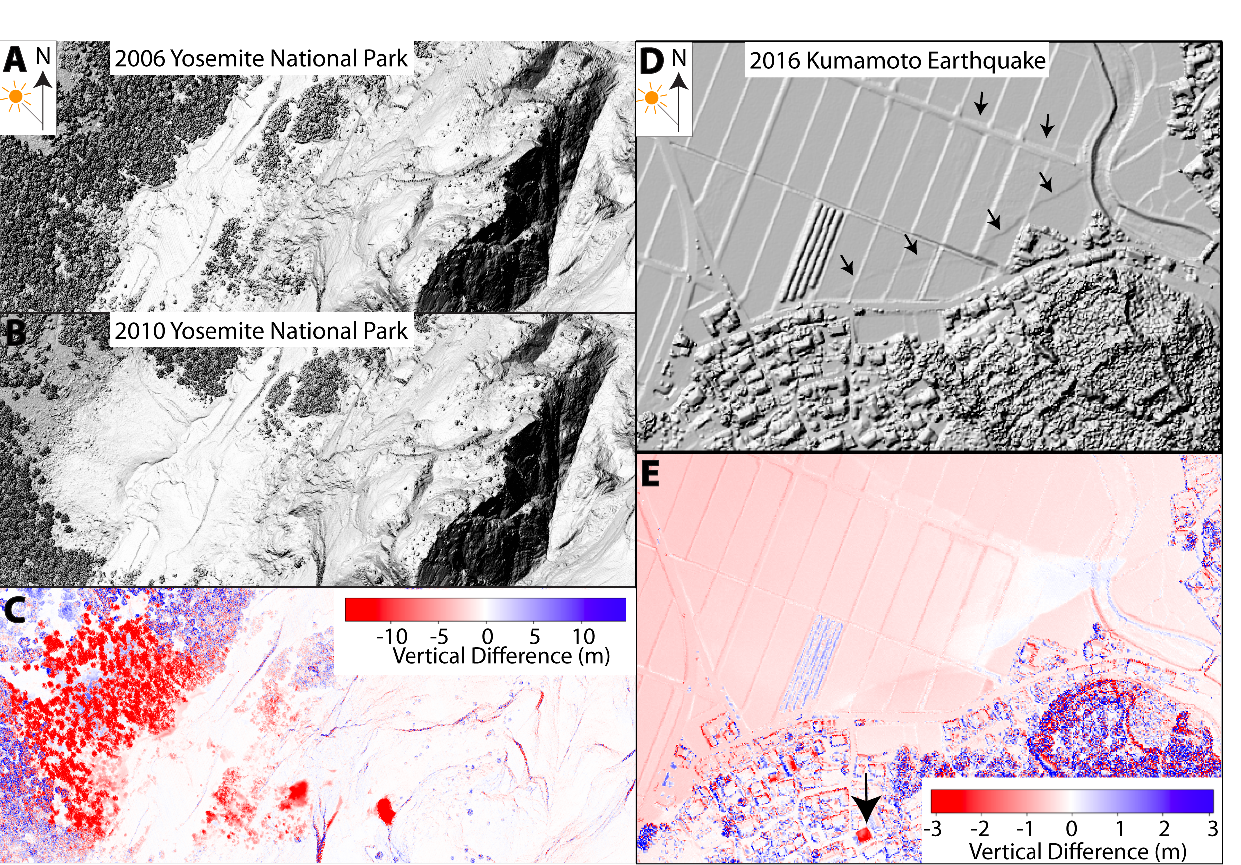
Vertical differencing in OpenTopography. (A–C) Yosemite National Park, California. Differencing shows rockfalls and treefalls near cliff edges (red) and vegetation changes (purple). (D-E) Tectonic fault ruptures through agricultural fields during the M 7 2016 Kumamoto, Japan, earthquake. The differencing shows downward motion (red) punctuated by two faults. The red square represents a collapsed building.

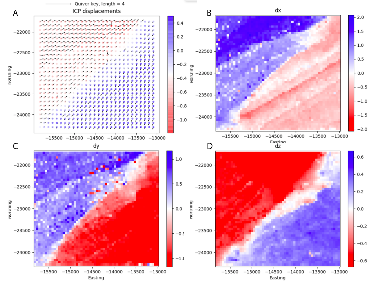
Three-dimensional differencing for the 2016 M 7 Kumamoto, Japan, earthquake, that produced ~2 m of oblique right-lateral surface slip. (A) 3D displacement field, (B) East-west, (C) north-south, and (D) vertical displacement.
Links to perform topographic differencing for the datasets in these examples:
- Differencing at Yosemite National Park Hint: Select either vertical differencing option.
Differencing for the 2016 M7 Kumamoto, Japan, Earthquake
OpenTopography has compiled our topographic differencing resources including video tutorials, blog posts with differencing examples, material presented at workshops, links to GitHub code repositories, and a differencing exercise designed for undergraduate courses.
