New NCALM datasets in California, Oregon, and North Carolina now available
Three new NCALM (National Center for Airborne Laser Mapping) datasets are now available from OpenTopography. Two of these datasets examine snow hydrology and dynamics in the western US. These include a dataset within the Sierra Nevada mountains near Truckee, California which was collected for Cara Piske at the University of Nevada, Reno to investigate forest-snow interactions in a high elevation critical zone. In addition, in March 2022, a dataset was collected east of Eugene, Oregon for Sarah Newcomb at Idaho State University. This dataset supports the investigation of the link between snowpack heterogeneity and subsurface storage and transmissivity in the rain-snow transition zone.
Finally, NCALM collected a dataset for Paula Figueiredo at North Carolina State University to examine the Mw 5.1 2020 earthquake in Sparta, North Carolina.
NCALM is an NSF-funded center that supports the use of airborne laser mapping technology (a.k.a. lidar) in the scientific community and is jointly operated by the Department of Civil & Environmental Engineering, Cullen College of Engineering, University of Houston and the Department of Earth and Planetary Science, University of California, Berkeley. OpenTopography is the primary distributor of NCALM data.
Find the data here:
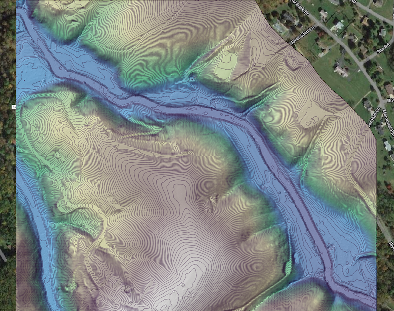
- Lidar Survey of Sparta Earthquake Rupture, NC 2020
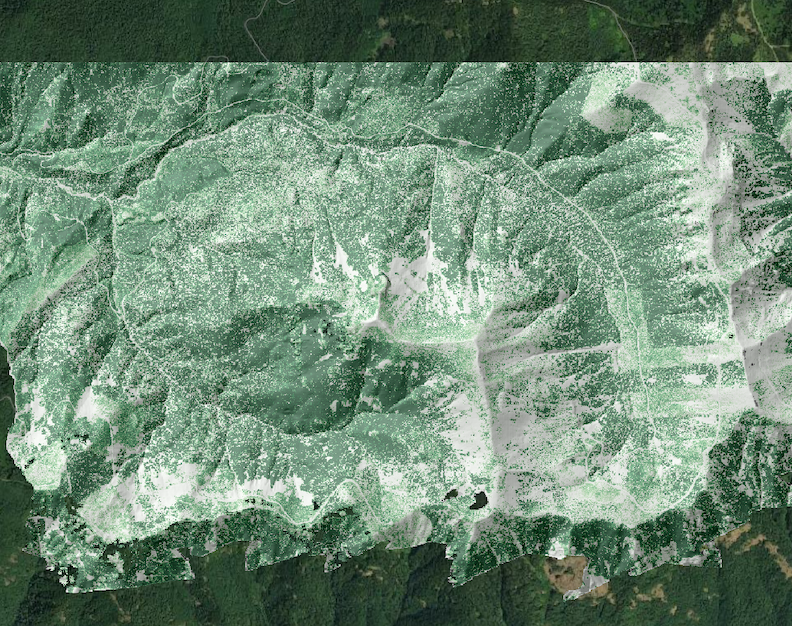
- Linking Snowpack Heterogeneity to Subsurface Storage and Transmissivity, OR 2022
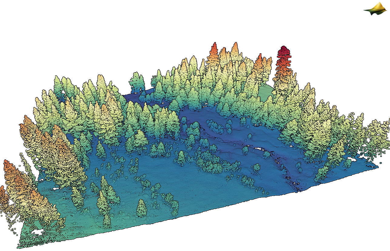
- Forest-Snow Interactions in a High Elevation Critical Zone, CA 2022

3D point cloud colored by elevation of a forested area of the dataset, Forest-Snow Interactions in a High Elevation Critical Zone, CA 2022

Canopy Height Model (CHM) draped on a digital terrain model (DTM) hillshade of Lookout Mountain east of Eugene, Oregon. Darker green indicates taller trees. Background image: Google Earth (dataset: Linking Snowpack Heterogeneity to Subsurface Storage and Transmissivity, OR 2022).

DTM of the Little River in Sparta, NC with 0.25m contours. (dataset: Lidar Survey of Sparta Earthquake Rupture, NC 2020).
