New lidar dataset covering the Kern River Canyon, California
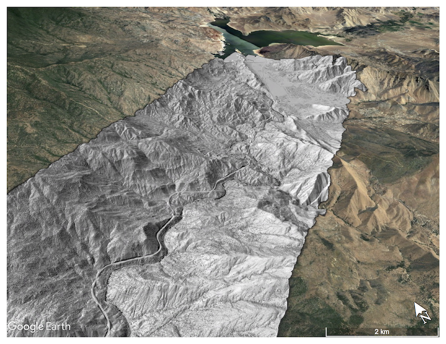
OpenTopography is pleased to announce the release of a lidar dataset covering 252 km2 covering the Kern River Canyon, California. Data were collected in October of 2016 by NCALM for Dr. William Krugh at California State University, Bakersfield as part of the Center for Climate and Natural Resource Solutions for Water-limited Regions project. This project is part of NSF's Center for Research Excellence in Science and Technology (CREST) program. NCALM is an NSF-funded center that supports the use of airborne laser mapping technology (a.k.a. lidar) in the scientific community and is jointly operated by the Department of Civil & Environmental Engineering, Cullen College of Engineering, University of Houston and the Department of Earth and Planetary Science, University of California, Berkeley. OpenTopography is the primary distributor of NCALM data.

Digital Surface Model (DSM) Hillshade of Kern River. Isabella Lake in background

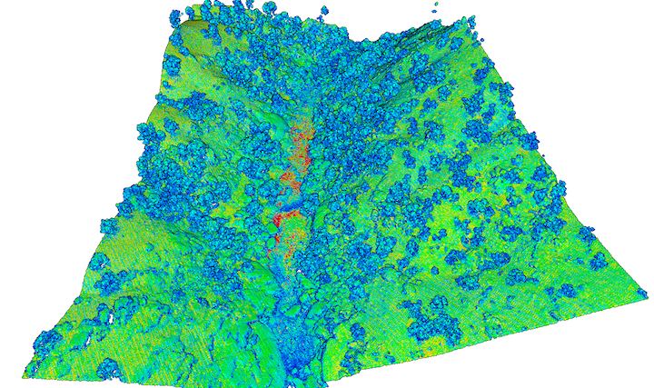
Point cloud of intensity-gradient over a class V+ section of rapids in the Kern River.
High intensity-gradient values are in red, and indicate areas of the terrain that are highly variable in their reflectivity.
