New datasets available in Utah, California, Florida and more
OpenTopography is happy to announce the release of over a dozen new datasets. Eight of these datasets were collected by the National Center for Airborne Laser Mapping (NCALM) as part of their seed grant program. NCALM is an NSF-funded center that supports the use of airborne laser mapping technology (a.k.a. lidar) in the scientific community and is jointly operated by the Department of Civil & Environmental Engineering, Cullen College of Engineering, University of Houston and the Department of Earth and Planetary Science, University of California, Berkeley. The release of these data via OpenTopography is the product of a memorandum of understanding (MOU) between OpenTopography and NCALM to make OT the primary distribution pathway for NCALM data.
NCALM Seed Grant Datasets
- Santa Clarita Topography
- Little San Bernardino Mountains, Joshua Tree National Park, California
- Channel Avulsion in Bishop, California
- Lake Bonneville, Utah
- Big Creek, California
- Woodland-encroached sagebrush ecosystem, Nevada
- Sea Grass Beds, Apalachicola, FL
- Niobrara River, Nebraska
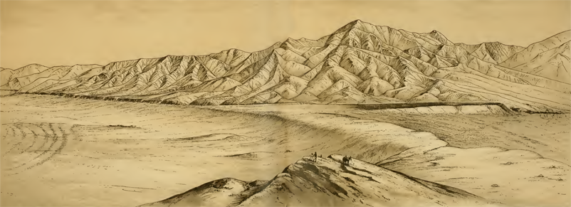
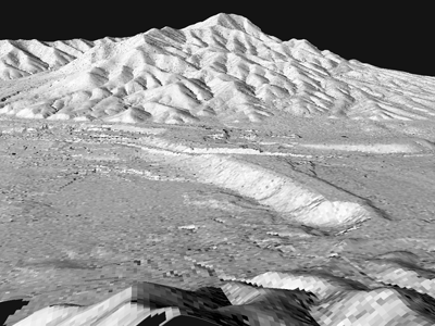
Top is an illustration from USGS Monograph 1 (Gilbert, 1890) showing the Stockton sand bar at the edge of ancient Lake Bonneville which is covered by the Lake Bonneville, Utah dataset. Below that, are two visualizations of the dataset showing a similar view of the sand bar. On the left is a visualization of the Lake Bonneville point cloud, colored by elevation and on the right is a hillshade of lidar-derived topography rendered in 3D.


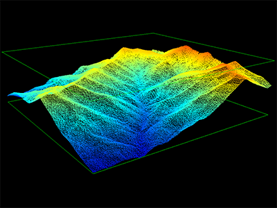
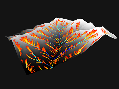
Left: partial point cloud for the Lake Bonneville, Utah dataset, colored by elevation. Right: raster and drainage network generated from the point cloud using OpenTopography's TauDEM processing capability.
In addition to the NCALM seed grant datasets, we also have additions to our collection covering the Critical Zone Observatories, Everglades National Park, and two datasets over the Wax Lake Delta, Louisiana, which was created after the construction of a canal in 1942 to reduce flood risk downstream.
Other NCALM Datasets
- Everglades National Park
- Calhoun Critical Zone Observatory 2016 Leaf Off LiDAR Survey
- Boulder Creek Critical Zone Observatory Snow-On Lidar Survey
- Wax Lake Delta, Louisiana, USA 2009
Other


