
June 2026 Data Releases
Jul 13, 2026
New datasets were added in June 2026 spanning the US mainland, Alaska, and two continental to global-scale digital terrain models (DTMs). ANADEM is a machine learning-derived DTM covering all of South America, while GEDTM is a near-global-scale DTM. This month's additions also include two lidar surveys in California, USGS 3DEP lidar datasets in Alabama, Arkansas, Idaho, and Alaska, and a Community Dataspace dataset over southwestern Virginia.
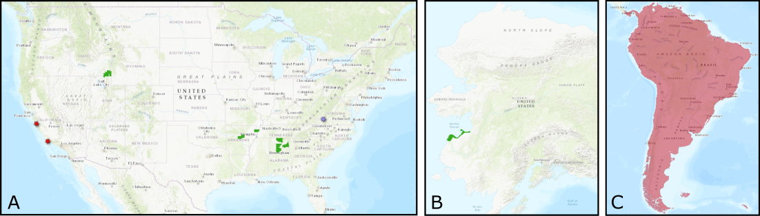
A. Locations of new USGS 3DEP datasets in Alabama, Arkansas, Idaho (green polygons), OT-hosted datasets in California (red markers), and a Community Dataspace dataset in Virginia (purple marker). B. A large USGS 3DEP lidar dataset in Alaska along the Norton Sound (green polygon). C. Machine learning derived digital terrrain models are now available for all of South America (ANADEM - red polygon) and globally (GEDTM).
OpenTopography Hosted Datasets
Two new NCALM Seed grant projects in California were released this month. A lidar dataset to map coastal dune erosion was collected for Shannon Sondeno at the California State University, Monterey Bay. In addition, a lidar dataset to monitor tree water stress in the Dangermond and Sedgwick preserves was collected for Jean Allen at the University of California, Santa Barbara
Two new global and continental-scale digital terrain models have been added this month: ANADEM, covering South America, and GEDTM, covering nearly all global landmasses. Both datasets represent a significant advance in the ability to characterize the bare-earth terrain from existing Digital Surface Models.
New OpenTopography hosted data:
- Mapping Coastal Dune Erosion, CA 2025
- Monitoring Tree Water Stress, CA 2025
- ANADEM: A Digital Terrain Model for South America
- Global Ensemble Digital Terrain Model
USGS 3D Elevation Program (3DEP) Datasets
The USGS is currently making 3DEP lidar point cloud data available via an Amazon Web Services (AWS) S3 Requester Pays Bucket, and as an AWS Public Dataset. To learn more about 3DEP and AWS see this USGS press release: USGS 3DEP Lidar Point Cloud Now Available as Amazon Public Dataset. Consistent with OpenTopography's mission of making high resolution topography data easier to discover and use, we provide a layer of value-added services that enable our users to subset, grid, download, and/or visualize any portion of the USGS 3DEP collection.
USGS 3DEP data is freely available to our core US academic user community (e.g. users who register with a .edu email domain). However, non-academics can access 3DEP data, as well as all other restricted datasets, by signing up for OpenTopography Plus (OT+). OT+ is a subscription service that enables one-stop, easy-to-use access to the highest quality lidar topography for the US. For more details about OT+, or to sign up, see the OT+ signup page.
New USGS 3DEP Datasets:
- USGS LPC ID Franklin Bear 2017 LAS 2018
- AL 11County 2 B23
- AK TyphoonMerbokNV5 1 F23
- AL 19Co 1 B24
- AR Eastern 10 D23
- AR Eastern 1 D23
OpenTopography Community Dataspace Datasets
The OpenTopography Community Dataspace allows users who are producing small to moderate sized topographic datasets (with technologies such as lidar and photogrammetry) to archive their data with OpenTopography via a simple drag and drop user interface. This feature is designed to support data publication and citation, academic data reuse, and educational applications. Each submission is reviewed by OpenTopography staff and approved on a case-by-case basis. Datasets in the OT Dataspace receive a Digital Object Identifier (DOI) and are displayed on the OpenTopography Find Data Map so they are discoverable and downloadable alongside data hosted by OpenTopography. The Dataspace is meant to complement standard OpenTopography data hosting for larger datasets produced by our data provider partners.
New Community Dataspace data:
Sample Graphics From Data Released in June 2026
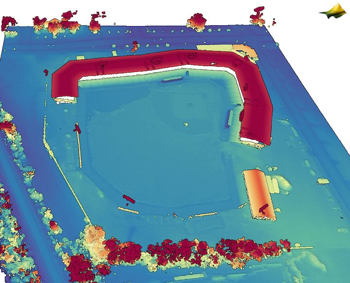
3D point cloud colored by elevation of Rickwood Field - the oldest professional baseball stadium in the US. Built in 1910. Data Source: USGS 3DEP: AL 11County 2 B23
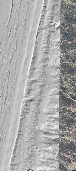
A hillshade of a section of coastline of the Salina River Dunes Natural Preserve draped on Google Earth imagery. Data Source: OpenTopography: Mapping Coastal Dune Erosion, CA 2025.
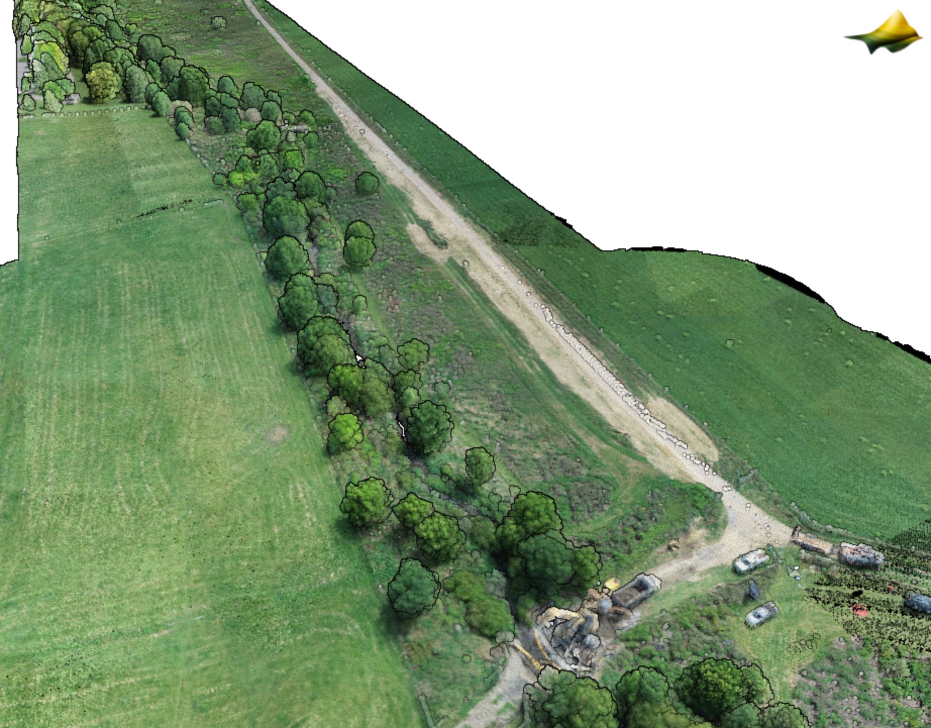
A 3D point cloud colored by RGB values from imagery of a section of the Virginia Tech StREAM Lab. Data Source: Community Dataspace: Virginia Tech StREAM Lab Summer 2024 Drone Lidar Survey.
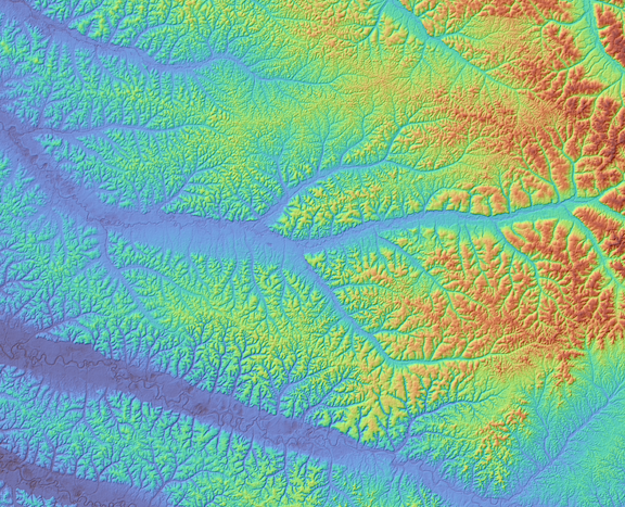
A Digital Terrain Model (DTM) of a section of the Congo River basin. The DTM is colored by elevation and draped on a hillshade generated from the Global Ensemble Digital Terrain Model (GEDTM).