July 2025 Data Releases
Aug 11, 2025
OpenTopography provides easy, centralized access to a diverse collection of topographic data. We strive to simplify data discovery by providing a single, accessible platform that integrates data from a variety of sources including the USGS 3D Elevation Program (3DEP), NOAA Coastal Lidar, Natural Resources Canada, Polar Geospatial Center, and many more. Below are highlights of datasets that became available on the OpenTopography platform in July 2025.
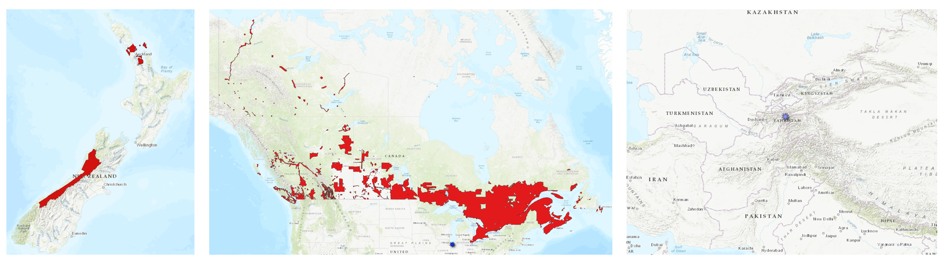
Left hand panel shows the location of new LINZ data near Auckland, New Zealand and over the Southern Alps. The central panel shows the spatial coverage of the Canadian High Resolution DEM (HRDEM) in red, and a NOAA dataset along the southern coast of Lake Michigan in blue. The right hand panel shows the location of a Community Dataspace dataset in the Yasman and Vakhsh Valleys of Tajikistan.
OpenTopography Hosted Dataset: High Resolution Digital Elevation Model Mosaic of Canada
In July 2025, we expanded our international data catalog with the addition of the High Resolution Digital Elevation Model (HRDEM) from Natural Resources Canada. The HRDEM is part of the CanElevation Series and supports the National Elevation Data Strategy implemented by Natural Resources Canada. OpenTopography now provides on-demand access to the 1-meter, lidar-derived portion of this collection, offering unprecedented detail across much of southern Canada. Derived from high-precision airborne lidar, this 1-meter resolution dataset is ideal for a wide range of applications—from floodplain mapping and geologic fault analysis to forestry, hydrology, and urban development. Access to the 1-meter HRDEM data is available free of charge to all academic users. For commercial and international users, the dataset is accessible through an OT+ subscription.
New OpenTopography hosted data:
NOAA Coastal Lidar Datasets
The NOAA Coastal Lidar Data is a collection of lidar projects from many different sources and agencies, geographically focused on the coastal areas of the United States of America. The data are stored in the Entwine Point Tile format, and hosted on Amazon as part of the AWS Public Dataset Program. Consistent with OpenTopography's mission of making high resolution topography data easier to discover and use, we provide a layer of value-added services that enable our users to subset, grid, download, and/or visualize any portion of the NOAA Coastal Lidar collection.
NOAA Digital Coast data is freely available to our core US academic user community (e.g. users who register with a .edu email domain). However, non-academics can access NOAA data, as well as all other restricted datasets, by signing up for OpenTopography Plus (OT+). OT+ is a subscription service that enables one-stop, easy-to-use access to the highest quality lidar topography for the US. For more details about OT+, or to sign up, see the OT+ signup page.
New NOAA Coastal Lidar data:
Land Information New Zealand (LINZ) Datasets
OpenTopography has an on ongoing collaboration with Land Information New Zealand that makes OpenTopography the primary distribution platform for point cloud data collected as part of the LINZ national elevation program.
New Land Information New Zealand data:
OpenTopography Community Dataspace Datasets
The OpenTopography Community Dataspace allows users who are producing small to moderate sized topographic datasets (with technologies such as lidar and photogrammetry) to archive their data with OpenTopography via a simple drag and drop user interface. This feature is designed to support data publication and citation, academic data reuse, and educational applications. Each submission is reviewed by OpenTopography staff and approved on a case-by-case basis. Datasets in the OT Dataspace receive a Digital Object Identifier (DOI) and are displayed on the OpenTopography Find Data Map so they are discoverable and downloadable alongside data hosted by OpenTopography. The Dataspace is meant to complement standard OpenTopography data hosting for larger datasets produced by our data provider partners.
New Community Dataspace data:
Sample Graphics From Data Released in July 2025
An interactive hillshade slider centered on Mount Royal Park in Montreal, Quebec. The Digital Terrain Model is on the left, and the Digital Surface Model is on the right. Click and drag the center line to the left or right to compare the DSM and DTM for this region. Data Source: High Resolution Digital Elevation Model Mosaic of Canada
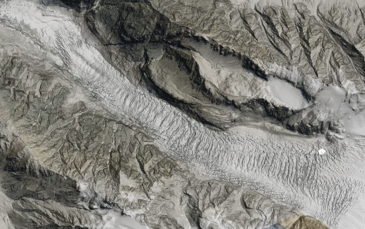
Imagery draped on hillshade of topography of Fox Glacier in the Southern alps. Data Source: LINZ: West Coast, New Zealand 2020-2025.
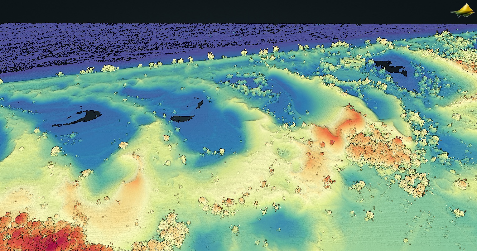
3D point cloud colored by elevation of the Ogden Sand Dunes on the southern shore of Lake Michigan. Data Source: NOAA: 2024 IN DNR Lidar: Indiana Coastline.
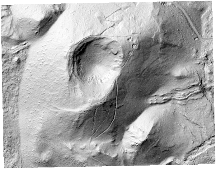
Digital Terrain Model (DTM) of a volcanic cone in Rangitoto Island Scenic Reserve, New Zealand. Data Source: LINZ: Auckland Part 2, New Zealand 2024.