December 2025 Data Releases
Jan 5, 2026
OpenTopography provides easy, centralized access to a diverse collection of topographic data. We strive to simplify data discovery by providing a single, accessible platform that integrates data from a variety of sources including the USGS 3D Elevation Program (3DEP), NOAA Coastal Lidar, Natural Resources Canada, Polar Geospatial Center, and many more. Below are highlights of datasets that became available or were updated on the OpenTopography platform in December 2025.
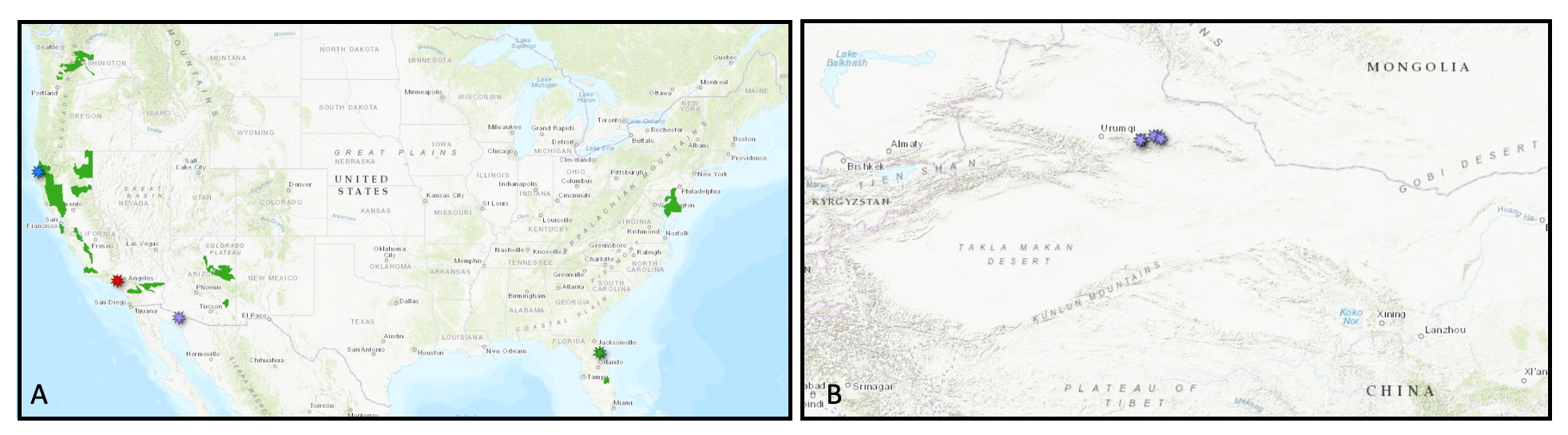
A. Locations of new USGS 3DEP datasets (green polygons), new NOAA data in northern California (blue marker), new Community Dataspace dataset in Mexico (purple marker), new OT data in Los Angeles (red marker), and new USGS 1m data in Florida (green marker) in the US. B. New Community Dataspace datasets in Northern China (purple markers)
USGS 3D Elevation Program (3DEP) Datasets
The USGS is currently making 3DEP lidar point cloud data available via an Amazon Web Services (AWS) S3 Requester Pays Bucket, and as an AWS Public Dataset. To learn more about 3DEP and AWS see this USGS press release: USGS 3DEP Lidar Point Cloud Now Available as Amazon Public Dataset. Consistent with OpenTopography's mission of making high resolution topography data easier to discover and use, we provide a layer of value-added services that enable our users to subset, grid, download, and/or visualize any portion of the USGS 3DEP collection.
USGS 3DEP data is freely available to our core US academic user community (e.g. users who register with a .edu email domain). However, non-academics can access 3DEP data, as well as all other restricted datasets, by signing up for OpenTopography Plus (OT+). OT+ is a subscription service that enables one-stop, easy-to-use access to the highest quality lidar topography for the US. For more details about OT+, or to sign up, see the OT+ signup page.
New USGS 3DEP Datasets:
- AZ NorthEast 3 D23
- AZ Safford QL2 2016
- CA CaliforniaGaps 1 B23
- CA CaliforniaGaps 3 B23
- CA CaliforniaGaps 4 B23
- CA NoCAL Wildfires PlumasNF B2 2018
- CA NorthCoastRanges 1 B23
- CA NorthCoastRanges 2 B23
- CA NorthernCA 3 B22
- CA NorthernCA 5 B22
- DE Statewide 1 B23
- FL 2017FortDrum 1 C22
- FL 2017PalmCoast 1 C22
- WA CentralWildfire 2 D22
- IL 10CoNRCS 2 D23
NOAA Coastal Lidar Datasets
The NOAA Coastal Lidar Data is a collection of lidar projects from many different sources and agencies, geographically focused on the coastal areas of the United States of America. The data are stored in the Entwine Point Tile format, and hosted on Amazon as part of the AWS Public Dataset Program. Consistent with OpenTopography's mission of making high resolution topography data easier to discover and use, we provide a layer of value-added services that enable our users to subset, grid, download, and/or visualize any portion of the NOAA Coastal Lidar collection.
NOAA Digital Coast data is freely available to our core US academic user community (e.g. users who register with a .edu email domain). However, non-academics can access NOAA data, as well as all other restricted datasets, by signing up for OpenTopography Plus (OT+). OT+ is a subscription service that enables one-stop, easy-to-use access to the highest quality lidar topography for the US. For more details about OT+, or to sign up, see the OT+ signup page.
New NOAA Coastal Lidar data:
OpenTopography Hosted Datasets
The majority of datasets hosted directly by OpenTopography are free and open to all users. OpenTopography is pleased to announce the addition of a lidar dataset from NCALM's NOW program. This dataset was collected over the Eaton Fire in Los Angeles, California, and will help quantify dry-ravel sediment mobilization from fires to improve debris-flow predictions.
New OpenTopography hosted data:
OpenTopography Community Dataspace Datasets
The OpenTopography Community Dataspace allows users who are producing small to moderate sized topographic datasets (with technologies such as lidar and photogrammetry) to archive their data with OpenTopography via a simple drag and drop user interface. This feature is designed to support data publication and citation, academic data reuse, and educational applications. Each submission is reviewed by OpenTopography staff and approved on a case-by-case basis. Datasets in the OT Dataspace receive a Digital Object Identifier (DOI) and are displayed on the OpenTopography Find Data Map so they are discoverable and downloadable alongside data hosted by OpenTopography. The Dataspace is meant to complement standard OpenTopography data hosting for larger datasets produced by our data provider partners.
New Community Dataspace data:
- Survey of Displaced Geomorphic Surfaces of the Mulei Fault, China 2024
- Digital Elevation Model of Crater Elegante, Sonora, Mexico, November 2022
Sample Graphics From Data Released in December 2025
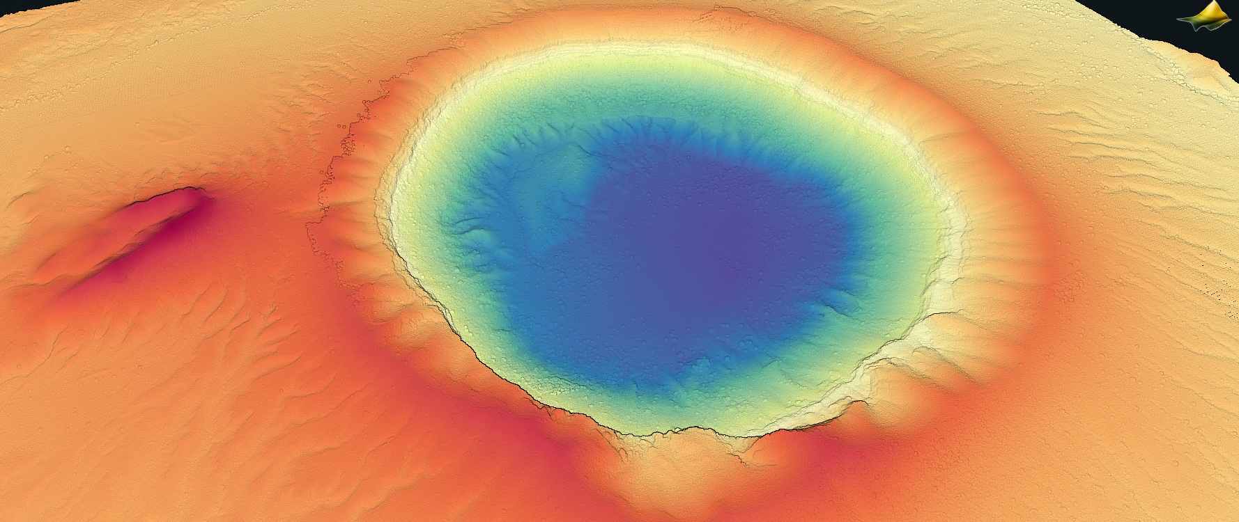
Colorized point cloud of a Structure from Motion survey of the Crater Elegante in Mexico. Data Source: CDS: Digital Elevation Model of Crater Elegante, Sonora, Mexico, November 2022
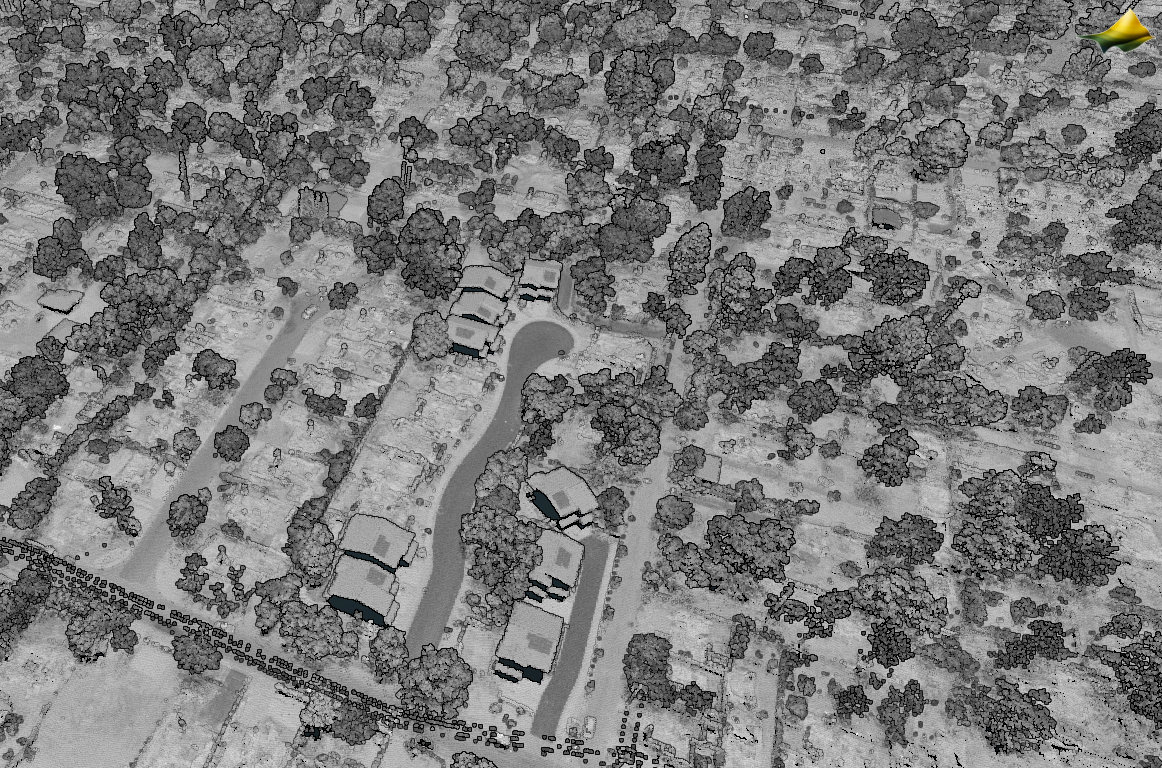
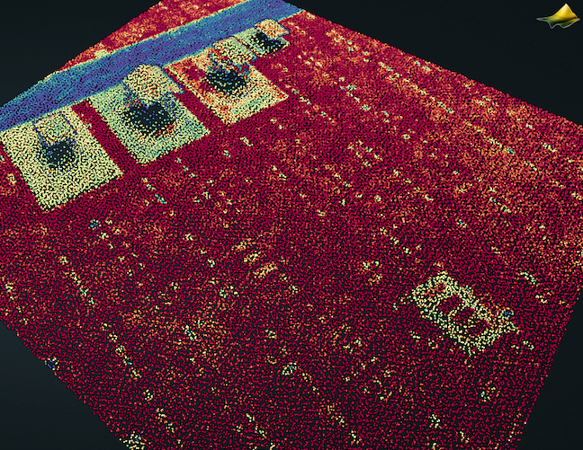
Lidar point cloud colored by intensity of the neighborhood destroyed by the Eaton Fire. Data Source: OT: Quantifying Sediment Mobilization by Wildfire, CA 2025
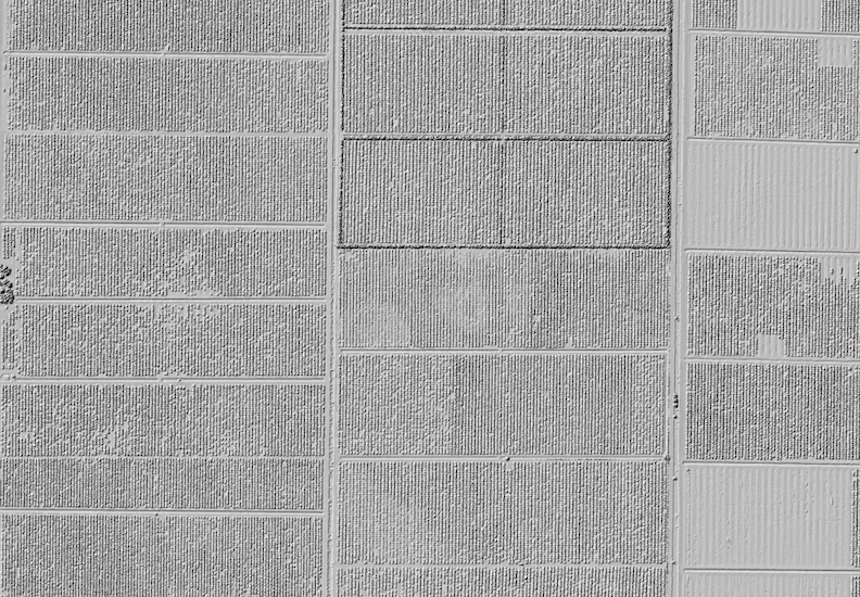
Hillshade of citrus farms in Florida. Data Source: USGS 3DEP: FL 2017FortDrum 1 C22.
What are all those light-colored patches on the ground? Gravestones in a cemetery! This is a plot of intensity gradient which is the rate of change in intensity between neighboring points. The intensity of a lidar return over stone is quite different than surrounding grass or soil, so the headstones plot clearly in an intensity gradient style plot. Data Source: NOAA: 2019 Lidar: Eureka, CA.