California, Maine, New Mexico, North Carolina, Pennsylvania and Utah Point Data Available
Eight datasets from six states were recently released by OpenTopography covering areas of California, Maine, New Mexico, North Carolina, Pennsylvania and Utah. These data include four Critical Zone Observatory (CZO) datasets, three National Center for Airborne Laser Mapping (NCALM) datasets and one dataset from the Utah Geological Survey.
Critical Zone Observatory Datasets:
Under OpenTopography's memorandum of understanding with the six NSF Critical Zone Observatories, we will be hosting all lidar data products collected to support research at the CZO sites. The CZOs are environmental laboratories established to study the chemical, physical and biological processes that shape the Earth's surface, and thus lidar is one of several tools being utilized. Four CZO datasets have been released including the Southern Sierra Nevada CZO (snow on, snow off) and the Susquehanna Shale Hills CZO (leaf on, leaf off).
- Southern Sierra Nevada Critical Zone Observatory: Snow On
- Southern Sierra Nevada Critical Zone Observatory: Snow Off
- Susquehanna Shale Hills Critical Zone Observatory: Leaf On Survey
- Susquehanna Shale Hills Critical Zone Observatory: Leaf Off Survey
National Center for Airborne Laser Mapping Datasets (NCALM):
NCALM is a NSF-funded center that supports the use of airborne laser mapping technology (a.k.a. lidar) in the scientific community and is jointly operated by the Department of Civil & Environmental Engineering, Cullen College of Engineering, University of Houston and the Department of Earth and Planetary Science, University of California, Berkeley. Two of the three datasets were collected under NCALM's graduate student seed proposal program that awards ten projects per year to graduate student PIs who need lidar data for their research. Each collection is typically limited to no more than 40 square kilometers. The release of these data via OpenTopography is the product of a memorandum of understanding (MOU) between OpenTopography and NCALM to make OT the primary distribution pathway for NCALM data.
- Landron Peak, New Mexico Survey
- Columbia, NC: Modeling Coastal Plain Wetland Ecosystems
- Survey of Sheepscot, Narragaugus and Pleasant Rivers, Maine
Utah Geological Survey Data:
The Utah Geological Survey as part of its mission to provide timely scientific information about Utah's geologic environment, resources, and hazards, acquired LiDAR data with its partners in support of various geologic mapping and research projects. In 2011, the UGS and partners acquired approximately 4,927 square kilometers of 1 meter LiDAR data over the Cedar/Parowan Valley, Great Salt Lake shoreline/wetlands, Hurricane fault zone, Lowry Water, Ogden Valley, and North Ogden areas of Utah. The datasets from the UGS and its partners are in the public domain and can be freely distributed with proper credit to the UGS and its partners.


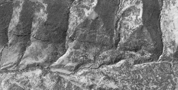
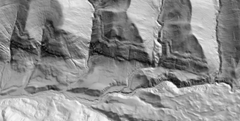
Oblique view of highest hit (left) and ground (right) hillshade imagery along Joes Valley Fault Zone, Central Utah.
