August 2025 Data Releases
Sep 9, 2025
OpenTopography provides easy, centralized access to a diverse collection of topographic data. We strive to simplify data discovery by providing a single, accessible platform that integrates data from a variety of sources including the USGS 3D Elevation Program (3DEP), NOAA Coastal Lidar, Natural Resources Canada, Polar Geospatial Center, and many more. Below are highlights of datasets that became available or were updated on the OpenTopography platform in August 2025.
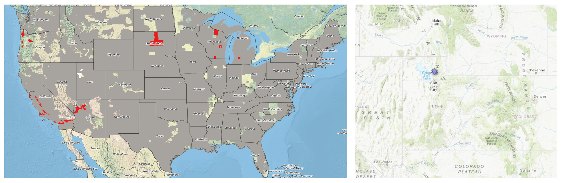
Left hand panel shows the location of existing USGS 3DEP 1 meter coverage (gray), and areas where new 1 meter data were added in August (red). The right hand panel shows the location of a new Community Dataspace dataset in Utah, east of Ogden.
USGS 3DEP 1m Raster Dataset Updates
The USGS 3DEP standard one-meter digital terrain models (DTMs) are produced exclusively from high resolution lidar source data. These DTMs are hydro-flattened, represent the topographic bare-earth surface, and are seamless within collection projects. This dataset is continually growing as new lidar data is collected, processed, and integrated into the 1 meter mosaic.
The USGS 1m data is freely available to our core US academic user community (e.g. users who register with a .edu email domain). However, non-academics can access USGS data, as well as all other restricted datasets, by signing up for OpenTopography Plus (OT+). OT+ is a subscription service that enables one-stop, easy-to-use access to the highest quality topography data for the US. For more details about OT+, or to sign up, see the OT+ signup page.
Latest USGS 1m DEM data:
OpenTopography Community Dataspace Datasets
The OpenTopography Community Dataspace allows users who are producing small to moderate sized topographic datasets (with technologies such as lidar and photogrammetry) to archive their data with OpenTopography via a simple drag and drop user interface. This feature is designed to support data publication and citation, academic data reuse, and educational applications. Each submission is reviewed by OpenTopography staff and approved on a case-by-case basis. Datasets in the OT Dataspace receive a Digital Object Identifier (DOI) and are displayed on the OpenTopography Find Data Map so they are discoverable and downloadable alongside data hosted by OpenTopography. The Dataspace is meant to complement standard OpenTopography data hosting for larger datasets produced by our data provider partners.
New Community Dataspace data:
Sample Graphics From Data Released in August 2025
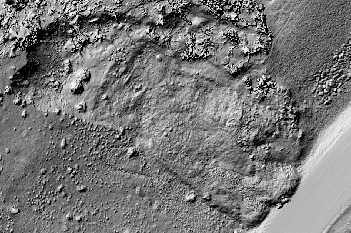
Hillshade of the ZigZag Landslide near Snow Basin Road (UT-226), Morgan County, Utah. Data Source: CDS: 2021 ZigZag Landslide Reconnaissance, Morgan County, Utah.
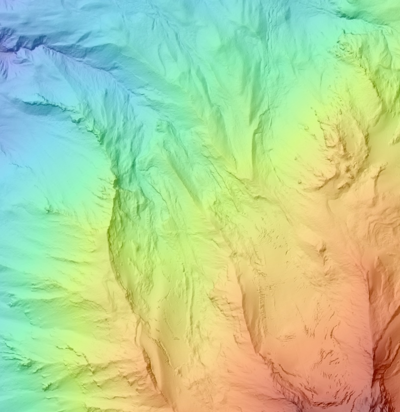
Colored hillshade of Mt Jefferson, Oregon. Data Source: OT: USGS 1 meter Digital Elevation Model.
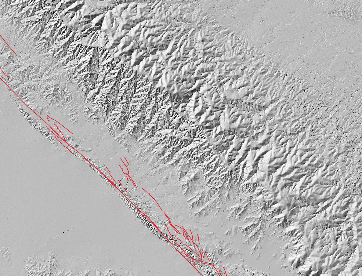
Hillshade of a section of the Carizzo Plain in California with the San Andreas fault zones plotted in red. Fault boundaries downloaded from the USGS Quaternary Fault and Fold Database of the United States. Data Source: OT: USGS 1 meter Digital Elevation Model.