Announcing On-Demand Vertical Differencing in OpenTopography
OpenTopography is happy to formally announce the release of new web-based functionality for on-demand vertical differencing (a.k.a. change detection) of multi-temporal high resolution topographic data. If you follow us on Twitter, you may have seen some posts in December during the annual American Geophysical Union meeting highlighting this functionality where we first announced it in a talk: Scott et al., 2018, Web-based Topographic Differencing of High Resolution Topography Data.
Via OpenTopography’s portal interface, users can now quickly calculate surface change from a variety of tectonic, geomorphic, and anthropogenic processes including earthquakes, volcanic eruptions, river erosion, landslides, sand dune migration, and urban development. Topographic differencing is currently enabled for over 30 overlapping dataset pairs located on three continents. As additional multi-temporal datasets become available, the differencing functionality will be enabled.
Within the scientific community, topographic differencing is an emerging technique for mapping changes in natural and anthropogenic landscapes. Our vertical differencing change detection capability is the latest offering from OpenTopography in a growing set of processing tools that promote data discovery and analysis for both novice and expert users.
Vertical differencing is the subtraction of gridded elevation data (a.k.a. raster or digital elevation models (DEMs)) and can be performed with either default settings or parameters chosen by the user. To perform topographic differencing, users select two overlapping point cloud datasets within the OpenTopography archive. The system then generates DEMs and calculates the change in the surface elevation between the two datasets. The raster-based differencing results are displayed and can be downloaded along with the relevant metadata.
This YouTube video tutorial explains how to perform vertical differencing on OpenTopography:
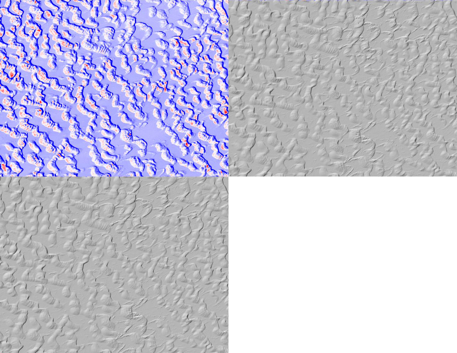
BELOW: Sand dune migration at the White Sands National Monument, New Mexico. Difference is calculated between airborne lidar datasets collected in September 2009 and June 2010. Erosion or downward motion of the ground surface is colored in red. Deposition or upward movement is colored in blue. For the New Mexico Sand dune case, we see that the dunes are migrating towards the north-east, driven by a dominant wind direction from the southwest.

Reference:
Scott, C.P., Crosby, C., Nandigam, V., Arrowsmith, R., Phan, M., Web-based Topographic Differencing of High-Resolution Topography Data: American Geophysical Union Fall Meeting, 2018, G53A-06.
