10 New Point Cloud Datasets from Brazil, Alaska, California, Montana, North Carolina & Oregon
Apr 1, 2013
OpenTopography has released ten datasets covering a small area in Brazil as well as the US states of Alaska, California, Montana, North Carolina and Oregon. These data cover a diverse range of topographic environments and were collected to study active tectonics, volcanic areas, coastal geomorphology and hydrology.
Coastal Dune Fields of Garopaba and Vila Nova, Santa Catarina State, Brazil
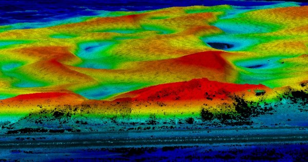
OpenTopography recently posted our first dataset in the Southern Hemisphere! This small dataset covers a 10 square kilometer area of two coastal dune fields (Garopaba and Vila Nova) in southern Brazil and was collected October 18, 2010. The purpose of the survey was to investigate the morphometry and evolution of coastal dune fields.

Point cloud image showing oblique view of Vila Nova dune field, colored by elevation. A highway in the foreground (bottom) of the image for scale
National Center for Airborne Laser Mapping (NCALM) Data
Nine datasets in this release were collected by the National Center for Airborne Laser Mapping (NCALM) over areas of Alaska, California, Montana, North Carolina and Oregon. NCALM is an NSF-funded center that supports the use of airborne laser mapping technology (a.k.a. lidar) in the scientific community and is jointly operated by the Department of Civil & Environmental Engineering, Cullen College of Engineering, University of Houston and the Department of Earth and Planetary Science, University of California-Berkeley. Three datasets were collected under NCALM's graduate student seed proposal program that awards ten projects per year to graduate student PIs who need lidar data for their research. Each collection is typically limited to no more than 40 square kilometers. The release of these data via OpenTopography is the product of a memoranda of understanding (MOU) between OpenTopography and NCALM to make OT the primary distribution pathway for NCALM data.
- Flathead Lake Biological Station, MT (September 2005)
- LiDAR Survey of Parts of Potomac and Susquehanna Rivers
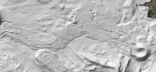
- North Sister, OR: Collier Cone Lava Flow
- Mojave Desert, CA: Evolution of the Hector Mine Earthquake Surface Rupture
- Northern California Coast: Slope Failure in Low and High Uplift Regions
- St. Elis Mountains and Gulf of Alaska
- North Carolina Coast: Quantifying Patterns of Coastal Change (June 2006)
- North Carolina Coast: Quantifying Patterns of Coastal Change (July 2007)

Hillshade image in Google Earth of Collier Cone lava flow. North Sister, Cascades, Oregon.
