OpenTopography 2022 Community Survey Review
OpenTopography conducted a survey of its user community to gain feedback on existing services, prioritize new development and to enhance existing services, and track evolving community needs. The survey was developed by the OpenTopography Advisory Committee, and was distributed to OpenTopography users via our email newsletter. A total of 523 users responded to the survey. The results of the survey are summarized as follows.
Of the respondents, approximately 40% work in academia, 34% work in the private sector or industry, and 13% work in government.

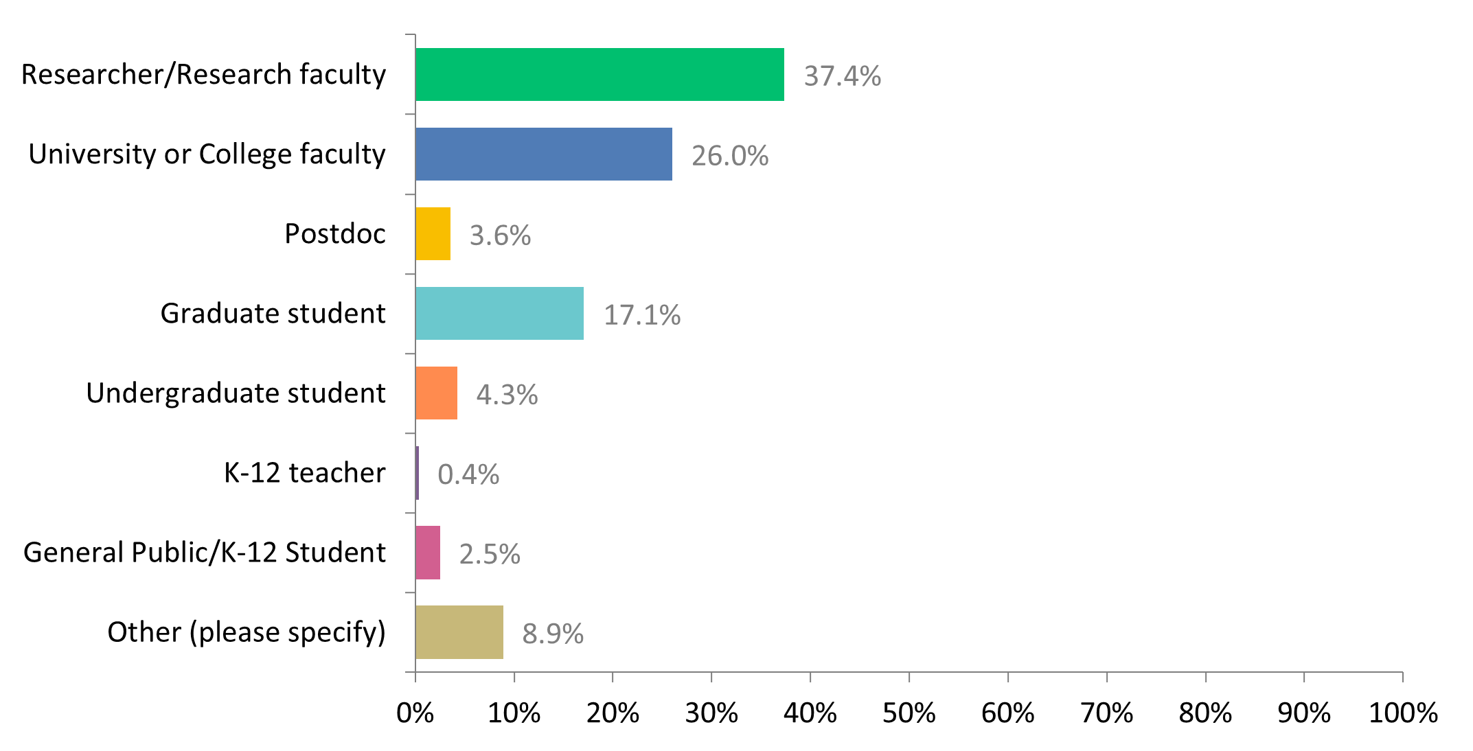
Of the academic respondents, 37% are research faculty, 26% are university faculty, and 17% are graduate students.
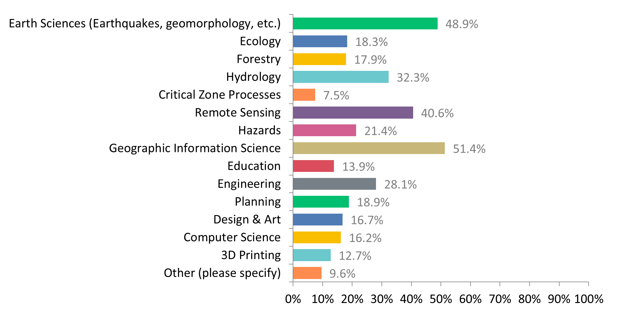
Respondents had primary areas of interest in GIS, earth sciences, remote sensing, hydrology, and engineering applications.
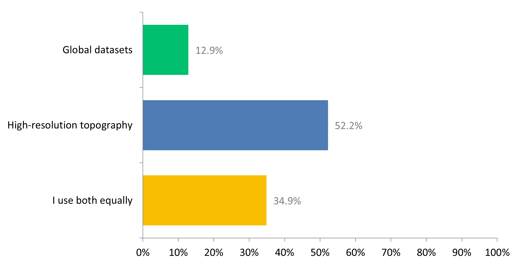
The majority of respondents primarily use high resolution topography (HRT) data on OpenTopography, with 35% of respondents indicating they equally use HRT and global datasets.
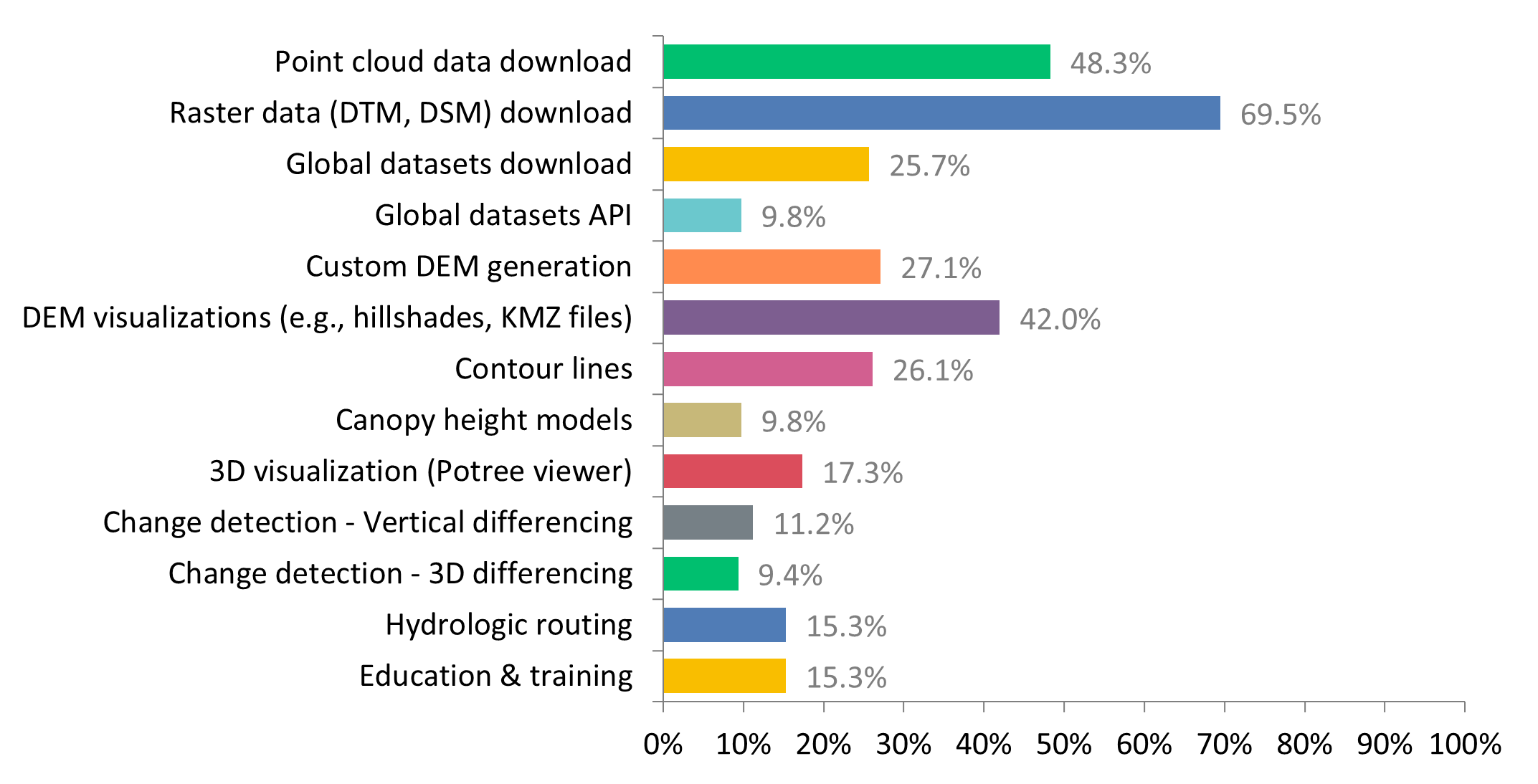
Of the OpenTopography tools and features, many respondents use raster download, point cloud download, and DEM visualizations.
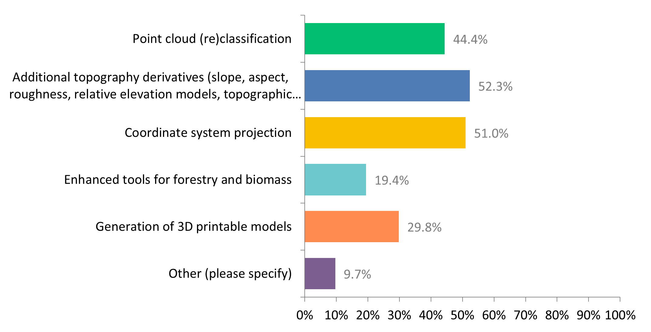
Approximately half of respondents would like to see tools for additional topography derivatives, coordinate system reprojection, and point cloud (re)classification.
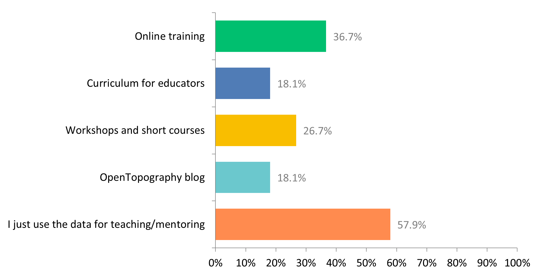
Of the respondents who use OpenTopography for education, over half use OpenTopography data for teaching and learning, 37% use our online training resources, and only 18% use our designed curriculum materials.
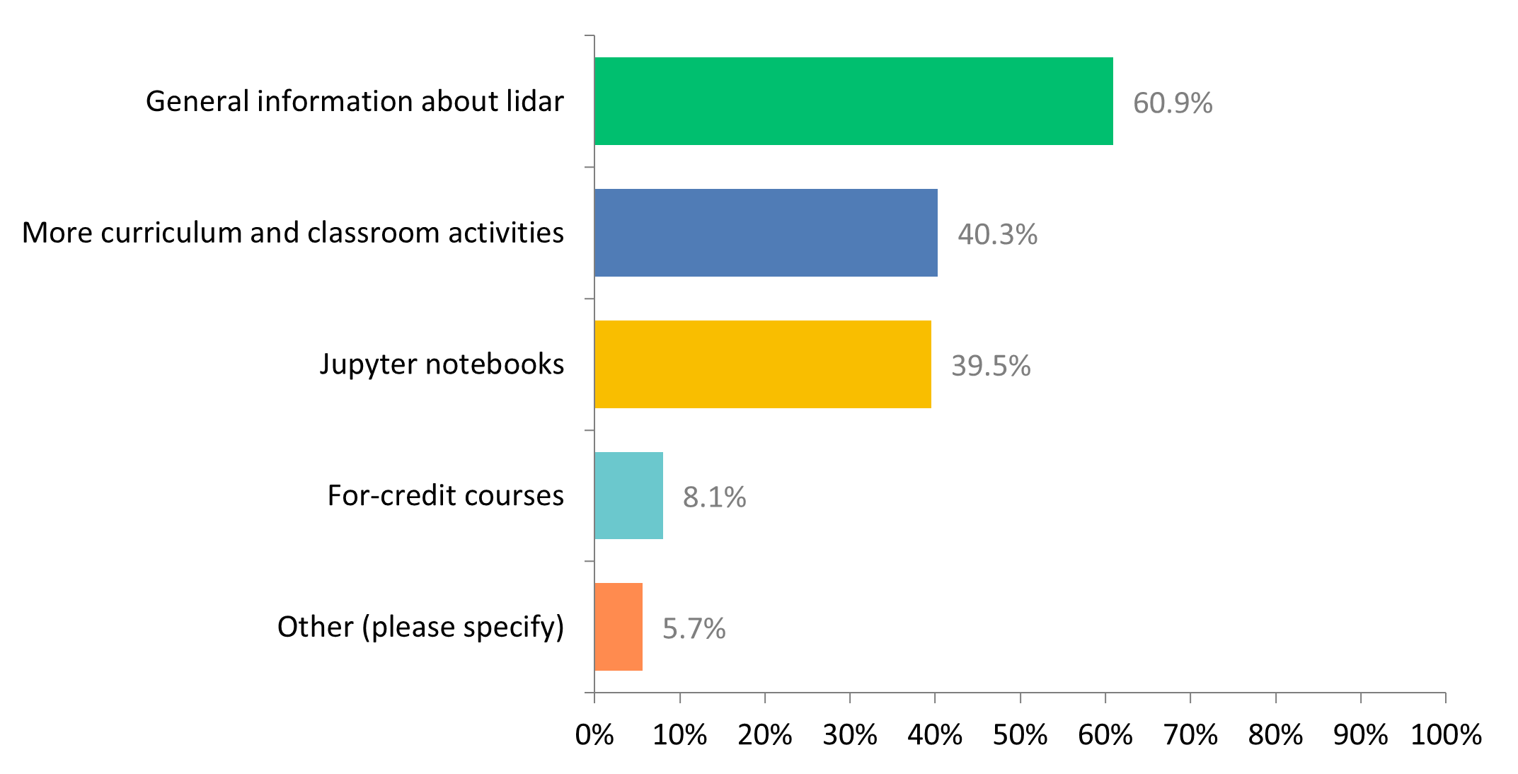
Of educational user respondents, the majority would like to see more general information about lidar, in addition to more curriculum/classroom activities and Jupyter Notebooks.
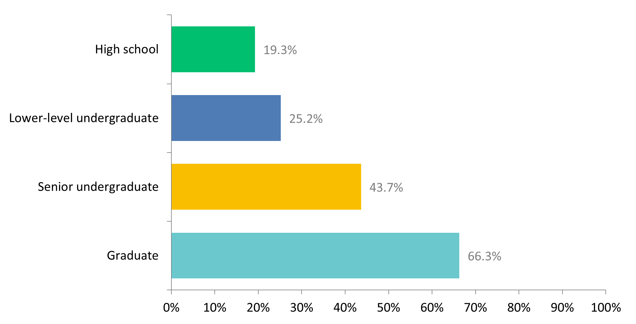
Educational user respondents primarily wanted graduate and higher level undergraduate educational materials.
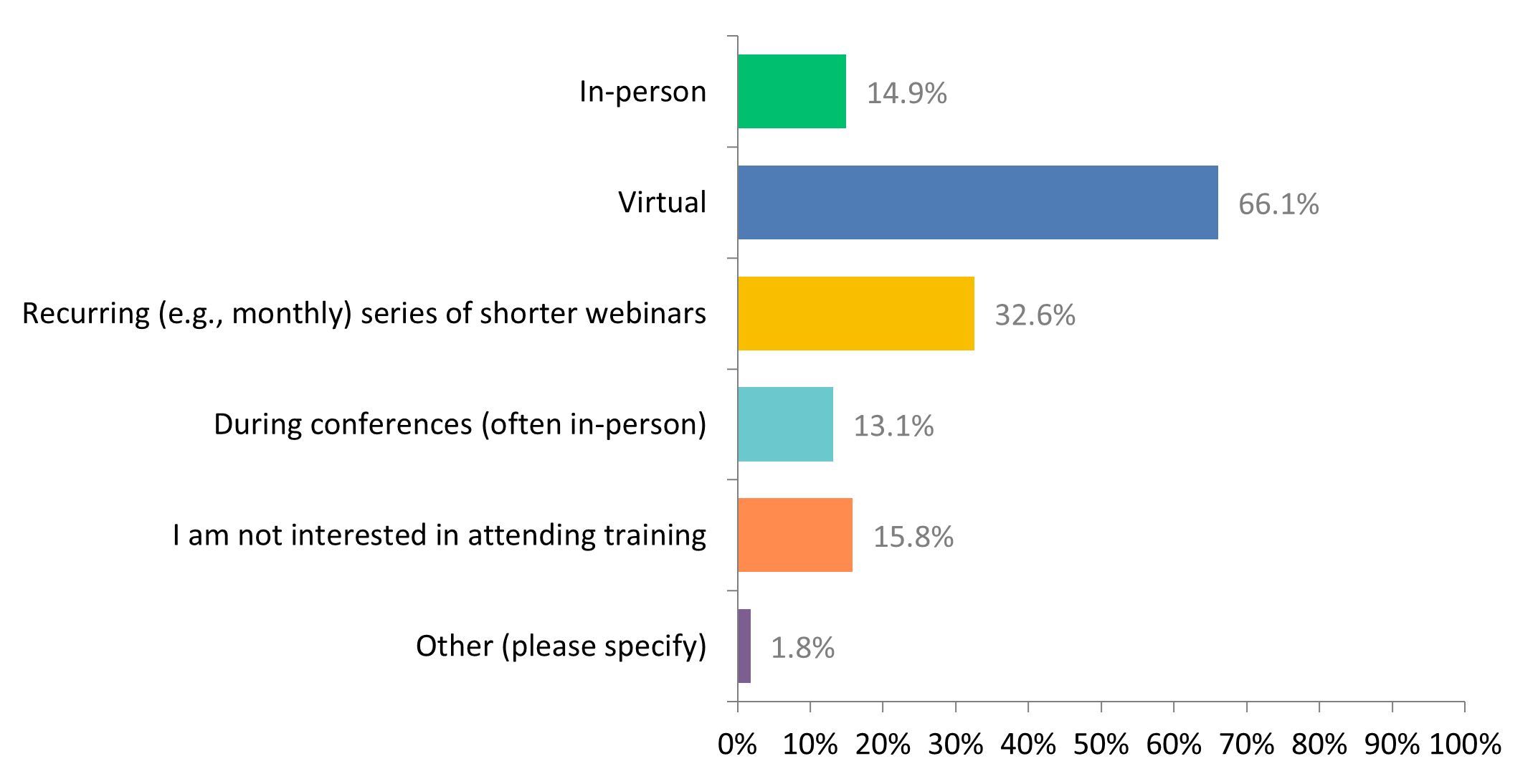
The majority of respondents were interested in virtual training sessions, and a third were interested in recurrently (monthly) webinars. Respondents indicated a high interest in training session on all the tools that are available on OpenTopography.
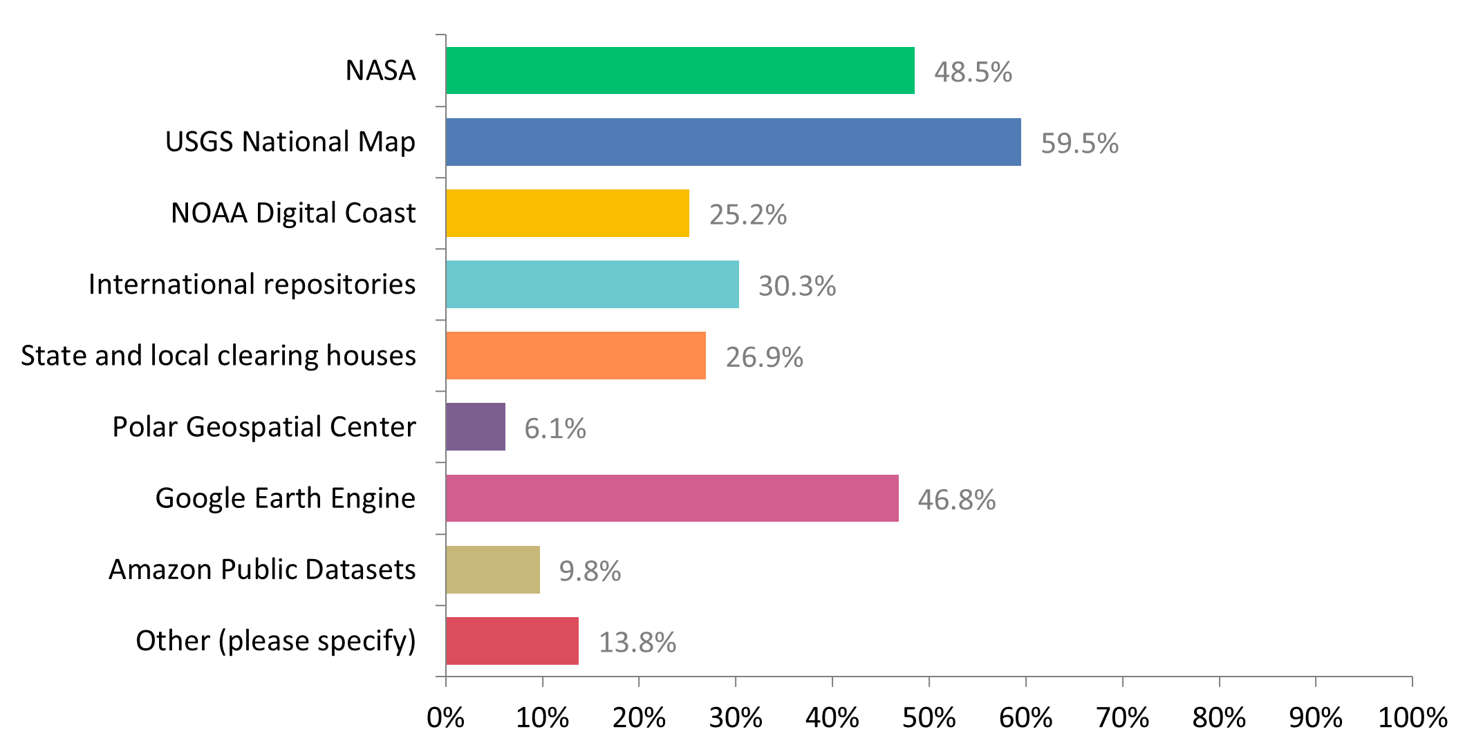
In addition to OpenTopography, respondents also commonly access data from the National Map, NASA, and Google Earth Engine.
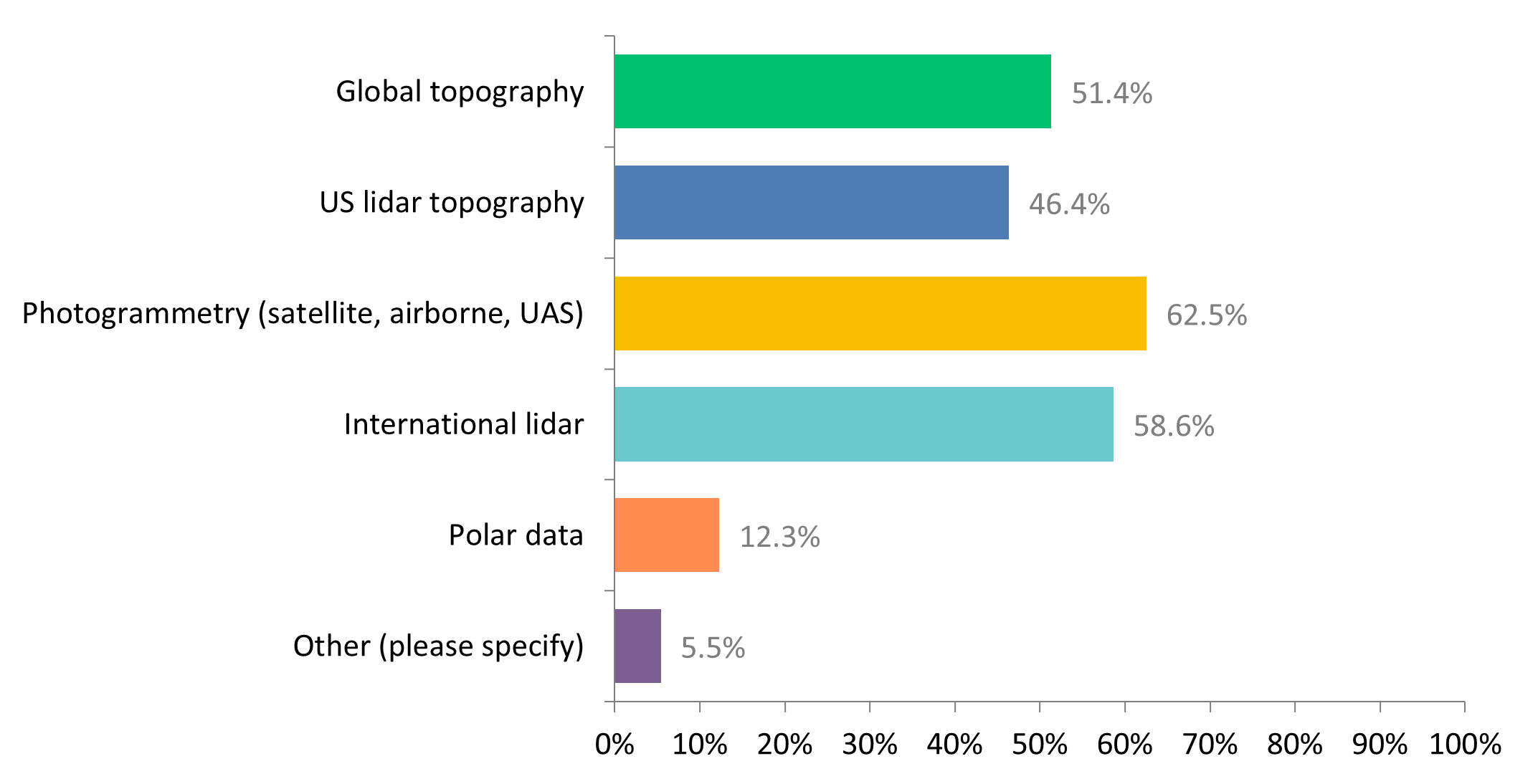
Respondents were most interested in access to more photogrammetry datasets, international lidar, global topography, and US lidar topography.
Regarding new features and tools, many respondents would like to select data using a polygon rather than a rectangle and would like to have a low-resolution map preview of the data. Respondents would like larger processing limits and and non-academic users would like access to all USGS 3DEP data at no cost. Respondents also indicated that they would like to be notified of new datasets that have been added in their area of interest.
Overall the survey respondents were very thankful for and appreciative of the services that OpenTopography provides.
