LiDAR data for N. Baja, Mexico in Google Earth: pre-M 7.2 El Mayor - Cucapah earthquake

Thanks to a close collaboration with OpenTopography colleague Alejandro Hinojosa at CICESE in Ensenada, Mexico, we have obtained 5 meter resolution LiDAR topography data for the epicentral region of the Sunday, April 4th 2010 magnitude 7.2 El Mayor - Cucapah earthquake in northern Baja, Mexico. These data, which cover an area of over 2,000 square kilometers southwest of Mexicali, were acquired in 2006 by the Instituto Nacional de Estadística y Geografía (INEGI), a Mexican government agency. We've been told that these data were collected from an elevation of 6000 m with GSD of 10 to 12 meters.
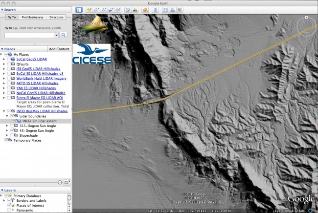
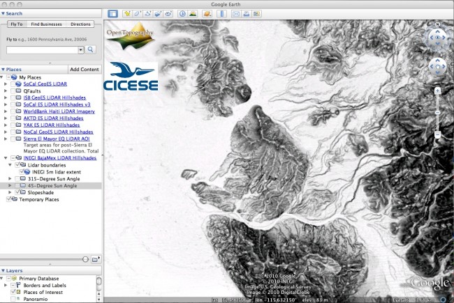
As I've done for the EarthScope LiDAR hosted by OpenTopography as well as the data collected following the January Haiti Earthquake, I've generated hillshade and slopeshde imagery from the DEM data and produced a network linked Google Earth KMZ file that can be used to access the imagery. Download the KMZ file using the button below and open in Google Earth to get started:
At the moment, we have not obtained permission from the INEGI to release the actual DEM data (and we do not have the point cloud data), but we hope that the derived imagery accessed via Google Earth will be helpful for researchers currently investigating ground rupture and other phenomena associated with last month's earthquake. To assist groups working in the field who won't have network access to connect to the imagery stored on OpenTopography servers, KMZs with the imagery stored locally can be downloaded below:
We anticipate that higher-resolution LiDAR topography will be collected along the ground rupture in the next few weeks. Clearly these pre-event data, although lower resolution than forthcoming data in the region, present an exciting opportunity for comparing pre- and post-event data to calculate near-field deformation along the rupture. We're optimistic that we'll be able to obtain permission to distribute both the DEM and point cloud INEGI data in the future so that they can be used for these types of analysis.
NOTES:
- The LiDAR topography data set from which these images were derived was acquired by INEGI and kindly provided to OpenTopography by Alejandro Hinojosa at CICESE. Citation for the LiDAR topography data is: "INEGI 2006, Modelo digital de elevación de alta resolución Lidar, Tipo TERRENO".
- The extent of the LiDAR data is shown by the cyan colored outlines. The images will load once the user has zoomed into an area of interest. The imagery becomes progressively higher resolution as you zoom in.
- All of the imagery is accessed via "Network Link" to servers in San Diego, thus a strong and consistent internet connection is required. Alternatively, you can download the individual KMZ files above where the imagery is stored locally, removing the need for a network connection. Note however that access to the default imagery and map layers in Google Earth requires a connection.
- The transparency of the LiDAR hillshades can be adjusted using the slider bar at the bottom of the PLACES menu in the left hand navigation bar.
EXAMPLES:


