Recent New and Updated LINZ Datasets
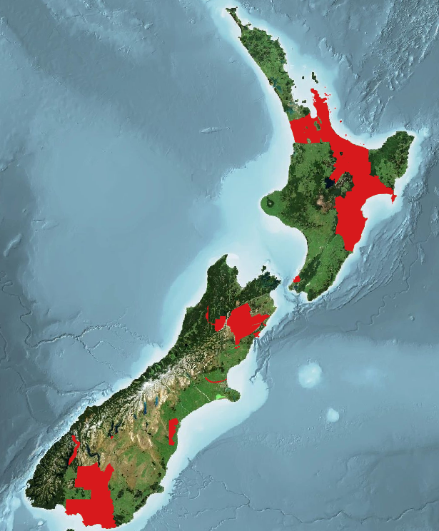
Over the past several months, OpenTopography has been working hard to add new datasets, and append more data to previously published projects over New Zealand. These datasets are available through an ongoing collaboration between OpenTopography and LINZ that makes OpenTopography the primary distribution platform for point cloud data collected as part of the LINZ National Elevation Program. Collectively these new data add an additional 53,000 km2 of high resolution topographic data over both the North and South Islands (see areas in red in figure below).
Find the data here:
- Southland, New Zealand 2020-2023 (New)
- Waikato, New Zealand 2021 (New)
- Porirua, Wellington, New Zealand 2023 (New)
- Marlborough, New Zealand 2020-2022 (Addendum)
- Kaikōura and Waimakariri, Canterbury, New Zealand 2022 (New)
- Canterbury, New Zealand 2020-2022 (Addendum)
- Tasman, New Zealand 2020-2022 (Addendum)
- Bay of Plenty Northwest, New Zealand 2020-2021 (Addendum)
- Wānaka, Otago, New Zealand 2022-2023 (New)
- Hawke's Bay, New Zealand, 2020-2021 (Addendum)

Spatial coverage of new LINZ datasets (since Spring 2023) in red.

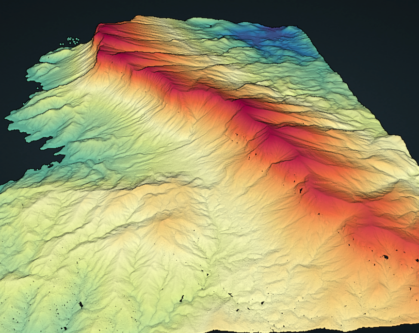
Point cloud colored by elevation of Panekire Bluff on the southern shore of Lake Waikaremoana. The Panekire Bluff is part of the Lake Waikaremoana Great Walk. (Data from Hawke's Bay, New Zealand 2020-2021)

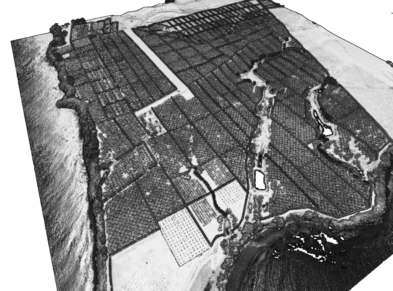
3D point cloud colored by intensity over a tree farm on Motiti Island. (Data from: Bay of Plenty, New Zealand 2019-2022)

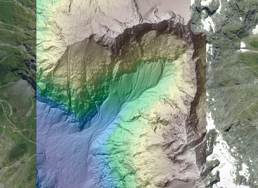
Digital Terrain Model (DTM) of a section of the Fjordlands National Park near Mount Christina. DTM is colored by elevation and draped on imagery provided by LINZ. (Data from: Southland, New Zealand 2020-2023)
