Educational Resources on OpenTopography
by Emily Zawacki and Chelsea Scott
OpenTopography provides high-quality and ready-to-use educational resources that facilitate integrating high resolution topography into classroom lessons and activities at a variety of levels. With these resources and exercises, students use cutting-edge technology related to high resolution topography to learn about geologic processes. These resources include laboratory and classroom exercises for undergraduate and graduate courses, pre-generated lidar products of landforms, including files for 3D printing, an introduction to lidar, and Jupyter notebooks. Each of these resources are described below.
Laboratory and Classroom Exercises
OpenTopography offers laboratory and classroom exercises that use high resolution topography to explore topics related to rivers and geomorphology, topographic differencing and earthquakes, and structural geology. In our newest activity, the Indiana White River Meanders Mapping Exercise, students map and observe how the White River in Indiana has changed over five years by using lidar topographic hillshades. Students also evaluate the longer-term evolution of the river's form and assess how local infrastructure may be impacted. This exercise is designed for introductory-level Earth science, physical geology, or water resources courses in junior colleges and universities.
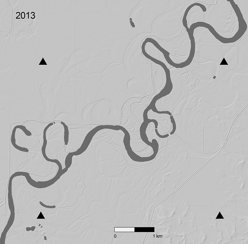
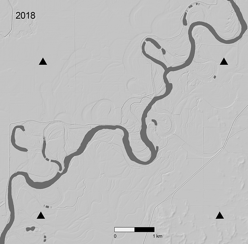
Lidar hillshades of the White River, Indiana used in the Indiana White River Meanders Mapping Exercise.
In the exercise Topographic differencing: Earthquake along the Wasatch fault, students use lidar topography data along the Wasatch Fault in Salt Lake City, Utah, to measure how much and in what direction the ground moved during a hypothetical, but realistic, earthquake. The exercise is intended for intermediate to advanced level undergraduate courses that cover faulting, such as structural geology, geomorphology, geophysics, or geohazards courses. The National Association of Geoscience Teachers (NAGT) ranked this exercise as 'exemplary,'
In the Structural Geology Exercise for Remotely Examining Folds at Painted Canyon Near the San Andreas Fault, students learn about the structural geology surrounding Painted Canyon near the Southern San Andreas Fault, California. Students measure the geometry of a fold based on a dataset produced using structure from motion (SfM) photogrammetry on Uncrewed Aerial Vehicle (UAV a.k.a. drone) photographs. The exercise was designed for a graduate-level structural geology class but would also fit well into undergraduate-level classes, especially if field trips cannot take place.
Additionally, OpenTopography highlights community resources for applying lidar data to teach Earth science. These resources were sourced from OpenTopography short courses, as well as the Earth science education community.
OpenLandform Catalog
The OpenLandform Catalog is a collection of landforms with images and products designed for teachers, students, or others interested in geologic landforms viewed in high resolution topography. The OpenLandform Catalog lists geologic landforms sourced from data hosted by OpenTopography along with brief information on the relevant formation process. Each landform includes pre-generated products including digital elevation models (DEM), hillshades and other derived products, Google Earth KMZ files, STL files for 3D printing, the point cloud data (LAZ), and a link to an online point cloud viewer. This material supplements advanced high school and introductory college level Earth science courses.
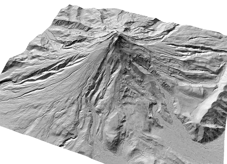
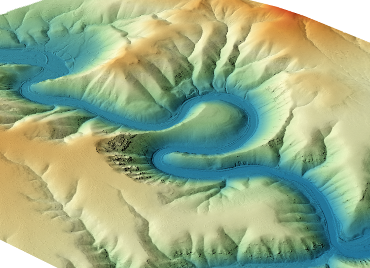
Hillshade of Mount Hood, Oregon (left), DEM of entrenched meander along the Yakima River, Washington (right) from the OpenLandform Catalog.
What is Lidar?
OpenTopography's new educational page What is Lidar? provides an easy to understand introduction to lidar for undergraduate and advanced high school students. The page provides an explanation of how lidar works and is used, what digital elevation models (DEMs) are, and links to other video resources that explain lidar. Instructors can direct their students towards this resource when discussing lidar in class, or use materials from the page in lectures on lidar.
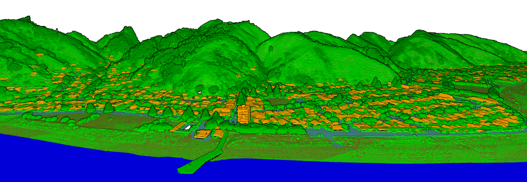
3D point cloud colored by classification (brown=ground, green=vegetation, orange=buildings, blue=water) of the Eastbourne suburb of Lower Hutt, New Zealand.
Jupyter Notebooks
OpenTopography has several of Jupyter Notebooks available that use OpenTopography data and processing resources. These Notebooks are an excellent tool for individual online training, or for integration in classroom settings. The Overview of the Rayshader Library notebook produces 2D and 3D data visualizations and maps. This notebook is also available in an RStudio format and can be used to create stunning visualizations of landscapes.
The notebook Programmatic Access to OpenTopography’s Cloud Optimized GeoTIFF (COG) Global Datasets demonstrates several methods to access cloud-based global topographic datasets such as NASA's Shuttle Radar Topography Mission (SRTM) data catalog in OpenTopography, and how COGs can be used to streamline data processing. The Subsampling Lidar Point Clouds for STL Output notebook thins point clouds to create a mesh that can be exported as a standard triangle language (STL) file for 3D modeling or printing.
OpenTopography's full library of Jupyter Notebooks can be found here. OpenTopography is actively developing new Jupyter Notebooks for educational and training use that will be published as they are completed.
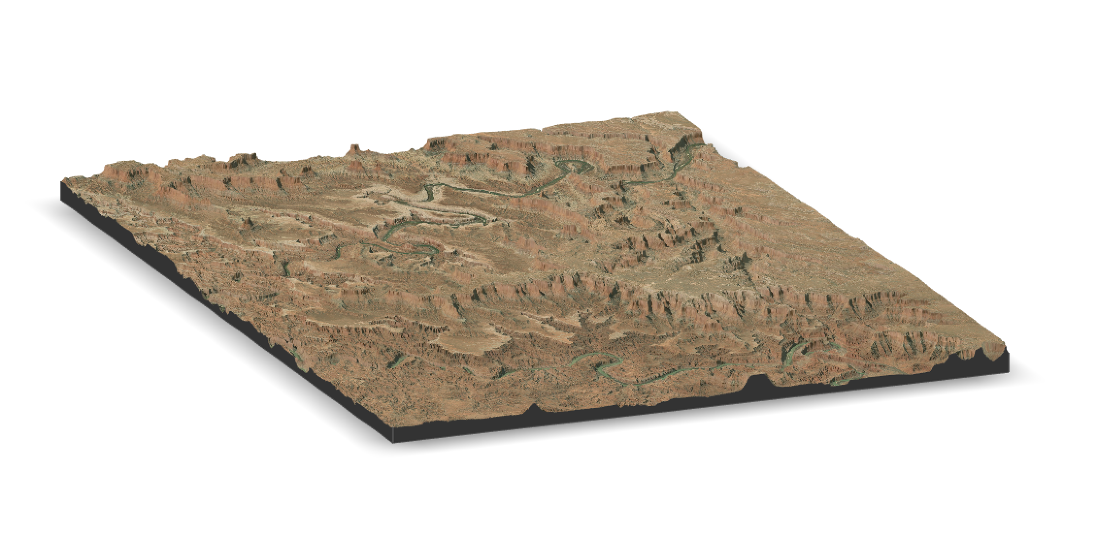
Canyonlands, Utah created using the Rayshader Jupyter Notebook.
