Land Information New Zealand (LINZ) dataset covering Whanganui, NZ released
OpenTopography is pleased to announce the release of a new lidar dataset covering 444 square kilometers of Whanganui and the surrounding area on the North Island of New Zealand. The dataset, "Whanganui Urban, Manawatu-Whanganui, New Zealand, 2020-2021" has a large average point spacing of 16.58 pts/m2, and was funded by Whanganui District Council, with data management by Toitu Te Whenua Land Information New Zealand. This dataset is available through on ongoing collaboration between OpenTopography and Land Information New Zealand (LINZ), that makes OpenTopography the primary distribution platform for point cloud data collected as part of the LINZ national elevation program.
Get the data:

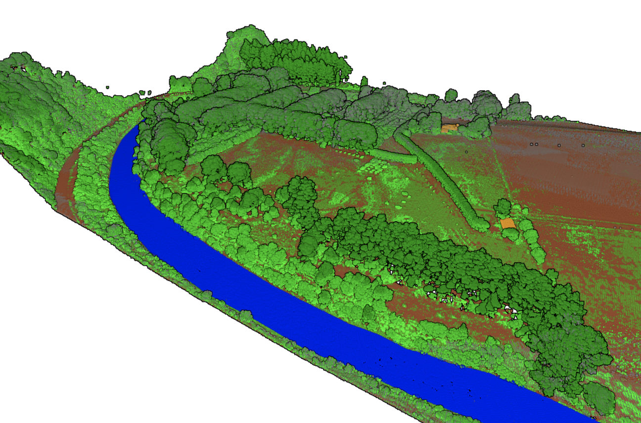
Point cloud colored by classification of a riverside farm. This dataset includes point classification of low, medium, and high vegetation which can be seen in the image as varying shades of green. In addition: water is colored blue, buildings are colored orange, and the ground surface is colored brown.

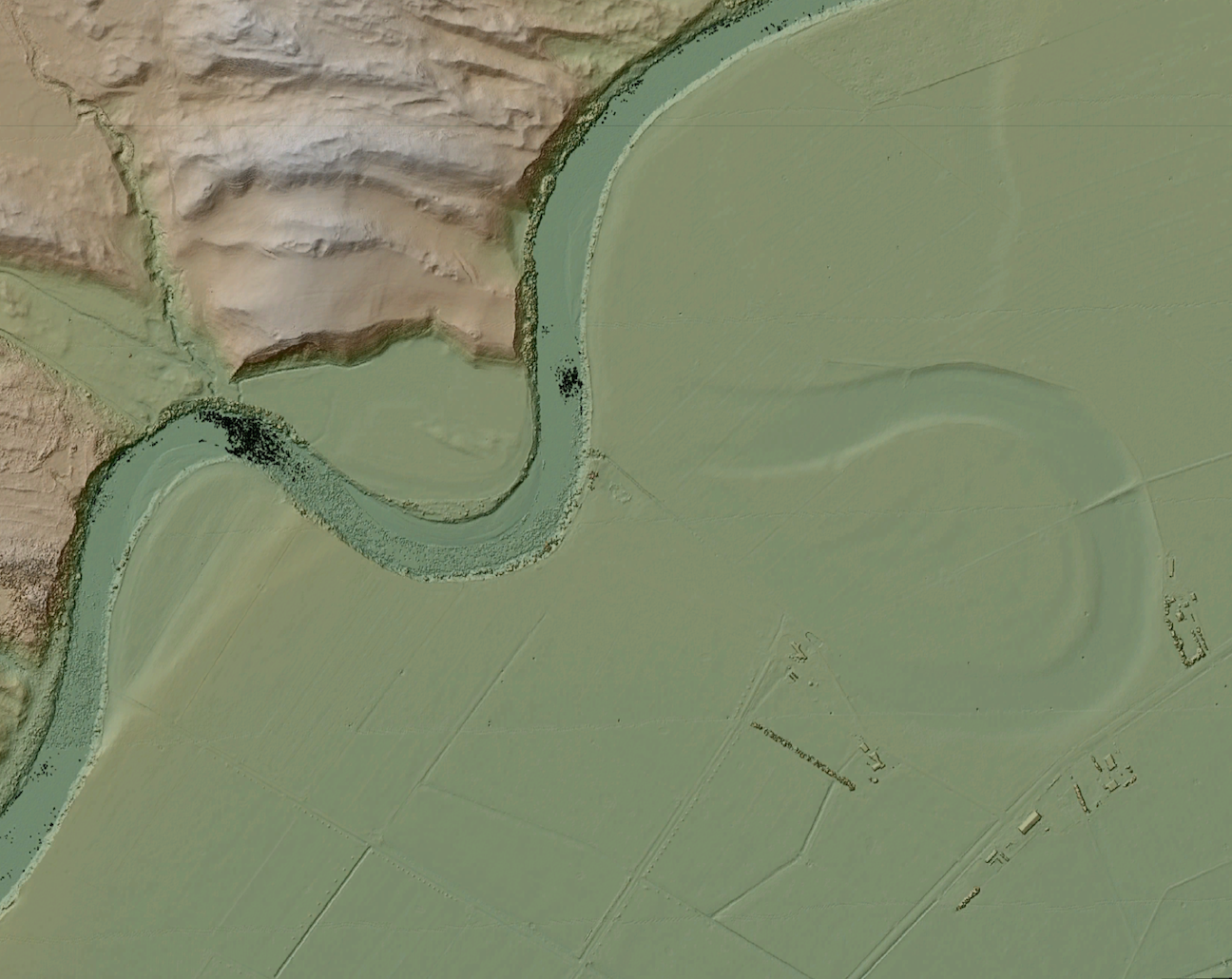
Hillshade colored by elevation. The DEM was created using the minimum value per grid cell with the "Local Gridding" algorithm. Using this method, the Oxbow Lake is more apparent..
