New NCALM datasets capturing post-fire landscapes in California, and Hurricane Harvey impacts in Texas
OpenTopography is pleased to announce the release of four new NCALM Seed datasets covering areas of California, and one hurricane rapid response project in Texas. These datasets were collected by NCALM, an NSF-funded center that supports the use of airborne laser mapping technology (a.k.a. lidar) in the scientific community and is jointly operated by the Department of Civil & Environmental Engineering, Cullen College of Engineering, University of Houston and the Department of Earth and Planetary Science, University of California, Berkeley. OpenTopography is the primary distributor of NCALM data.
Get the data:
- Change Detection of Post-fire Runoff Events, CA 2019
- Post-fire Debris Flows in Santa Monica Mountains, CA 2019
- Meandering Channels in Death Valley, CA 2019
- Post Hurricane Harvey Mapping of the Mission River, Texas 2018

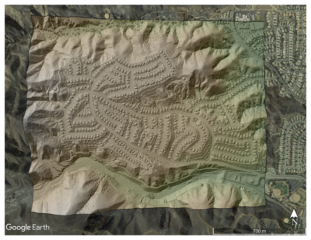
Colored hillshade of subdivision on eastern edge of hills impacted by wildfires near Lake Elsinore, CA. Base imagery provide by Google Earth. Data Source: Change Detection of Post-fire Runoff Events, CA 2019.

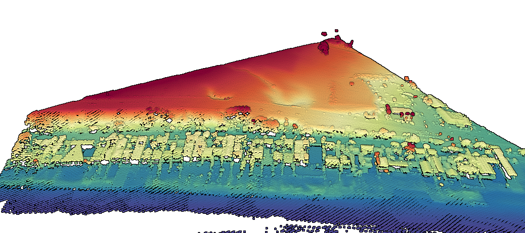
Point cloud colored by elevation of Malibu beach homes along the coastline.
Data Source: Post-fire Debris Flows in Santa Monica Mountains, CA 2019

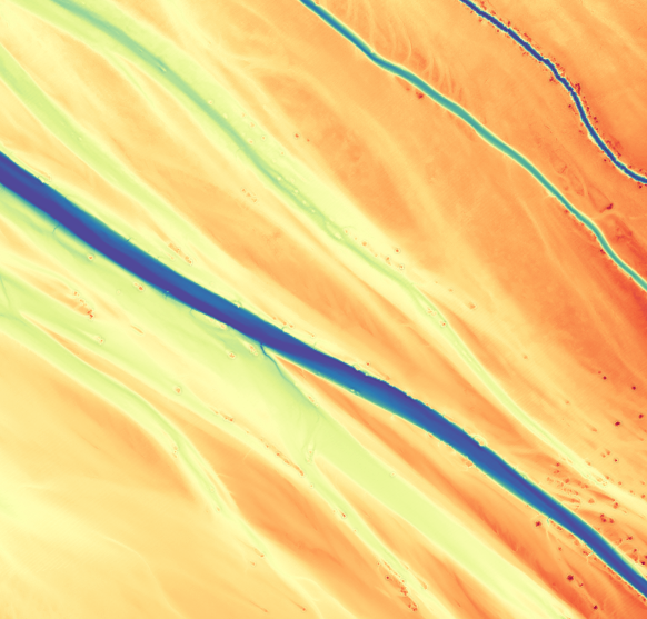
Digital Elevation Model of dry river channels in Death Valley, CA. Data Source: Meandering Channels in Death Valley, CA 2019

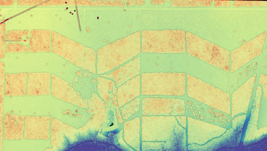
Lidar point cloud colored by elevation showing a unique agricultural landscape in Texas. Data Source: Post Hurricane Harvey Mapping of the Mission River, Texas 2018
