Topographic Differencing Showcase
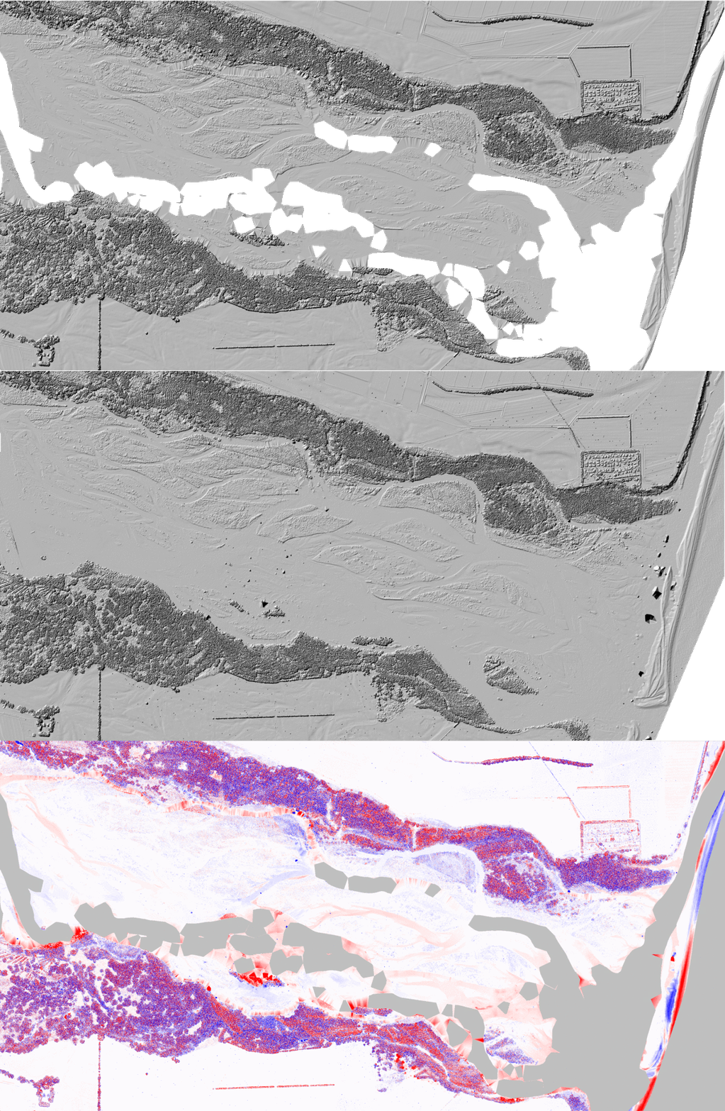
OpenTopography recently released on-demand vertical differencing. Here, we showcase a range of anthropogenic, geomorphic, and tectonic processes imaged using topographic differencing on OpenTopography’s portal. In each image, erosion or downward change of the Earth’s surface is colored in red, while deposition or upward change is colored in blue. We include a link to the change detection page for each dataset pair so you can run your own jobs and explore.

2018 Kilauea, Hawaii, Volcanic eruption: The Kilauea Volcano erupted from May to August 2018 along Kilauea’s east rift zone and produced considerable damage to nearby communities. This image shows subsidence within the volcanic crater from June to July 2018. https://portal.opentopography.org/differencing?opentopoID=OTLAS.062018.6...

Salt Lake City, Utah, Airport: Topographic differencing reveals airplane location at the Salt Lake City Airport during the two lidar surveys. Red airplanes were present during the first lidar acquisition, and blue airplanes were present during the second acquisition. https://portal.opentopography.org/differencing?opentopoID=OTLAS.122014.2...

The Waitaki River, New Zealand: This illustrates erosion and deposition along the Waitaki River of the South Island of New Zealand between March and November 2016.
https://portal.opentopography.org/differencing?opentopoID=OTLAS.012019.2...

Rockfall at Yosemite National Park, California: Rocks and trees fall near Half Dome in Yosemite between summer 2006 and summer 2010. According to the National Park Service, Yosemite has experienced over 1000 rockfalls during the past 150 years. The park works with geologists to study rockfalls using different imaging tools like lidar to ultimately reduce the risk posed by rockfalls. https://portal.opentopography.org/differencing?opentopoID=OTLAS.092012.2...

2016 M7 Kumamoto, Japan, Earthquake: The April 2016 M7 Kumamoto earthquake ruptured the Kyushu Island of southwestern Japan and produced over 2 m of fault slip along the Earth’s surface. Here, we see downward motion over the entire landscape (red color) punctuated by three faults represented by sharp changes in the vertical displacement across the agricultural fields.
https://portal.opentopography.org/differencing?opentopoID=OTLAS.052018.2...

Tree clear cuts, South Island, New Zealand: This shows the cutting down of trees near Christchurch on the South Island of New Zealand between 2012 and 2014.
https://portal.opentopography.org/differencing?opentopoID=OTLAS.122016.2...

Calhoun Critical Observatory, South Carolina: Leaves fall from trees between Summer 2014 and Winter 2016 at the Calhoun Critical Observatory. This landscape was farmed heavily for over a century.
https://portal.opentopography.org/differencing?opentopoID=OTLAS.072016.2...
