Two new satellite-derived point clouds available
OpenTopography is pleased to announce the release of two new photogrammetric datasets derived from the Pleiades 1A and 1B satellites. These datasets are unique among those provided through OpenTopography, as the point clouds were created using stereo imagery taken from space and not using lidar technology.
El Mayor-Cucapah Earthquake, Pleiades 2014
On April 4, 2010 a 7.2 Mw earthquake shook upper Baja California, just south of the US-Mexico border. The earthquake resulted in extensive damage to buildings in the area, causing an estimated $1.15 billion in damage. For more information on the earthquake, see UNAVCO's El Mayor-Cucapah geophysical event response page. This dataset was used in a study by Zhou et al. to evaluate height difference measurements taken from Pleiades stereo imagery. In the study, they compared the elevation differences measured by Pleiades with those measured using airborne lidar and determined that the vertical accuracy of the Pleiades DEMs is ∼0.3 m.
This new dataset joins four other El Mayor-Cucapah earthquake datasets on OpenTopography:
Airborne Lidar:
El Mayor-Cucapah Earthquake (4 April 2010) Rupture Lidar Scan
2006 INEGI Sierra Cucupah Empirically Corrected Lidar Dataset
Terrestrial laser scanning:
El Mayor-Cucapah Earthquake Rupture Terrestrial Laser Scan-Site 1
El Mayor-Cucapah Earthquake Rupture Terrestrial Laser Scan-Site 2


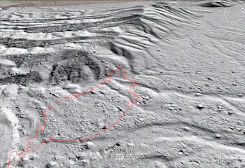
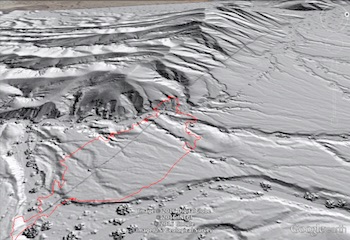
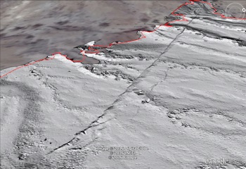
Google Earth visualization of the Borrego Fault post-earthquake. Imagery is derived from datasets collected using, from left to right, satellite, airborne, and terrestrial methods. The red outline in all three images shows the extent of TLS Site 1. The fault scarp can be seen in the north (top-right in the image) of the satellite-derived imagery, while it can be seen in the north and south of the airborne-derived image. The TLS image, which has a much higher point density, shows the scarp in the greatest detail but over a small area.
East Helanshan Fault, northern China
This dataset covers an area in Yinchuan, China that experienced a large earthquake on January 3, 1739. The quake has been reported to be as large as magnitude 8.0, which would make it one of the largest continental normal-faulting earthquakes in recorded history. Using this dataset, Middleton et al. determined a revised magnitude estimate of 7.1 to 7.6.
These datasets are provided in collaboration with Natural Environment Research Council, UK (NERC) COMET (Centre for Observation and Modelling of Earthquakes, Volcanoes and Tectonics)
