April 2025 Data Releases
Apr 29, 2025
OpenTopography provides easy, centralized access to a diverse collection of topographic data. We strive to simplify data discovery by providing a single, accessible platform that integrates data from academic, private, and federal sources, including the USGS 3D Elevation Program (3DEP) and NOAA Coastal Lidar. Below are highlights of datasets that became available on the OpenTopography platform in April 2025.
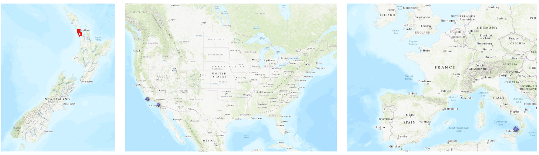
Left hand panel shows new Land Information New Zealand (LINZ) dataset coverage in red. Middle panel shows two new Community Dataspace datasets in purple in Southern California. Right hand panel shows the location of a new Community Dataspace dataset in purple over the Stromboli volcano in Southern Italy.
Land Information New Zealand (LINZ) Datasets
OpenTopography has an on ongoing collaboration with Land Information New Zealand that makes OpenTopography the primary distribution platform for point cloud data collected as part of the LINZ national elevation program.
New Land Information New Zealand data:
OpenTopography Community Dataspace Datasets
The OpenTopography Community Dataspace allows users who are producing small to moderate sized topographic datasets (with technologies such as lidar and photogrammetry) to archive their data with OpenTopography via a simple drag and drop user interface. This feature is designed to support data publication and citation, academic data reuse, and educational applications. Each submission is reviewed by OpenTopography staff and approved on a case-by-case basis. Datasets in the OT Dataspace receive a Digital Object Identifier (DOI) are are displayed on the OpenTopography Find Data Map so they are discoverable and downloadable alongside data hosted by OpenTopography. The Dataspace is meant to complement standard OpenTopography data hosting for larger datasets produced by our data provider partners
New Community Dataspace data:
- Dawson Los Monos Canyon Reserve Pasture and Creek UAV LiDAR Survey, CA 2024
- UAV LiDAR Survey of RDM at Jack and Laura Dangermond Preserve, CA 2024
- High-Resolution SfM Topography of Stromboli volcano (Italy), 08 May 2021
Sample Graphics From Data Released in April 2025

3D point cloud colored by intensity of downtown Auckland, New Zealand and the Auckland SkyTower. Data Source: OpenTopography: Auckland Part 1, New Zealand 2024.
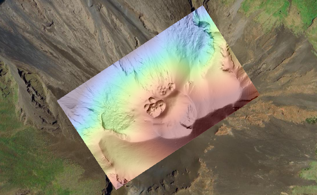
Hillshade draped on colorized DEM of Stromboli Volcano in Southern Italy. Data Source: Community Dataspace: High-Resolution SfM Topography of Stromboli volcano (Italy), 08 May 2021.
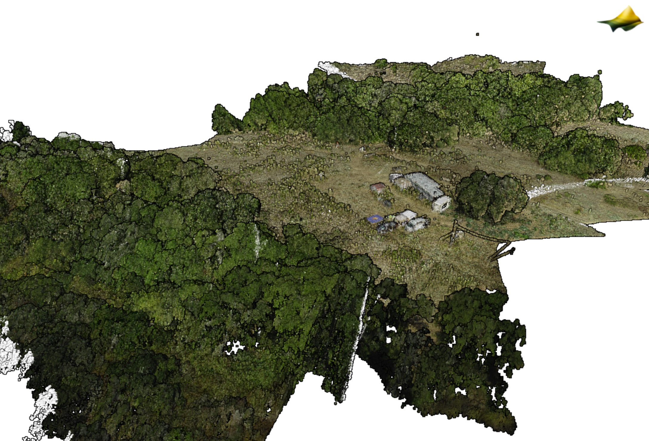
3D point cloud colored by RGB over the Dawson Los Monos Canyon Reserve. Data Source: Community Dataspace: Dawson Los Monos Canyon Reserve Pasture and Creek UAV LiDAR Survey, CA 2024.