The coasts of the Great Lakes are highly dynamic environments. Bluff erosion provides sediment for beaches but also poses a hazard to life and infrastructure. Assessing bluff retreat is key to preventing or mitigating financial and infrastructure losses.
This activity is designed as a two- to three-hour laboratory exercise for community college and introduction-level courses. Students use lidar remote sensing data to learn about dynamic coastal erosion. They analyze lidar and lake water levels to investigate how the morphology of a portion of the Lake Michigan coastline changes over a decade. Students consider the interplay between the hydrosphere and the Earth’s surface in the Great Lakes region and how bluff erosion affects local communities. We provide an accompanying background reading, two instructional videos, and slides for a brief (15-minute) introductory lecture on the key concepts necessary to complete the lab.
See an introduction to this activity in this video
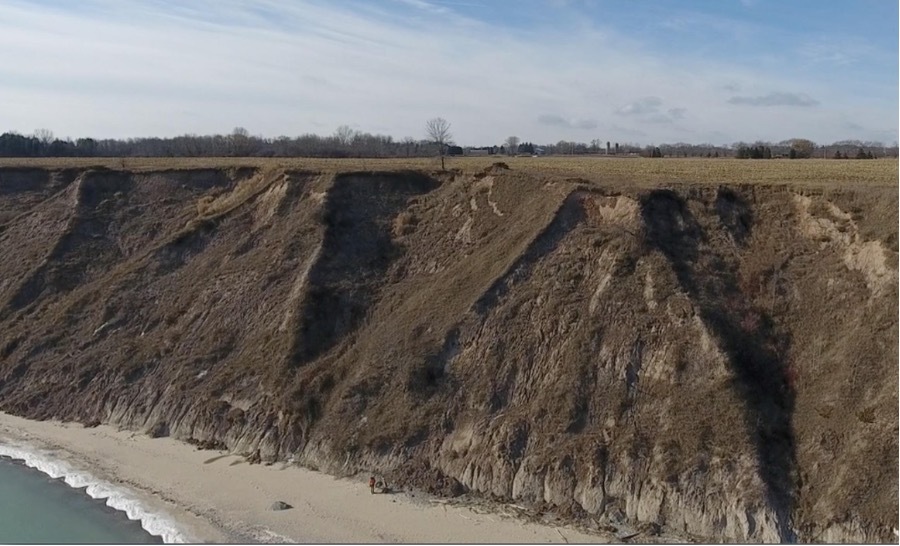
Aerial photo of the Wisconsin coastline along Lake Michigan showing a bluff.
Learning Goals:
- Characterize a coastal bluff in Wisconsin by identifying key features on a topographic profile, a student-made sketch, and satellite imagery.
- Summarize factors that make a bluff stable or unstable
- Describe how geomorphologists use topographic data to investigate changes along the coastline
- Analyze changes to the bluff geomorphology over decadal timescale using multi-temporal lidar topographic data
- Develop and test predictions about changes in bluff geomorphology related to fluctuations in Lake Michigan water levels
- Explain the relationship between bluff stability and coastal erosion in the Great Lakes region and its relevance to local communities
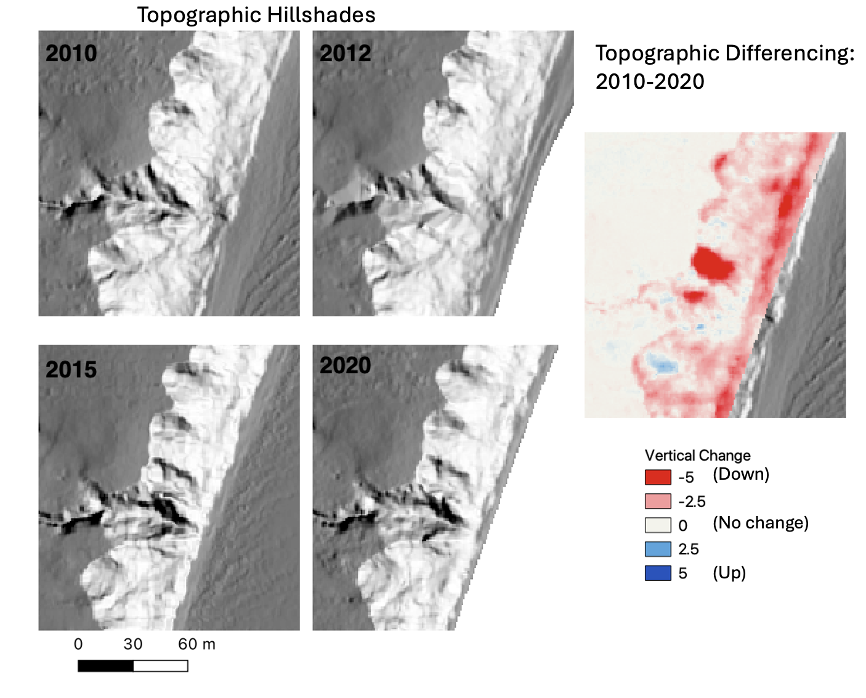
Change along the Michigan coastline showing topographic hillshades (left) and vertical change (right) from 2010- 2020.
Context for Use:
The activity is intended for community college and freshman/sophomore students. This version is designed for face-to-face settings but can be adapted for online teaching. Students should be familiar with basic geomorphology terminology for glaciated areas (e.g., drumlin, esker) and for slopes (e.g., crest, toe, face, face retreat, bluff). Ideally, students will have practiced sketching exercises; if not, the instructor should spend some time introducing sketching (suggestions are provided below). We also provide reading materials and lecture slides on coastal erosion, lidar, and the Lake Michigan coastline.
Lab Material:
- Background reading
- Slides for lecture and discussion prior to the lab
- Lab Activity
- 3D print file for a portion of the Lake Michigan coastline analyzed in the lab. The file is ready to be imported into your 3D printer software and printed. If you do not have access to a 3D printer, there are a variety of websites that provide 3D printing services such as Craftcloud, 3D Experience Marketplace, and Treatstock.
Videos for this lab:
- Drone View of the Wisconsin Coastline
- Time-Lapse of a Bluff Failure
- Lake Michigan Bluff Retreat Seen with Lidar: Lidar-derived topographic hillshades from 2010-2020 show bluff retreat along the Lake Michigan shoreline.
- Lake Michigan Shoreline Differencing on OpenTopography: Learn how to perform topographic differencing on OpenTopography and visualize the results in QGIS. Designed for those interested in learning more after completing the lab.
Web resources:
Authors: Carolina Michel 1, Chelsea Scott2, Sally Stevens3, Kate Flick4, and Luke Zoet3.
1CREATE for STEM Institute, Michigan State University, East Lansing, MI
2School of Earth and Space Exploration, Arizona State University, Tempe, AZ
3University of Wisconsin-Madison, Department of Geoscience, Madison, WI
4Department of Earth Science, College of the Menominee Nation, Keshena, WI
Acknowledgements: OpenTopography is supported by the National Science Foundation under Award Numbers 2410799, 2410800 & 2410801. We thank Beth Pratt Sitaula for valuable feedback on the activity.