OpenTopography-Sourced Data Featured in Recent Publications
A pair of recent publications related to paleoseismic research in California feature lidar topography data accessed and processed via OpenTopography. Both papers utilize B4 lidar data extensively, and OpenTopography played an integral role in providing access to both the point cloud and custom digital elevation models discussed in the publications.
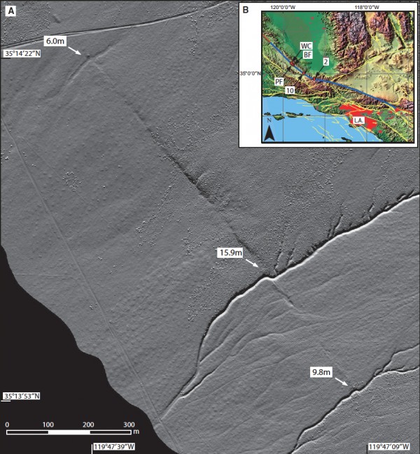
The first publication - LaDiCaoz and LiDARimager--MATLAB GUIs for LiDAR data handling and lateral displacement measurement, Zielke and Arrowsmith, Geosphere, February 2012, v. 8, p. 206-221 - presents MATLAB-based software for calculating "lateral displacements of offset sublinear geomorphic features such as stream channels or alluvial fan edges" in order to constrain slip from paleoearthquakes. The LiDiCaoz software was developed for and used in the San Andreas fault offset study highlighted in March 2010 in Science.
In the second publication - LiDAR and Field Observations of Slip Distribution for the Most Recent Surface Ruptures along the Central San Jacinto Fault, Salisbury et al., Bulletin of the Seismological Society of America, April 2012, v. 102, p. 598-619 - the authors use lidar topography to measure tectonically offset features along the Clark strand of the San Jacinto fault to illustrate the pattern of paleoearthquakes. A ScienceNewsOnline.com highlight of the research is available here.

Figure 1. Zielke and Arrowsmith, 2012. OpenTopography generated hillshade of the San Andreas fault at Bidart Fan in the Carrizo Plain, California.
