New lidar datasets available in New Zealand
OpenTopography is pleased to announce the release of two new datasets in New Zealand.
Marlborough Fault System, South Island, New Zealand
The Marlborough Fault System is a set of major faults on New Zealand's South Island. The fault system accommodates a stepover in the boundary between the Pacific and Australian tectonic plates. The lidar data were collected by the U.S. National Center for Airborne Laser Mapping (NCALM) in collaboration with New Zealand Aerial Mapping for PI James F. Dolan, University of Southern California. High resolution ( ≥ 12 shots/m2) data were collected over parts of the fault system's four major faults: the Hope, Clarence, Awatere, and Wairau faults.
Auckland, New Zealand 2013
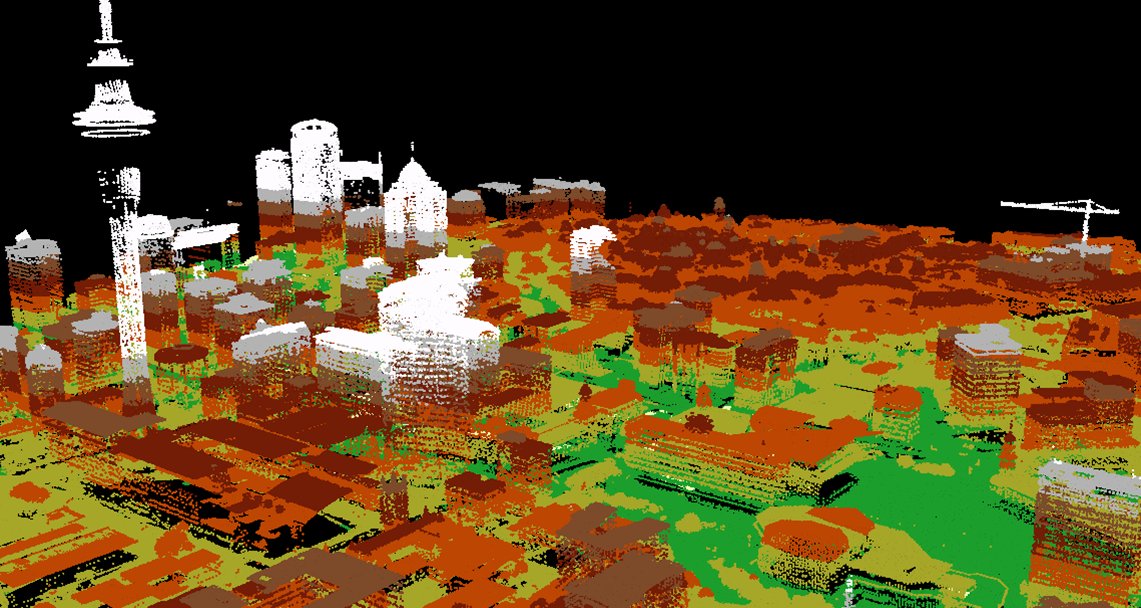
Land Information New Zealand (LINZ) has partnered with OpenTopography to make lidar data available across the Auckland urban metro and adjacent rural areas. This large dataset covers approximately 2,250 km2 and includes over 10.7 billion data points. Auckland is New Zealand's largest metro area and home to approximately 30 percent of the country's population. The Auckland metro is tectonically stable compared to much of the rest of New Zealand. Erosion is a large natural hazard affecting the city, however, as well as the threat of future volcanic eruptions. Vestiges of Auckland's volcanic past, such as the Maungawhau / Mount Eden scoria cone, dot the city. Hosting of these data in OpenTopography is a trial that we hope will lead to a larger collaboration to make LINZ lidar data available through OpenTopography.

Lidar-derived elevation visualization of Auckland's urban core produced by Land Information New Zealand. The Sky Tower, the tallest free-standing structure in the Southern Hemisphere, stands tall among the city's skyline.

